Shionada-shuku

Last updated
Hiroshige's print of Shionada-shuku, part of the series The Sixty-nine Stations of the Kiso Kaido Kisokaido23 Shionada.jpg
Hiroshige's print of Shionada-shuku, part of the series The Sixty-nine Stations of the Kiso Kaidō

Shionada-shuku(塩名田宿,Shionada-shuku) was the twenty-third of the sixty-nine stations of the Nakasendō. It is located in the present-day city of Saku, in Nagano Prefecture, Japan.

69 Stations of the Nakasendō

The 69 Stations of the Nakasendō are the rest areas along the Nakasendō, which ran from Nihonbashi in Edo to Sanjō Ōhashi in Kyoto. The route stretched approximately 534 km (332 mi) and was an alternate trade route to the Tōkaidō.

Nakasendō

The Nakasendō, also called the Kisokaidō (木曾街道), was one of the five routes of the Edo period, and one of the two that connected Edo to Kyoto in Japan. There were 69 stations (staging-posts) between Edo and Kyoto, crossing through Musashi, Kōzuke, Shinano, Mino and Ōmi provinces. In addition to Tokyo and Kyoto, the Nakasendō runs through the modern-day prefectures of Saitama, Gunma, Nagano, Gifu and Shiga, with a total distance of about 534 km (332 mi).

Saku, Nagano City in Chūbu, Japan

Saku is a city located in Nagano Prefecture, Japan. As of 1 October 2016, the city had an estimated population of 99,056, and a population density of 234 persons per km². Its total area is 423.51 square kilometres (163.52 sq mi).

Contents

History

Shionada-shuku is located on the eastern bank of the Shinano River, just across from Yawata-shuku. Both Shionada-shuku and Yawata-shuku were first developed under the orders of Tokugawa Ieyasu after the Battle of Sekigahara, and then were further developed after the development of the Tōkaidō and the Nakasendō. [1] At its peak, the post town had about 10 minor inns, and in 1844, it was recorded to have two honjin and one sub-honjin. [1]

Shinano River river in Japan

The Shinano River, known as the Chikuma River in its upper reaches, is the longest and widest river in Japan and the third largest by basin area. It is located in northeastern Honshu, rising in the Japanese Alps and flowing generally northeast through Nagano and Niigata Prefectures before emptying into the Sea of Japan.

Yawata-shuku

Yawata-shuku was the twenty-fourth of the sixty-nine stations of the Nakasendō. It is located in the present-day city of Saku, in Nagano Prefecture, Japan.

Tokugawa Ieyasu Founder and first shogun of the Tokugawa shogunate of Japan

Tokugawa Ieyasu was the founder and first shōgun of the Tokugawa shogunate of Japan, which effectively ruled Japan from the Battle of Sekigahara in 1600 until the Meiji Restoration in 1868. Ieyasu seized power in 1600, received appointment as shōgun in 1603, and abdicated from office in 1605, but remained in power until his death in 1616. His given name is sometimes spelled Iyeyasu, according to the historical pronunciation of the kana character he. Ieyasu was posthumously enshrined at Nikkō Tōshō-gū with the name Tōshō Daigongen (東照大権現). He was one of the three unifiers of Japan, along with his former lord Nobunaga and Toyotomi Hideyoshi.

There was a bridge which connected Shionada and Yawata, but it was washed away by a flood and never rebuilt. Instead, the river was crossed with ferry service or by fording.

Neighboring post towns

Nakasendō
Iwamurada-shuku - Shionada-shuku - Yawata-shuku

Related Research Articles

Ageo-shuku

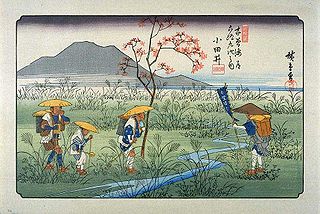
Ageo-shuku was the fifth of the sixty-nine stations of the Nakasendō highway connecting Edo with Kyoto during the Edo period. It was located in the present-day city of Ageo, Saitama Prefecture, Japan.

Shiojiri-shuku

Shiojiri-shuku was the thirtieth of the sixty-nine stations of the Nakasendō. It is located in the central part of the present-day city of Shiojiri, Nagano Prefecture, Japan.

Shimosuwa-shuku

Shimosuwa-shuku was the twenty-ninth of the sixty-nine stations of the Nakasendō, as well as being the ending location of the Kōshū Kaidō. It is located in the present-day town of Shimosuwa, Suwa District, Nagano Prefecture, Japan.

Warabi-shuku

Warabi-shuku was the second of the sixty-nine stations of the Nakasendō highway connecting Edo with Kyoto during the Edo period. It was located in the present-day city of Warabi, Saitama Prefecture, Japan.

Wada-shuku

Wada-shuku was the twenty-eighth of the sixty-nine stations of the Nakasendō highway connecting Edo with Kyoto during the Edo period. It was located in the present-day town of Nagawa, in the Chiisagata District of Nagano Prefecture, Japan.

Nagakubo-shuku

Nagakubo-shuku was the twenty-seventh of the sixty-nine stations of the Nakasendō highway connecting Edo with Kyoto during the Edo period. It is located in the present-day town of Nagawa, in the Chiisagata District of Nagano Prefecture, Japan.

Mochizuki-shuku

Mochizuki-shuku was the twenty-fifth of the sixty-nine stations of the Nakasendō. It is located in the present-day city of Saku, in Nagano Prefecture, Japan.

Iwamurada-shuku

Iwamurada-shuku was the twenty-second of the sixty-nine stations of the Nakasendō. It is located in the present-day city of Saku, in Nagano Prefecture, Japan.

Otai-shuku

Otai-shuku was the twenty-first of the sixty-nine stations of the Nakasendō. It is located in the present-day town of Miyota, in the Kitasaku District of Nagano Prefecture, Japan.

Kumagai-shuku

Kumagai-shuku was the eighth of the sixty-nine stations of the Nakasendō highway connecting Edo with Kyoto during the Edo period. It was located in the present-day city of Kuamagaya, Saitama Prefecture, Japan.

Karuisawa-shuku

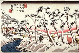
Karuisawa-shuku was the eighteenth of the sixty-nine stations of the Nakasendō. It is located in the northern portion of the present-day town of Karuizawa, in the Kitasaku District of Nagano Prefecture, Japan. Karuisawa-shuku is 10 km (6.2 mi) from the preceding post station, Sakamoto-shuku, and 4 km (2.5 mi) from the following one, Kutsukake-shuku.

Kutsukake-shuku

Kutsukake-shuku was the nineteenth of the sixty-nine stations of the Nakasendō. It is located in the present-day town of Karuizawa, in the Kitasaku District of Nagano Prefecture, Japan.

Fukaya-shuku

Fukaya-shuku was the ninth of the sixty-nine stations of the Nakasendō highway connecting Edo with Kyoto during the Edo period It was located in the present-day city of Fukaya, Saitama Prefecture, Japan.

Honjō-shuku

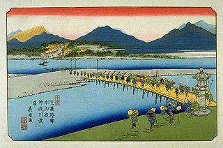
Honjō-shuku was the tenth of the sixty-nine stations of the Nakasendō highway connecting Edo with Kyoto during the Edo period. It was the largest of the stations in terms of population and number of buildings. It was located in the present-day city of Honjō, Saitama Prefecture, Japan.

Okegawa-shuku

Okegawa-shuku was the sixth of the sixty-nine stations of the Nakasendō highway connecting Edo with Kyoto during the Edo period. It was located in the present-day city of Okegawa, Saitama Prefecture, Japan.

Kōnosu-shuku

Kōnosu-shuku was the seventh of the sixty-nine stations of the Nakasendō highway connecting Edo with Kyoto during the Edo period. It was located in the present-day city of Kōnosu, Saitama Prefecture, Japan.

Sakamoto-shuku

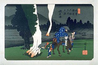
Sakamoto-shuku was the seventeenth of the sixty-nine stations of the Nakasendō. It is located in the present-day city of Annaka, Gunma Prefecture, Japan.

Itahana-shuku

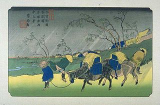
Itahana-shuku was the fourteenth of the sixty-nine stations of the Nakasendō. It is located in the present-day city of Annaka, Gunma Prefecture, Japan. Ruins of its honjin can be found at the Princess Kazunomiya Inn.

References

  1. 1 2 Saku-shi Homepage Archived 2007-09-27 at the Wayback Machine .. City of Saku. Accessed August 10, 2007.

Coordinates: 36°16′16.4″N138°25′18.6″E / 36.271222°N 138.421833°E / 36.271222; 138.421833

Geographic coordinate system Coordinate system

A geographic coordinate system is a coordinate system that enables every location on Earth to be specified by a set of numbers, letters or symbols. The coordinates are often chosen such that one of the numbers represents a vertical position and two or three of the numbers represent a horizontal position; alternatively, a geographic position may be expressed in a combined three-dimensional Cartesian vector. A common choice of coordinates is latitude, longitude and elevation. To specify a location on a plane requires a map projection.