
Tamamura is a town located in Gunma Prefecture, Japan. As of February 2015, the town had an estimated population of 36,952, and a population density of 1430 persons per km². Its total area is 25.78 km².

The Five Routes, sometimes translated as "Five Highways", were the five centrally administered routes, or kaidō, that connected the capital of Japan at Edo with the outer provinces during the Edo period (1603–1868). The most important of the routes was the Tōkaidō, which linked Edo and Kyoto. Tokugawa Ieyasu started the construction of these five routes to increase his control over the country in 1601, but it was Tokugawa Ietsuna, the 4th shōgun of the Tokugawa shogunate and Ieyasu's great-grandson, who declared them as major routes. Post stations were set up along the route for travelers to rest and buy supplies. The routes thrived due to the policy of sankin-kōtai, that required the daimyōs to travel in alternate years along the routes to Edo.

Isesaki is a city located in Gunma Prefecture, Japan. As of February 2015, the city had an estimated population of 208,705, and a population density of 1500 persons per km². Its total area is 139.44 km².

Ageo-shuku was the fifth of the sixty-nine stations of the Nakasendō highway connecting Edo with Kyoto during the Edo period. It was located in the present-day city of Ageo, Saitama Prefecture, Japan.

Shiojiri-shuku was the thirtieth of the sixty-nine stations of the Nakasendō. It is located in the central part of the present-day city of Shiojiri, Nagano Prefecture, Japan.

Kumagai-shuku was the eighth of the sixty-nine stations of the Nakasendō highway connecting Edo with Kyoto during the Edo period. It was located in the present-day city of Kuamagaya, Saitama Prefecture, Japan.
The Nikkō Kaidō (日光街道) was one of the five routes of the Edo period and it was built to connect Edo with the Nikkō Tōshō-gū, which is located in the present-day city of Nikkō, Tochigi Prefecture, Japan. It was established in 1617 by Tokugawa Ieyasu, in order for him to have a smoother route to the shrine. With only twenty-one stations, the Nikkō Kaidō was the shortest of the five routes, but it shares seventeen stations with the Ōshū Kaidō. Part of its route can be traced with Japan's Route 4.

Oiwake-shuku was the twentieth of the sixty-nine stations of the Nakasendō. It is located in the present-day town of Karuizawa, in the Kitasaku District of Nagano Prefecture, Japan.

Fukaya-shuku was the ninth of the sixty-nine stations of the Nakasendō highway connecting Edo with Kyoto during the Edo period It was located in the present-day city of Fukaya, Saitama Prefecture, Japan.
Honjō-shuku was the tenth of the sixty-nine stations of the Nakasendō highway connecting Edo with Kyoto during the Edo period. It was the largest of the stations in terms of population and number of buildings. It was located in the present-day city of Honjō, Saitama Prefecture, Japan.

Okegawa-shuku was the sixth of the sixty-nine stations of the Nakasendō highway connecting Edo with Kyoto during the Edo period. It was located in the present-day city of Okegawa, Saitama Prefecture, Japan.

Kōnosu-shuku was the seventh of the sixty-nine stations of the Nakasendō highway connecting Edo with Kyoto during the Edo period. It was located in the present-day city of Kōnosu, Saitama Prefecture, Japan.

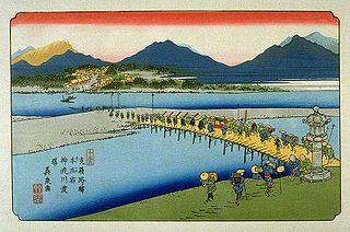
Shinmachi-shuku was the eleventh of the sixty-nine stations of the Nakasendō. It is located in the present-day city of Takasaki, Gunma Prefecture, Japan.
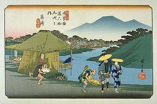
Takasaki-shuku was the thirteenth of the sixty-nine stations of the Nakasendō. It is located in the present-day city of Takasaki, Gunma Prefecture, Japan.

Matsuida-shuku was the sixteenth of the sixty-nine stations of the Nakasendō. It is located in the present-day city of Annaka, Gunma Prefecture, Japan, at the foot of Mount Myōgi.
Mikuni Kaidō (三国街道) was an ancient highway in Japan that stretched from Takasaki-juku on the Nakasendō to Teradomari-juku on the Hokuriku Kaidō.
The Kōshū Kaidō (甲州街道) was one of the five routes of the Edo period. It was built to connect Edo with Kai Province in modern-day Yamanashi Prefecture, Japan. The route continues from there to connect with the Nakasendō's Shimosuwa-shuku in Nagano Prefecture. Many feudal lords from Shinano Province made use of the road during sankin-kōtai, including those from the Takatō, Suwa and Iida domains.

The Sixty-nine Stations of the Kiso Kaidō or Sixty-nine Stations of the Kiso Road, is a series of ukiyo-e works created by Utagawa Hiroshige and Keisai Eisen. There are 71 total prints in the series. The common name for the Kiso Kaidō is "Nakasendō," so this series is sometimes referred to as the Sixty-nine Stations of the Nakasendō. It is a follow up to Hiroshige's The Fifty-three Stations of the Tōkaidō and he produced 47 of the prints, with Eisen being responsible for the rest.


