Shiojiri-shuku

Last updated
Keisai Eisen's print of Shiojiri-shuku, part of the series The Sixty-nine Stations of the Kiso Kaido Kisokaido30 Shiojiri.jpg
Keisai Eisen's print of Shiojiri-shuku, part of the series The Sixty-nine Stations of the Kiso Kaidō
Lake Midoriko near Shiojiri Pass, east of Shiojiri-shuku Lake Midoriko.jpg
Lake Midoriko near Shiojiri Pass, east of Shiojiri-shuku

Shiojiri-shuku(塩尻宿,Shiojiri-shuku) was the thirtieth of the sixty-nine stations of the Nakasendō. It is located in the central part of the present-day city of Shiojiri, Nagano Prefecture, Japan.

69 Stations of the Nakasendō

The 69 Stations of the Nakasendō are the rest areas along the Nakasendō, which ran from Nihonbashi in Edo to Sanjō Ōhashi in Kyoto. The route stretched approximately 534 km (332 mi) and was an alternate trade route to the Tōkaidō.

Nakasendō

The Nakasendō, also called the Kisokaidō (木曾街道), was one of the five routes of the Edo period, and one of the two that connected Edo to Kyoto in Japan. There were 69 stations (staging-posts) between Edo and Kyoto, crossing through Musashi, Kōzuke, Shinano, Mino and Ōmi provinces. In addition to Tokyo and Kyoto, the Nakasendō runs through the modern-day prefectures of Saitama, Gunma, Nagano, Gifu and Shiga, with a total distance of about 534 km (332 mi).

Shiojiri, Nagano City in Chūbu, Japan

Shiojiri is a city located in Nagano Prefecture, Japan. As of 1 October 2016, the city had an estimated population of 66,801, and a population density of 230 persons per km². Its total area is 289.98 square kilometres (111.96 sq mi).

Contents

History

This area was originally built by Ōkubo Nagayasu in the Keichō era of the early Edo period. There was a shorter route along the Nakasendō that connected Shimosuwa-shuku and Niekawa-juku directly, but the route was changed to include this post town, as well as Seba-juku and Motoyama-juku, after Ōkubo's death. It eventually became the connecting post town between Shimosuwa-shuku and Seba-juku. During its most prosperous period, there were over 70 buildings in the town and it thrived as one of the kokudaka of the Matsumoto Domain. Because of its size, it was divided into "upper," "central" and "lower" portions. [1] During the Meiji period, there was a large fire, which destroyed most of the town. [1]

Ōkubo Nagayasu was a Japanese samurai bureaucrat and daimyō of the Edo period.

Keichō Japanese era

Keichō (慶長) was a Japanese era name after Bunroku and before Genna. This period spanned from October 1596 to July 1615. The reigning emperors were Go-Yōzei-tennō (後陽成天皇) and Go-Mizunoo-tennō (後水尾天皇).

Edo period period of Japanese history

The Edo period or Tokugawa period (徳川時代) is the period between 1603 and 1868 in the history of Japan, when Japanese society was under the rule of the Tokugawa shogunate and the country's 300 regional daimyō. The period was characterized by economic growth, strict social order, isolationist foreign policies, a stable population, "no more wars", and popular enjoyment of arts and culture. The shogunate was officially established in Edo on March 24, 1603, by Tokugawa Ieyasu. The period came to an end with the Meiji Restoration on May 3, 1868, after the fall of Edo.

The post station also served as one terminus for the Sanshū Kaidō, a trade route which brought salt to Japan's interior. Records show that in 1843, Shiojiri-juku had 794 residents and 166 buildings. Among the building, there was one honjin , one sub-honjin, and 75 hatago .

<i>Honjin</i>

Honjin (本陣) is the Japanese word for an inn for government officials, generally located in post stations (shukuba) during the later part of the Edo period.

Hatago (旅籠) were Edo period lodgings for travelers at shukuba along the national highways, including the Edo Five Routes and the subroutes. In addition to a place to rest, hatago also offered meals and other foods to the travelers. They were also called hatagoya (旅籠屋).

Neighboring post towns

Nakasendō
Shimosuwa-shuku - Shiojiri-shuku - Seba-juku
Shio no Michi's Sanshū Kaidō
Shiojiri-shuku(starting location) - Ono-juku

Related Research Articles

Magome-juku

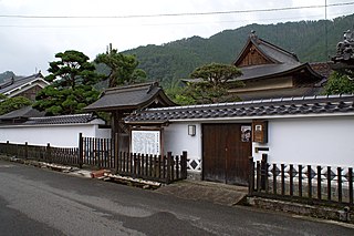
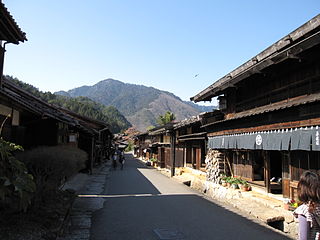
Magome-juku was the forty-third of the sixty-nine stations of the Nakasendō, an ancient road that connected Kyoto and Edo during the Edo period. It was also the last of eleven stations along the Kisoji, which was the precursor to a part of the Nakasendō, running through the Kiso Valley. This well-preserved section of the old route is in the present-day city of Nakatsugawa, Gifu Prefecture, Japan.

Edo Five Routes Five Highways in Edo period Japan

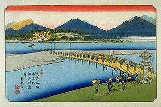
The Five Routes, sometimes translated as "Five Highways", were the five centrally administered routes, or kaidō, that connected the capital of Japan at Edo with the outer provinces during the Edo period (1603–1868). The most important of the routes was the Tōkaidō, which linked Edo and Kyoto. Tokugawa Ieyasu started the construction of these five routes to increase his control over the country in 1601, but it was Tokugawa Ietsuna, the 4th shōgun of the Tokugawa shogunate and Ieyasu's great-grandson, who declared them as major routes. Post stations were set up along the route for travelers to rest and buy supplies. The routes thrived due to the policy of sankin-kōtai, that required the daimyōs to travel in alternate years along the routes to Edo.

Ageo-shuku

Ageo-shuku was the fifth of the sixty-nine stations of the Nakasendō highway connecting Edo with Kyoto during the Edo period. It was located in the present-day city of Ageo, Saitama Prefecture, Japan.

Shimosuwa-shuku

Shimosuwa-shuku was the twenty-ninth of the sixty-nine stations of the Nakasendō, as well as being the ending location of the Kōshū Kaidō. It is located in the present-day town of Shimosuwa, Suwa District, Nagano Prefecture, Japan.

Motoyama-juku

Motoyama-juku was the thirty-second of the sixty-nine stations of the Nakasendō. It is located in the central part of the present-day city of Shiojiri, Nagano Prefecture, Japan.

Wada-shuku

Wada-shuku was the twenty-eighth of the sixty-nine stations of the Nakasendō highway connecting Edo with Kyoto during the Edo period. It was located in the present-day town of Nagawa, in the Chiisagata District of Nagano Prefecture, Japan.

Nagakubo-shuku

Nagakubo-shuku was the twenty-seventh of the sixty-nine stations of the Nakasendō highway connecting Edo with Kyoto during the Edo period. It is located in the present-day town of Nagawa, in the Chiisagata District of Nagano Prefecture, Japan.

Kumagai-shuku

Kumagai-shuku was the eighth of the sixty-nine stations of the Nakasendō highway connecting Edo with Kyoto during the Edo period. It was located in the present-day city of Kuamagaya, Saitama Prefecture, Japan.

Fukaya-shuku

Fukaya-shuku was the ninth of the sixty-nine stations of the Nakasendō highway connecting Edo with Kyoto during the Edo period It was located in the present-day city of Fukaya, Saitama Prefecture, Japan.

Honjō-shuku

Honjō-shuku was the tenth of the sixty-nine stations of the Nakasendō highway connecting Edo with Kyoto during the Edo period. It was the largest of the stations in terms of population and number of buildings. It was located in the present-day city of Honjō, Saitama Prefecture, Japan.

Okegawa-shuku

Okegawa-shuku was the sixth of the sixty-nine stations of the Nakasendō highway connecting Edo with Kyoto during the Edo period. It was located in the present-day city of Okegawa, Saitama Prefecture, Japan.

Kōnosu-shuku

Kōnosu-shuku was the seventh of the sixty-nine stations of the Nakasendō highway connecting Edo with Kyoto during the Edo period. It was located in the present-day city of Kōnosu, Saitama Prefecture, Japan.

Ai no Shuku were unofficial post stations along historical routes in Japan. These post stations formed organically along routes when the distance between two places was too far or when there were difficult passes nearby. Because they were not officially designated rest areas, travelers along the roads were not allowed to stay in these post stations. Sometimes the Japanese is shortened to 間宿.

<i>Shukuba</i> post stations of Japan in the Edo period

Shukuba (宿場) were post stations during the Edo period in Japan, generally located on one of the Edo Five Routes or one of its sub-routes. They were also called shuku-eki (宿駅). These post stations were places where travelers could rest on their journey around the nation. They were created based on policies for the transportation of goods by horseback that were developed during the Nara and Heian periods.

<i>The Sixty-nine Stations of the Kiso Kaidō</i>

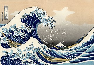
The Sixty-nine Stations of the Kiso Kaidō or Sixty-nine Stations of the Kiso Road, is a series of ukiyo-e works created by Utagawa Hiroshige and Keisai Eisen. There are 71 total prints in the series. The common name for the Kiso Kaidō is "Nakasendō," so this series is sometimes referred to as the Sixty-nine Stations of the Nakasendō. It is a follow up to Hiroshige's The Fifty-three Stations of the Tōkaidō and he produced 47 of the prints, with Eisen being responsible for the rest.

Shio no Michi

Shio no Michi was an old kaidō, or road, in ancient Japan and was used to transport salt from the ocean to the inland central Honshū. In the Middle Ages, salt was brought both from the Sea of Japan and the Pacific Ocean to Shinano Province for processing. The road leading from the Sea of Japan to Shinano Province was called the Chikuni Kaidō (千国街道), whereas the road leading from the Pacific Ocean was called the Sanshū Kaidō (三州街道).

References

  1. 1 2 Shiojiri-shuku Machinami Archived 2007-07-01 at the Wayback Machine .. Accessed July 16, 2007.

Coordinates: 36°06′13.3″N137°58′30.0″E / 36.103694°N 137.975000°E / 36.103694; 137.975000

Geographic coordinate system Coordinate system

A geographic coordinate system is a coordinate system that enables every location on Earth to be specified by a set of numbers, letters or symbols. The coordinates are often chosen such that one of the numbers represents a vertical position and two or three of the numbers represent a horizontal position; alternatively, a geographic position may be expressed in a combined three-dimensional Cartesian vector. A common choice of coordinates is latitude, longitude and elevation. To specify a location on a plane requires a map projection.