Hiratsuka-juku

Last updated
Hiratsuka-juku in the 1830s, as depicted by Hiroshige in the Hoeido edition of The Fifty-three Stations of the Tokaido (1831-1834) Tokaido07 Hiratsuka.jpg
Hiratsuka-juku in the 1830s, as depicted by Hiroshige in the Hōeidō edition of The Fifty-three Stations of the Tōkaidō (1831–1834)

Hiratsuka-juku(平塚宿,Hiratsuka-juku) was the seventh of the fifty-three stations ( shukuba ) of the Tōkaidō. It is located in the present-day city of Hiratsuka, Kanagawa Prefecture, Japan.

53 Stations of the Tōkaidō Wikimedia list article

The 53 Stations of the Tōkaidō are the rest areas along the Tōkaidō, which was a coastal route that ran from Nihonbashi in Edo to Sanjō Ōhashi in Kyoto.

<i>Shukuba</i> post stations of Japan in the Edo period

Shukuba (宿場) were post stations during the Edo period in Japan, generally located on one of the Edo Five Routes or one of its sub-routes. They were also called shuku-eki (宿駅). These post stations were places where travelers could rest on their journey around the nation. They were created based on policies for the transportation of goods by horseback that were developed during the Nara and Heian periods.

Tōkaidō (road) road of premodern Japan. sometimes mean region (see Q1196306)

The Tōkaidō road (東海道), which roughly means "eastern sea route," was the most important of the Five Routes of the Edo period in Japan, connecting Kyoto to Edo. Unlike the inland and less heavily travelled Nakasendō, the Tōkaidō travelled along the sea coast of eastern Honshū, hence the route's name.

Contents

History

Hiratsuka-juku was first established in 1601, at the orders of Tokugawa Ieyasu. [1] In 1651, though, it merged with part of the nearby village of Yawata. In 1655, it was renamed "Shinhiratsuka-juku." [1]

Tokugawa Ieyasu Founder and first shogun of the Tokugawa shogunate of Japan

Tokugawa Ieyasu was the founder and first shōgun of the Tokugawa shogunate of Japan, which effectively ruled Japan from the Battle of Sekigahara in 1600 until the Meiji Restoration in 1868. Ieyasu seized power in 1600, received appointment as shōgun in 1603, and abdicated from office in 1605, but remained in power until his death in 1616. His given name is sometimes spelled Iyeyasu, according to the historical pronunciation of the kana character he. Ieyasu was posthumously enshrined at Nikkō Tōshō-gū with the name Tōshō Daigongen (東照大権現). He was one of the three unifiers of Japan, along with his former lord Nobunaga and Toyotomi Hideyoshi.

During a census in 1843, the post station was found to have a population of 2,114 people and 443 houses, which included one honjin , 1 sub-honjin and 54 hatago . [1] The classic ukiyo-e print by Andō Hiroshige (Hōeidō edition) from 1831–1834 does not depicts the post station at all, but instead shows a zig-zag road above marshy fields, with Mount Fuji appearing behind Shonan Daira in the background. One of the travelers is a professional courier running as part of the mail service offered along the Tōkaidō. Relays of runners could convey a message from Edo to Kyoto in 90 hours.

Census Acquiring and recording information about the members of a given population

A census is the procedure of systematically acquiring and recording information about the members of a given population. The term is used mostly in connection with national population and housing censuses; other common censuses include agriculture, business, and traffic censuses. The United Nations defines the essential features of population and housing censuses as "individual enumeration, universality within a defined territory, simultaneity and defined periodicity", and recommends that population censuses be taken at least every 10 years. United Nations recommendations also cover census topics to be collected, official definitions, classifications and other useful information to co-ordinate international practice.

<i>Honjin</i>

Honjin (本陣) is the Japanese word for an inn for government officials, generally located in post stations (shukuba) during the later part of the Edo period.

Hatago (旅籠) were Edo period lodgings for travelers at shukuba along the national highways, including the Edo Five Routes and the subroutes. In addition to a place to rest, hatago also offered meals and other foods to the travelers. They were also called hatagoya (旅籠屋).

Neighboring post towns

Tōkaidō
Fujisawa-shuku - Hiratsuka-juku - Ōiso-juku

Related Research Articles

Mishima-shuku

Mishima-shuku was the eleventh of the fifty-three stations of the Tōkaidō during Edo period Japan. It is located in the present-day city of Mishima, in Shizuoka Prefecture.

Fujikawa-shuku

Fujikawa-shuku was the thirty-seventh of the fifty-three stations of the Tōkaidō. It is located in the present-day city of Okazaki, in Aichi Prefecture, Japan. It was approximately 9 kilometres (5.6 mi) from Akasaka-juku, the preceding post station. Another accepted reading for this post town is "Fujikawa-juku."

Hodogaya-juku

Hodogaya-juku was the fourth of the fifty-three stations of the Tōkaidō. It is located in Hodogaya-ku in the present-day city of Yokohama, Kanagawa Prefecture, Japan. Occasionally, it is also written as 保土ヶ谷宿.

Yokkaichi-juku

Yokkaichi-juku was the forty-third of the fifty-three stations of the Tōkaidō. It is located in former Ise Province in what is now part of the city of Yokkaichi, in Mie Prefecture, Japan. It was 12.8 km from Kuwana-juku, the preceding post town.

Akasaka-juku (Tōkaidō)

Akasaka-juku was the thirty-sixth of the fifty-three stations of the Tōkaidō. It is located in present-day Toyokawa, Aichi Prefecture, Japan. It was only 1.7 kilometres (1.1 mi) from Goyu-juku, the preceding post station.

Kuwana-juku

Kuwana-juku was the forty-second of the fifty-three stations of the Tōkaidō. It is located in former Ise Province in what is now part of the city of Kuwana, in Mie Prefecture, Japan. It was located on the western shores of the Ibi River and is considered to be the easternmost point of the Kansai dialect. It is 28 km from the preceding post station of Miya-juku.

Kanaya-juku

Kanaya-juku was the twenty-fourth of the fifty-three stations of the Tōkaidō. It is located in what is now part of Shimada, Shizuoka Prefecture, Japan. During the Edo period, it was the easternmost post station of Tōtōmi Province.

Totsuka-juku

Totsuka-juku was the fifth of the fifty-three stations (shukuba) of the Tōkaidō. It was the eastern-most post station in Sagami Province. It is now located in Totsuka-ku in the present-day city of Yokohama, Kanagawa Prefecture, Japan.

Fujisawa-shuku

Fujisawa-shuku was the sixth of the fifty-three stations of the Tōkaidō. It is located in the present-day city of Fujisawa, Kanagawa Prefecture, Japan.

Ishiyakushi-juku

Ishiyakushi-juku was the forty-fourth of the fifty-three stations of the Tōkaidō. It is located in former Ise Province in what is now part of the city of Suzuka, Mie Prefecture, Japan. It received its name from the nearby Buddhist temple, Ishiyakushi-ji.

Ōiso-juku

Ōiso-juku was the eighth of the fifty-three stations (shukuba) of the Tōkaidō. It is located in the present-day town of Ōiso, located in Naka District, Kanagawa Prefecture, Japan.

Okitsu-juku

Okitsu-juku was the seventeenth of the fifty-three stations of the Tōkaidō. It is located in what is now part of the Shimizu-ku area of Shizuoka, Shizuoka Prefecture, Japan.
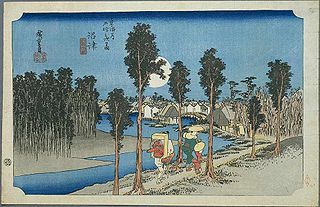
Numazu-juku

Numazu-juku was the twelfth of the fifty-three stations of the Tōkaidō. It is located in the present-day city of Numazu, Shizuoka Prefecture, Japan.

Ejiri-juku

Ejiri-juku was the eighteenth of the fifty-three stations of the Tōkaidō. It is one of four former post stations located in what is now part of the Shimizu-ku area of Shizuoka, Shizuoka Prefecture, Japan. It was 3.4 kilometers from Okitsu-juku, the preceding post station.

Miya-juku

Miya-juku was the forty-first of the fifty-three stations of the Tōkaidō. It is located in former Owari Province in what is now part of the Atsuta-ku section of the city of Nagoya, in Aichi Prefecture, Japan. It was six km from Narumi-juku, the preceding post station.

Futagawa-juku

Futagawa-juku was the thirty-third of the fifty-three stations of the Tōkaidō. It is located in what is now the city of Toyohashi, Aichi Prefecture, Japan. It was the eastern most post station in Mikawa Province.

Maisaka-juku

Maisaka-juku was the thirtieth of the fifty-three stations of the Tōkaidō. It is located in the western portion of Hamamatsu in Shizuoka Prefecture, Japan. During the Edo period, the area was part of Tōtōmi Province. The kanji for the post station were originally written 舞坂 (Maisaka).

Yoshida-juku

Yoshida-juku was the thirty-fourth of the fifty-three stations of the Tōkaidō. It is located in the center of what is now the city of Toyohashi, Aichi Prefecture, Japan. It was 287 kilometres (178 mi) from the start of the route in Edo's Nihonbashi and 6.1 kilometres (3.8 mi) from Futagawa-juku to the east and 10.5 kilometres (6.5 mi) from Goyu-shuku to the west.

Narumi-juku

Narumi-juku was the fortieth of the fifty-three stations of the Tōkaidō. It is located in former Owari Province in what is now part of the Midori-ku section of the city of Nagoya, in Aichi Prefecture, Japan.

Shōno-juku

Shōno-juku was the forty-fifth of the fifty-three stations of the Tōkaidō. It is located in former Ise Province in what is now part of the city of Suzuka, Mie Prefecture, Japan.

References

  1. 1 2 3 11 Hiratsuka-juku. Hiratsuka City Museum. Accessed November 5, 2007.

Further reading

International Standard Book Number Unique numeric book identifier

The International Standard Book Number (ISBN) is a numeric commercial book identifier which is intended to be unique. Publishers purchase ISBNs from an affiliate of the International ISBN Agency.