Shelley, Western Australia

Last updated

Shelley
Perth,  Western Australia
Shelley, Western Australia
Coordinates 32°01′47″S115°53′12″E / 32.0297125°S 115.8866113°E / -32.0297125; 115.8866113
Population4,795 (SAL 2021) [1]
Postcode(s) 6148
Location14 km (9 mi) from Perth
LGA(s) City of Canning
State electorate(s) Riverton
Federal division(s) Tangney
Suburbs around Shelley:
Salter Point Waterford Wilson
Rossmoyne ShelleyWilson
Bull Creek Willetton Riverton

Shelley is a suburb of Perth, Western Australia, located within the City of Canning.

Contents

History

The suburb was part of Riverton until the mid-1960s; its name is believed to refer to shells found in the area on the shores of the Canning River. [2]

Boundary

The suburb's northern foreshore is bound by Riverton Drive North. In the east, the borders starts from Riverton Drive East, Barbican Street East, Tudor avenue South, Tribute Street, Modillion Avenue, Corinthian Road East.

A stretch of Leach Highway forms the south western border of the suburb until it goes up to Fifth Avenue and zig zags up back to Riverton Drive North.

Education

Shelley has one primary school located within its borders, Shelley Primary School which is off Monota Avenue. Shelley is located within the Rossmoyne Senior High School zone and is close to Curtin University.

Shopping

Shelley contains a neighbourhood shopping centre called Shelley Hub that comprises a Post office and Newsagent, SK Cafe and Indian Restaurant, Shelley Fish n' Chips, Celebrations Liquor, Wizard Pharmacy, Shelley Dental, Phill Bean Korean Restaurant, Kevin Baruffi & Associates, Shelley Chinese, Shelley Podiatrist, Shelley Hairdressers and Shelley Beauty Salon. Shelley Hub is around 200 metres (660 ft) west of Southlands Medical Services.

Transport

Shelley residents have access to major bus routes. Off Leach Highway the 998 and 999 CircleRoute buses travel to Fremantle and to Curtin University in the opposite direction respectively. Another bus service which Shelley residents have access to is the 178, which travels from Bull Creek Station to Elizabeth Quay Bus Station.

Bus

Related Research Articles

Dianella is a suburb of Perth, Western Australia. It is within the local government area of the City of Stirling.

<span class="mw-page-title-main">Waterford, Western Australia</span> Suburb of Perth, Western Australia

Waterford is a small riverside suburb of Perth, the state capital of Western Australia. Its local government area is the City of South Perth.

<span class="mw-page-title-main">Riverton, Western Australia</span> Suburb of Perth, Western Australia

Riverton is a southeastern suburb of Perth, the capital city of Western Australia. Its local government area is the City of Canning.

<span class="mw-page-title-main">Fremantle railway station</span> Railway station in Fremantle, Western Australia

Fremantle railway station is the terminus of Transperth's Fremantle line in Western Australia.

<span class="mw-page-title-main">North Fremantle railway station</span> Railway station in Perth, Western Australia

North Fremantle railway station is a railway station on the Transperth network. It is located on the Fremantle line, 16.2 kilometres from Perth, serving the Fremantle suburb of North Fremantle.

<span class="mw-page-title-main">Mosman Park railway station</span> Railway station in Perth, Western Australia

Mosman Park railway station is a railway station on the Transperth network. It is located on the Fremantle line, 13.5 kilometres from Perth station serving the suburbs of Mosman Park and Cottesloe.

<span class="mw-page-title-main">Ardross, Western Australia</span> Suburb of Perth, Western Australia

Ardross is a suburb of Perth, Western Australia, located within the City of Melville. It was once an area of land acquired by the Scotsman, Sir Alexander Percival Matheson in 1896. In Matheson's subdivision of the adjoining suburb of Applecross, he created "Ardross Street" naming it after either the town of Ardrossan on the Scottish west coast or Ardross Castle, located about 40 kilometres north of Inverness. The suburb derives its name from this street.

<span class="mw-page-title-main">Parkwood, Western Australia</span> Suburb of Perth, Western Australia

Parkwood is a southeastern suburb of Perth, the capital city of Western Australia. Its local government area is the City of Canning.

<span class="mw-page-title-main">Alfred Cove, Western Australia</span> Suburb of Perth, Western Australia

Alfred Cove is a southern suburb of Perth, Western Australia. Its local government area is the City of Melville.

<span class="mw-page-title-main">Applecross, Western Australia</span> Suburb of Perth, Western Australia

Applecross is an affluent riverside suburb of Perth, Western Australia, bounded by Canning Highway and the Swan River. It is located within the City of Melville.

<span class="mw-page-title-main">Bentley, Western Australia</span> Suburb of Perth, Western Australia

Bentley is a southern suburb of Perth, the capital city of Western Australia, 8 kilometres (5.0 mi) southeast of Perth's central business district. Its local government areas are the City of Canning and the Town of Victoria Park. Bentley is home to the main campus of Curtin University and Technology Park.

<span class="mw-page-title-main">Cannington, Western Australia</span> Suburb of Perth, Western Australia

Cannington is a southern suburb of Perth, Western Australia. Its local government area is the City of Canning.

Lynwood is a small southeastern suburb of Perth, the capital city of Western Australia. Its local government area is the City of Canning.

Rossmoyne is a suburb of Perth, Western Australia, within the City of Canning. Rossmoyne is located 14 kilometres (8.7 mi) south of central Perth, and is bounded by Leach Highway to the south, the Bull Creek to the west, the Canning River to the north, and Shelley to the east.

St James is a suburb shared between the Town of Victoria Park and the City of Canning in the Perth metropolitan area.

<span class="mw-page-title-main">Willetton, Western Australia</span> Suburb of Perth, Western Australia

Willetton is a large southern suburb of Perth, Western Australia. Its local government area is the City of Canning.

<span class="mw-page-title-main">Wilson, Western Australia</span> Suburb of Perth, Western Australia

Wilson is a suburb of Perth, Western Australia, located within the City of Canning on the north bank of the Canning River. It is a fairly old suburb with parks and close proximity to prominent shopping centres in South Perth. It is favoured by Curtin University students, the reason being its convenient access to the university. Bus numbers 72 and 75 travel through this suburb. The suburb contains Castledare, Kent Street Weir, Canning River and Lo Quay River Cafe. Wilson is located quite closely to various park, some of those being Cetenary Park, Thomas Moore Park, and Alderley Park.

<span class="mw-page-title-main">Bull Creek railway station</span> Railway station in Perth, Western Australia

Bull Creek railway station is a railway station on the Transperth network. It is located on the Mandurah line, 11.7 kilometres from Perth station inside the median strip of the Kwinana Freeway serving the suburb of Bull Creek.

<span class="mw-page-title-main">Belmont, Western Australia</span> Suburb of Perth, Western Australia

Belmont is a suburb of Perth, the capital city of Western Australia, and is located 7 kilometres (4 mi) east of Perth's central business district (CBD) on the southern bank of the Swan River. Its local government area is the City of Belmont.

<span class="mw-page-title-main">Nedlands, Western Australia</span> Suburb of Perth, Western Australia

Nedlands is a western suburb of Perth, the capital city of Western Australia. It is a part of the local government areas of the City of Nedlands and the City of Perth. It is about 7 kilometres (4 mi) from the Perth CBD via either Thomas Street or Mounts Bay Road.
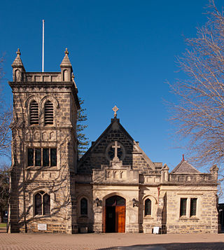
References

  1. Australian Bureau of Statistics (28 June 2022). "Shelley (WA) (suburb and locality)". Australian Census 2021 QuickStats. Retrieved 28 June 2022.  OOjs UI icon edit-ltr-progressive.svg
  2. "History of metropolitan suburb names – S". Western Australian Land Information Authority. Archived from the original on 16 March 2022. Retrieved 24 March 2020.
  3. "Route 75". Bus Timetable 15 (PDF). Transperth. 25 August 2023 [effective from 20 November 2023].
  4. "Route 178". Bus Timetable 9 (PDF). Transperth. 5 September 2023 [effective from 20 November 2023].
  5. "Route 179". Bus Timetable 13 (PDF). Transperth. 24 August 2023 [effective from 20 November 2023].
  6. "Route 509". Bus Timetable 13 (PDF). Transperth. 24 August 2023 [effective from 20 November 2023].
  7. "Route 998". CircleRoute Timetable 200 (PDF). Transperth. 29 August 2023 [effective from 20 November 2023].
  8. "Route 999". CircleRoute Timetable 200 (PDF). Transperth. 29 August 2023 [effective from 20 November 2023].

Commons-logo.svg Media related to Shelley, Western Australia at Wikimedia Commons