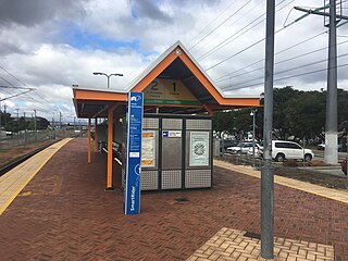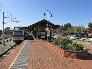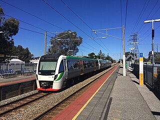
Ferndale is a southeastern suburb of Perth, Western Australia. Its local government area is the City of Canning. It is approximately 15 kilometres (9 mi) from Perth's central business district.

The Armadale line is a suburban railway service in Perth, Western Australia, operated by the Public Transport Authority as part of the Transperth system. The Armadale line is 30.4 kilometres (18.9 mi) long, and starts at Perth station, heading south-east of there to serve Perth's south-eastern suburbs, terminating at Armadale station.

Elizabeth Quay bus station, formerly the Esplanade Busport, is a Transperth bus station, located at the southern edge of the Perth CBD in Western Australia, next to the Perth Convention Exhibition Centre and Elizabeth Quay railway station. It has 35 stands and is served by 55 Transperth routes operated by Path Transit, Swan Transit and Transdev WA. It is also served by South West Coach Lines services.

Welshpool was a railway station on the Transperth network. It was located on the Armadale and Thornlie lines, 9.5 kilometres from Perth Station serving the suburbs of Welshpool and Bentley, Western Australia.

Armadale railway station is located on the South Western Railway, 30 kilometres from Perth station serving the suburb of Armadale, Brookdale and Haynes. It is the terminating point for Transperth Armadale line services and a calling point for Transwa Australind services.

Kelmscott railway station is located on the South Western Railway, 25.9 kilometres from Perth Station in the suburb of Kelmscott. It is served by Armadale Line services which are part of the Transperth network.

Gosnells railway station is located on the South Western Railway 21 kilometres from Perth Station in the suburb of Gosnells. It is served by Armadale Line services which are part of the Transperth network.

Maddington railway station is on the Transperth network. It is located on the Armadale Line, 17.7 kilometres from Perth Station serving the suburb of Maddington.

Cannington is a temporarily closed railway station on the Armadale and Thornlie lines, serving the suburb of Cannington south of Perth, Western Australia. It is located 12.2 kilometres (7.6 mi) from Perth Station, and is part of the Transperth commuter rail network. It temporarily closed on 20 November 2023 as part of the Victoria Park-Canning Level Crossing Removal Project.

Oats Street railway station is a temporarily-closed Transperth suburban railway station in Western Australia, located in the Perth suburbs of Carlisle and East Victoria Park. The station was served by the Armadale and Thornlie lines prior to its closure in November 2023.

Thornlie railway station is a temporarily closed railway station on the Transperth network. It was the terminus of the Thornlie line, a spur of the Armadale Line, seventeen kilometres (11 mi) from Perth Station serving the suburb of Thornlie, Western Australia. Under construction is the Thornlie-Cockburn Link which will link to Cockburn Central railway station along the Mandurah line via two new stations, Nicholson Road railway station and Ranford Road railway station.

Warwick railway station is a railway station on the Transperth network. It is located on the Joondalup line, 13 kilometres (8.1 mi) from Perth station serving the suburb of Warwick.

Alexander Heights is a suburb of Perth, Western Australia within the City of Wanneroo.

Welshpool is an inner southeastern suburb of Perth, Western Australia, located mostly within the City of Canning and partially within the Town of Victoria Park.

Applecross is an affluent riverside suburb of Perth, Western Australia, bounded by Canning Highway and the Swan River. It is located within the City of Melville.

Cannington is a southern suburb of Perth, Western Australia. Its local government area is the City of Canning.

Queens Park is a suburb of Perth, Western Australia, located within the City of Canning. Its postcode is 6107.

Wattle Grove is a suburb of Perth, Western Australia, located within the City of Kalamunda.

Rockingham railway station is a railway station in Rockingham, a suburb of Perth, Western Australia. It is on the Mandurah railway line, which is part of the Transperth commuter rail network. It has two side platforms, linked by a pedestrian overpass accessed by stairs, a lift, and escalators. Services run every 10 minutes during peak, and every 15 minutes between peak. The journey to Perth railway station is 43.2 kilometres (26.8 mi), and takes 34 minutes. The journey to Mandurah railway station is 27.6 kilometres (17.1 mi), and takes 17 minutes. The station has a bus interchange with twelve bus stands, and 14 regular bus routes.


