
The Shire Highlands are a plateau in southern Malawi, located east of the Shire River. It is a major agricultural area and the most densely populated part of the country.
The Shire Highlands are a plateau in southern Malawi, located east of the Shire River. It is a major agricultural area and the most densely populated part of the country.
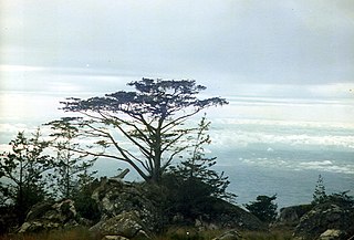
The highlands cover an area of roughly 7250 square kilometers. the plateau varies in elevation from 600 to 1100 meters, with various hills and mountains rising higher. The highest peak is Zomba Mountain at 2087 meters. The highlands are bounded on the west and south by the valley of the Shire River, an extension of the African Rift Valley. The Phalombe Plain slopes gently towards Lake Chilwa to the northeast, and separates the highlands from the taller Mulanje Massif to the east. Streams originating in the highlands drain west, south, and southeast towards the Shire River, or northeast into the closed basin of Lake Chilwa. [1]
The highlands have a cooler climate and more rainfall than the surrounding lowlands, and are home to distinct forests, woodlands, and grasslands that make up the South Malawi montane forest-grassland mosaic. [2]
The northernmost portion of the plateau includes a line of hills – Chinduzi, Mongolowe, Chaone, and Chikala – that extend 40 km east and west. The taller Zomba Plateau south of them. The northern hills are made up of syenite and nepheline syenite, and the Zomba plateau is made up of syenite and quartz syenite, which intruded into the much older Precambrian igneous and metamorphic rocks that compose much of the highlands. [3] The central portion includes numerous hills and mountains, including Chiradzulu (1774 m), Ndirande (1613 m), Soche (1533 m), and Michiru (1474 m). Thyolo Mountain lies at the southern end of the highlands. [4]
Yao are the predominant people of the northern highlands, and Chewa people in the center and south. The Lomwe people also live in the highlands.
Blantyre is the largest city in the highlands. Zomba is the second-largest, and served as the capital of Nyasaland and independent Malawi until 1975. Thyolo is a center of tea production.
Archeological evidence shows the highlands have been populated for thousands of years.
In the middle of the 19th century, Yao people migrated eastwards from the northern Mozambican coast, and established chiefdoms in the highlands – Malemia (Domasi), Mlumbe (Zomba), Kawinga (Chikala), Mpama (Chiradzulu), and Kapeni and Somba (in Blantyre District). The Yao chiefs were involved in the trade of ivory and slaves, centered on the Mozambican port of Quelimane. [5]
With encouragement and assistance from David Livingstone during his second Zambesi expedition, in 1861 Bishop Charles Mackenzie of the Universities' Mission to Central Africa set up a missionary station at Magomero, near Zomba in the highlands. After Mackenzie died in 1863, the mission was withdrawn. [6] [7] Later in the 19th century more British missions and plantations were established, expanding British influence in the highlands. In 1891 Harry Johnston was appointed Commissioner and Consul General to the British Central Africa Protectorate, the territories in the British sphere of influence north of the Zambezi River. Johnston set up a headquarters at Zomba, and between 1891 and 1895 subordinated the Yao chiefs to British rule, often by force. Johnston abolished the slave trade, and allowed British missionaries and settlers to lay claim to large tracts of the highlands. By 1894, Johnston had granted 'certificates of claim' to a handful of British settlers, missionaries, and private companies, granting them freehold property rights to 3776 km2, or over half the total area of the highlands. [8] In addition to private lands, Johnston established public or crown lands that included forest reserves, and African trust lands, held by the colonial state for customary use by the native people. Public lands and trust lands were later opened up to leaseholds of up to 99 years, effectively privatizing some of them. [9]
The Shire Highlands Railway Company built a railway across the highlands between 1903 and 1907, from Blantyre in the highlands to the river port of Chiromo, on the Shire River where it meets the Ruo. The railway was later extended north from Blantyre to Salima in central Malawi, south from Chiromo to Port Herald (present day Nsanje) in 1908, and from Port Herald to the Mozambican river port of Chindio on the Zambezi River in 1914.
From the late 19th century, tobacco, cotton, and coffee were grown for export. Coffee growing declined in importance by 1900, displaced by drought and competition with Brazilian coffee growers. Tea plantations were established in the highlands in the 1930s, first around Thyolo where the climate and soils were most favorable. Tea is still economically important in the highlands. [10] Other important crops include tung oil, tobacco, peanuts (groundnuts), and maize (corn). [11]
The History of Malawi covers the area of present-day Malawi. The region was once part of the Maravi Empire. In colonial times, the territory was ruled by the British, under whose control it was known first as British Central Africa and later Nyasaland. It became part of the Federation of Rhodesia and Nyasaland. The country achieved full independence, as Malawi, in 1964. After independence, Malawi was ruled as a one-party state under Hastings Banda until 1994.

Malawi is a landlocked country in southeast Africa. It is wholly within the tropics; from about 9°30S at its northernmost point to about 17°S at the southernmost tip. The country occupies a thin strip of land between Zambia and Mozambique, extending southwards into Mozambique along the valley of the Shire River. In the north and north east it also shares a border with Tanzania. Malawi is connected by rail to the Mozambican ports of Nacala and Beira. It lies between latitudes 9° and 18°S, and longitudes 32° and 36°E.
Nyasaland was a British protectorate located in Africa that was established in 1907 when the former British Central Africa Protectorate changed its name. Between 1953 and 1963, Nyasaland was part of the Federation of Rhodesia and Nyasaland. After the Federation was dissolved, Nyasaland became independent from Britain on 6 July 1964 and was renamed Malawi.

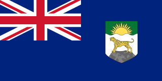
The British Central Africa Protectorate (BCA) was a British protectorate proclaimed in 1889 and ratified in 1891 that occupied the same area as present-day Malawi: it was renamed Nyasaland in 1907. British interest in the area arose from visits made by David Livingstone from 1858 onward during his exploration of the Zambezi area. This encouraged missionary activity that started in the 1860s, undertaken by the Universities' Mission to Central Africa, the Church of Scotland and the Free Church of Scotland, and which was followed by a small number of settlers. The Portuguese government attempted to claim much of the area in which the missionaries and settlers operated, but this was disputed by the British government. To forestall a Portuguese expedition claiming effective occupation, a protectorate was proclaimed, first over the south of this area, then over the whole of it in 1889. After negotiations with the Portuguese and German governments on its boundaries, the protectorate was formally ratified by the British government in May 1891.

Sir Henry Hamilton Johnston, known as Harry Johnston, was a British explorer, botanist, artist, colonial administrator, and linguist who travelled widely in Africa and spoke many African languages. He published 40 books on African subjects and was one of the key players in the Scramble for Africa that occurred at the end of the 19th century.
Zomba is a city in southern Malawi, in the Shire Highlands. It is the former capital city of Malawi.
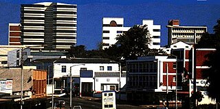
Blantyre is Malawi's centre of finance and commerce, and its second largest city, with an enumerated 800,264 inhabitants as of 2018. It is sometimes referred to as the commercial and industrial capital of Malawi as opposed to the political capital, Lilongwe. It is the capital of the country's Southern Region as well as the Blantyre District.

Mangochi is a township in the Southern Region of Malawi. Located near the southern end of Lake Malawi, in colonial times it used to be called Fort Johnston. As of 2018 it has a population of 53,498.
The British Central Africa Protectorate existed in the area of present-day Malawi between 1891 and 1907.
This page list topics related to Malawi.

The Zomba Plateau, also called the Zomba Massif, is a mountain of the Shire Highlands in southern Malawi. Its total area is about 130 square kilometres (50 sq mi), with a highest point of 2,087 metres (6,847 ft).

Zomba District is one of twelve districts in the Southern Region of Malawi, surrounded by the districts of Chiradzulu, Blantyre, Mulanje, Phalombe, Machinga, Balaka and the Republic of Mozambique to the east. The total land area is 2,363 km2, representing three percent of the total land area of Malawi. The capital is Zomba.

Chiradzulu Mountain is located in the Shire Highlands of Malawi, approximately 20 km to the north-east of Blantyre, Malawi's main commercial centre. The administrative district of Chiradzulu in southern Malawi was named after this mountain. Chiradzulu Mountain rises to a peak of 1,773m above sea level and is the third highest mountain peak in southern Malawi, after Mulanje Mountain, whose famous Sapitwa peak rises to 3,002m above sea level, and Zomba Mountain, which rises to 2,085m above sea level at its peak.
The South Malawi montane forest-grassland mosaic is an ecoregion of Malawi.
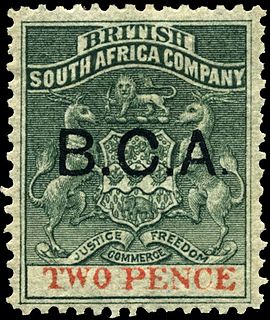
Certificates of Claim were a form of legal instrument by which the colonial administration of the British Central Africa Protectorate granted legal property titles to individuals, companies and others who claimed to have acquired land within the protectorate by grant or purchase. The proclamation of the British Central Africa Protectorate was endorsed by the British Foreign Office in May 1891, and Harry Johnston as Commissioner and Consul-General examined and adjudicated on all claims to the ownership of land said to have been acquired before or immediately after that date. Between late 1892 and March 1894, Johnston issued 59 Certificates of Claim for land, each of which was equivalent to a freehold title to the land claimed. Very few claims were disallowed or reduced in extent, and around 3.7 million acres, or 15% of the land area of the protectorate, was alienated, mainly to European settlers. No Certificates of Claim were issued after 1894, but this form of land title was never abolished, and some land in Malawi is still held under those certificates.
John Buchanan (1855–1896), was a Scottish horticulturist who went to Central Africa, now Malawi, in 1876 as a lay member of the missionary party that established Blantyre Mission. Buchanan came to Central Africa as an ambitious artisan: his character was described as dour and devout but also as restlessly ambitious, and he saw in Central Africa a gateway to personal achievement. He started a mission farm on the site of Zomba, Malawi but was dismissed from the mission in 1881 for brutality. From being a disgraced missionary, Buchanan first became a very influential planter owning, with his brothers, extensive estates in Zomba District. He then achieved the highest position he could in the British administration as Acting British Consul to Central Africa from 1887 to 1891. In that capacity declared a protectorate over the Shire Highlands in 1889 to pre-empt a Portuguese expedition that intended to claim sovereignty over that region. In 1891, the Shire Highlands became part of the British Central Africa Protectorate. John Buchanan died at Chinde in Mozambique in March 1896 on his way to visit Scotland, and his estates were later acquired by the Blantyre and East Africa Ltd.

The history of rail transport in Malawi began shortly after the turn of the twentieth century.

Malosa is a small trading centre located in the Zomba District of Malawi. The Malosa mountain range and plateau neighbours the more famous Zomba Plateau and is separated by the Domasi Valley. Malosa is on the M3, 27 km from the city of Zomba. The earth road from the trading post leads from the edge of the main road right up to the base of the Malosa mountain range.

The Shire Highlands Railway Company Ltd was a private railway company in colonial Nyasaland, incorporated in 1895 with the intention of constructing a railway from Blantyre to the effective head of navigation of the Shire River. After problems with routing and finance, a South African 3 ft 6 in gauge railway was constructed between 1903 and 1907, and extended in 1908 to a Nsanje, a distance of 113 miles (182 km) as water levels in the Shire River fell.

Sena railway, also called Shire Highlands railway, Dondo-Malawi railway and North-South Malawi railway, is a railway that connects Dondo, Mozambique, to Chipata, in Zambia. It is c. 1000 km long, in a 1067 mm gauge.