Shirley Field | |
Location | Along Airport Road, about 2.2 miles (3.5 km) east of Tallulah |
---|---|
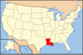
Nearest city | Tallulah, Louisiana |
Coordinates | 32°24′59″N91°09′03″W / 32.41625°N 91.15076°W |
Area | 25 acres (10 ha) |
Built | 1922 |
Built by | USDA Delta Laboratory |
Architectural style | Mission Revival, Spanish Revival |
NRHP reference No. | 85000270 [1] |
Added to NRHP | February 14, 1985 |
Shirley Field, also known as Scott Airfield, located off US 80 just east of Tallulah, Louisiana, dates from 1922. It was listed on the National Register of Historic Places on February 14, 1985. The listing included two contributing buildings and a contributing site. [1]
It is notable in the area of agriculture for its role in the development of cotton crop dusting, to control boll weevils. [2]
The field includes a Mission Revival-style terminal with round arch windows and a metal tile roof. It also includes a frame hangar from the 1920s, as well as two hangars from the 1950s. [2]
Moffett Federal Airfield, also known as Moffett Field, is a joint civil-military airport located in an unincorporated part of Santa Clara County, California, United States, between northern Mountain View and northern Sunnyvale. On November 10, 2014, NASA announced that it would be leasing 1,000 acres (400 ha) of the airfield property to Google for 60 years.
Gateway National Recreation Area is a 26,607-acre (10,767 ha) U.S. National Recreation Area in New York City and Monmouth County, New Jersey. It provides recreational opportunities that are not commonly found in a dense urban environment, including ocean swimming, bird watching, boating, hiking and camping. More than 8.7 million people visited Gateway National Recreation Area in 2022, making it the fourth-most visited unit of the National Park Service.
Fort Worth Meacham International Airport is a general aviation airport located near the intersection of Interstate 820 and Business U.S. Highway 287 in Fort Worth, Texas, United States. It is named after former Fort Worth Mayor Henry C. Meacham. The airport covers 745 acres.
Bowman Field is a public airport five miles (8.0 km) southeast of downtown Louisville, in Jefferson County, Kentucky. The airport covers 426 acres (172 ha) and has two runways. The FAA calls it a reliever airport for nearby Louisville Muhammad Ali International Airport.
Meridian Regional Airport is a joint civil-military public use airport located at Key Field, a joint-use public/military airfield. It is located 3 nautical miles southwest of Meridian, a city in Lauderdale County, Mississippi, United States. The Meridian Airport Authority owns the airport. At 10,003 feet (3,049 m), Key Field is home to the longest public use runway in Mississippi. It is mostly used for general aviation and military traffic, but it is also served by one commercial airline with scheduled passenger service subsidized by the Essential Air Service program.
Mitchel Air Force Base, also known as Mitchel Field, was a United States Air Force base located on the Hempstead Plains of Long Island, New York, United States. Established in 1918 as Hazelhurst Aviation Field #2, the facility was renamed later that year as Mitchel Field in honor of former New York City Mayor John Purroy Mitchel, who was killed while training for the Air Service in Louisiana.
Wendover Air Force Base is a former United States Air Force base in Utah now known as Wendover Airport. During World War II, it was a training base for B-17 and B-24 bomber crews. It was the training site of the 509th Composite Group, the B-29 unit that carried out the atomic bombings of Hiroshima and Nagasaki.
Scott Field Historic District began as a World War I era air base built in 1917 near O'Fallon, Illinois, and was expanded and rebuilt before World War II. The district contains primarily that portion of the base built prior to 1941, and is now contained within the renamed, expanded, and operational Scott Air Force Base. The district boundaries include 107 contributing buildings and structures, and exclude post-1945 buildings built in the areas surrounding the 1917 Main Base area.
Hangar One is one of the world's largest freestanding structures, covering 8 acres at Moffett Field near Mountain View, California in the San Francisco Bay Area.
Breddan Aerodrome is a heritage-listed abandoned aerodrome at Gregory Developmental Road, Breddan, Charters Towers Region, Queensland, Australia. It is located 15 kilometres (9.3 mi) north of Charters Towers. It was built from 1942 to 1943 by Allied Works Council and Queensland Main Roads Commission. The airfield was constructed for the USAAF 38th Bomb Group in August 1942 as a satellite field for Charters Towers Airport, and later used by the Royal Australian Air Force (RAAF) during World War II as a maintenance base. Consisting of two runways, the airfield was abandoned after 1948. Today, the remains of the airfield consist of some deteriorating runways, taxiways and hardstands, mostly being reclaimed by grassland and shrub. No buildings have survived. It is also known as Breddan Airfield and Breddan WWII Aircraft Maintenance, Repair and Salvage Depot. It was added to the Queensland Heritage Register on 16 April 2010.
Randolph Field Historic District is a National Historic Landmark District encompassing the central portion of Randolph Air Force Base, near San Antonio, Texas, US. Randolph Field was innovatively designed using Garden city movement principles, and includes a unique and well-preserved assemblage of Mission Revival and Art Deco architecture. Built between 1929 and 1931, it was the first permanent flight training facility of the United States military establishment, then the United States Army Air Corps and later the United States Air Force. It was listed on the National Register of Historic Places in 1996, and was declared a National Historic Landmark in 2001.
Landing Beaches; Aslito/Isely Field & Marpi Point, Saipan Island is a National Historic Landmark District consists of several discontiguous areas of the island of Saipan in the Northern Mariana Islands. The sites were designated for their association with the Japanese defense of Saipan during World War II, the 1944 Battle of Saipan in which United States forces captured the island, and the subsequent campaigns which used Saipan as a base. The district includes the landing beaches where the U.S. forces landed, the remnants of Japanese airfields Aslito and Marpi Point and Isely Field, the airfield built over much of Aslito from which B-29 bombers were used to bomb the Japanese home islands. The Marpi Point area includes Suicide Cliff and Banzai Cliff, two locations where significant numbers of Japanese military and civilians jumped to their deaths rather than surrender to advancing U.S. forces. The loss of Saipan was a major blow to the Japanese war effort, leading to the resignation of Prime Minister Hideki Tojo, The landmark designation was made in 1985.
King Airfield Hangar is a historic airplane hangar on Middleboro Avenue in Taunton, Massachusetts on private property near the Taunton Municipal Airport. It is a wood-frame structure, roughly 80 by 80 feet, with a curved corrugated metal roof.
The Bellanca Airfield was an airfield, aircraft plant, and service hangar built in 1928 by Giuseppe Bellanca and Henry B. DuPont in New Castle, Delaware. Located off Route 273 near the Delaware River, the plant produced approximately 3000 aircraft before closing in 1954.
The Germantown Colony and Museum is a museum and historical preservation project in Webster Parish, Louisiana about 7 miles (11 km) north of Minden in northwestern Louisiana, USA. It was listed on the National Register of Historic Places as Germantown in 1979.
Smith Field is a public airport north of downtown Fort Wayne, in Allen County, Indiana. It is owned and operated by the Fort Wayne Allen County Airport Authority. In the FAA's National Plan of Integrated Airport Systems for 2009–2013 it is a general aviation airport. The airport was listed on the National Register of Historic Places in 2002.
Henry Post Army Airfield is a military use airport located at Fort Sill in Comanche County, Oklahoma, United States. This military airport is owned by United States Army. Established as Post Field in 1917, it was one of thirty-two Air Service training camps established after the United States entry into World War I in April 1917.
The U.S. Naval Air Station, Sunnyvale Historic District, also known as Shenandoah Plaza, is a historic district located on 62.48 acres (25.3 ha) at Moffett Field, California.
Naval Air Station Wildwood was a United States Navy airport located in Lower Township, Cape May County, New Jersey, United States, about 4 miles (6.4 km) northwest of the central business district of Wildwood, a city in the same county. Former Hangar #1 now contains the Naval Air Station Wildwood Aviation Museum, whose collection focuses on World War II.
In the nation's quest to provide security along its lengthy coastlines, air reconnaissance was put forth by the futuristic Rear Admiral William A. Moffett. Through his efforts, two Naval Air Stations were commissioned in the early 1930s to port the Naval Airships (dirigibles) which he believed capable of meeting this challenge.