National Register of Historic Places listings in St. Landry Parish, Louisiana

Last updated

Location of St. Landry Parish in Louisiana Map of Louisiana highlighting Saint Landry Parish.svg
Location of St. Landry Parish in Louisiana

This is a list of the National Register of Historic Places listings in St. Landry Parish, Louisiana.

Contents

This is intended to be a complete list of the properties and districts on the National Register of Historic Places in St. Landry Parish, Louisiana, United States. The locations of National Register properties and districts for which the latitude and longitude coordinates are included below, may be seen in a map. [1]

There are 36 properties and districts listed on the National Register in the parish. Another property was once listed but has been removed.


    This National Park Service list is complete through NPS recent listings posted January 26, 2024. [2]

Map all coordinates using: OpenStreetMap

Current listings

[3] Name on the Register [4] ImageDate listed [5] Location City or townDescription
1 Academy of the Sacred Heart
Academy of the Sacred Heart Academy of the Sacred Heart, Grand Coteau, LA.jpg
Academy of the Sacred Heart
February 18, 1975
(#75002079)
Northeast of Grand Coteau
30°25′51″N92°02′14″W / 30.430833°N 92.037222°W / 30.430833; -92.037222 (Academy of the Sacred Heart)
Grand Coteau
2 Arlington Plantation House August 11, 1982
(#82004676)
North of Washington off Louisiana Highway 103
30°38′48″N92°04′19″W / 30.646667°N 92.071944°W / 30.646667; -92.071944 (Arlington Plantation House)
Washington vicinity
3 Burleigh House August 11, 1982
(#82004673)
Burleigh Lane
30°24′44″N92°02′54″W / 30.412222°N 92.048333°W / 30.412222; -92.048333 (Burleigh House)
Grand Coteau
4 Chretien Point Plantation
Chretien Point Plantation Chretien Point Plantation.jpg
Chretien Point Plantation
May 26, 1977
(#77001519)
2 miles southwest of Sunset on Blue Spring Rd.
30°23′26″N92°05′55″W / 30.390556°N 92.098611°W / 30.390556; -92.098611 (Chretien Point Plantation)
Sunset vicinity
5 Martin Donato House April 27, 2005
(#05000345)
8343 U.S. Route 182
30°33′14″N92°04′03″W / 30.553889°N 92.0675°W / 30.553889; -92.0675 (Martin Donato House)
Opelousas
6 Edward Benjamin Dubuisson House
Edward Benjamin Dubuisson House DubuissonWM.JPG
Edward Benjamin Dubuisson House
February 14, 1997
(#97000059)
437 N. Court St.
30°32′16″N92°04′58″W / 30.537778°N 92.082778°W / 30.537778; -92.082778 (Edward Benjamin Dubuisson House)
Opelousas
7 Alexandre Fontenot fils House October 22, 1982
(#82000453)
South of Grand Prairie off Louisiana Highway 103
30°40′31″N92°08′31″W / 30.675278°N 92.141944°W / 30.675278; -92.141944 (Alexandre Fontenot fils House)
Grand Prairie
8 Frozard Plantation House August 12, 1982
(#82004674)
South of Grand Coteau off Louisiana Highway 93
30°24′37″N91°59′57″W / 30.410278°N 91.999167°W / 30.410278; -91.999167 (Frozard Plantation House)
Grand Coteau vicinity
9 Grand Coteau Historic District November 25, 1980
(#80004320)
Louisiana Highway 93
30°25′39″N92°02′24″W / 30.4275°N 92.04°W / 30.4275; -92.04 (Grand Coteau Historic District)
Grand Coteau
10 Homeplace October 8, 1980
(#80004321)
North of Washington on Louisiana Highway 182
30°40′44″N92°03′27″W / 30.678889°N 92.0575°W / 30.678889; -92.0575 (Homeplace)
Washington vicinity
11 Labyche-Estorge House
Labyche-Estorge House LabEstWM.JPG
Labyche-Estorge House
October 5, 1982
(#82000454)
427 N. Market St.
30°32′15″N92°05′05″W / 30.5375°N 92.084722°W / 30.5375; -92.084722 (Labyche-Estorge House)
Opelousas
12 LaFleur House March 5, 1998
(#98000179)
753 Louisiana Highway 748
30°40′46″N92°09′22″W / 30.679444°N 92.156111°W / 30.679444; -92.156111 (LaFleur House)
Grand Prairie
13 Dominique LaLanne House and Store August 3, 1976
(#76002166)
Southwestern corner of Bridge and Dejean Sts.
30°36′53″N92°03′21″W / 30.614722°N 92.055833°W / 30.614722; -92.055833 (Dominique LaLanne House and Store)
Washington
14 Lamorandier-Prudhomme-Jackson House
Lamorandier-Prudhomme-Jackson House Lamorandier-Prudhomme-Jackson House, Saint Landry Parish, Louisiana 1983 Northeast.jpg
Lamorandier-Prudhomme-Jackson House
December 22, 1983
(#83003635)
Off U.S. Route 167
30°35′04″N92°03′41″W / 30.584444°N 92.061389°W / 30.584444; -92.061389 (Lamorandier-Prudhomme-Jackson House)
Opelousas vicinity
15 John Lewis House April 22, 1991
(#91000418)
Address Restricted
Opelousas
16 Liberty Theatre
Liberty Theatre LibertyWM.JPG
Liberty Theatre
February 19, 1987
(#87000177)
200 W. Park Ave.
30°29′35″N92°24′58″W / 30.493056°N 92.416111°W / 30.493056; -92.416111 (Liberty Theatre)
Eunice
17 Midland Branch Railroad Depot
Midland Branch Railroad Depot EuniceDepotWM.JPG
Midland Branch Railroad Depot
September 27, 1983
(#83000538)
1st and North Sts.
30°29′37″N92°24′54″W / 30.493611°N 92.415°W / 30.493611; -92.415 (Midland Branch Railroad Depot)
Eunice
18 Montet House April 12, 2006
(#06000244)
157 Shady Ln.
30°21′56″N92°02′03″W / 30.365556°N 92.034167°W / 30.365556; -92.034167 (Montet House)
Arnaudville vicinity
19 Moundville Plantation House December 12, 1976
(#76002167)
2.5 miles northwest of Washington off Louisiana Highway 103
30°38′37″N92°04′20″W / 30.643611°N 92.072222°W / 30.643611; -92.072222 (Moundville Plantation House)
Washington vicinity
20 Mouton House
Mouton House MoutonMansionWm.JPG
Mouton House
August 9, 1991
(#91001045)
261 N. Liberty St.
30°32′10″N92°05′12″W / 30.536111°N 92.086667°W / 30.536111; -92.086667 (Mouton House)
Opelousas Destroyed due to arson in July 2016. [6]
21 Old Federal Building
Old Federal Building OpelFedCourtWM.JPG
Old Federal Building
December 28, 1982
(#82000455)
162 S. Court St.
30°31′58″N92°04′58″W / 30.532778°N 92.082778°W / 30.532778; -92.082778 (Old Federal Building)
Opelousas
22 Opelousas City Hall
Opelousas City Hall OpelousasOldCityHallWM.JPG
Opelousas City Hall
September 8, 1987
(#87001470)
Junction of Market and Bellevue Sts. at Courthouse Sq.
30°32′03″N92°05′02″W / 30.53410°N 92.08382°W / 30.53410; -92.08382 (Opelousas City Hall)
Opelousas 1932-built Classical Revival structure.
23 Opelousas Historic District
Opelousas Historic District OPELOUSAS H.D. ST. LANDRY PARISH, LA.jpg
Opelousas Historic District
June 2, 1989
(#89000477)
Roughly bounded by Bellevue, Court St., Landry St., and Market St.
30°32′01″N92°05′00″W / 30.533611°N 92.083333°W / 30.533611; -92.083333 (Opelousas Historic District)
Opelousas
24 Plaisance School
Plaisance School Plaisance School.jpg
Plaisance School
August 23, 2004
(#04000080)
3264 Louisiana Highway 167
30°37′07″N92°07′57″W / 30.618611°N 92.1325°W / 30.618611; -92.1325 (Plaisance School)
Plaisance vicinityBuilt in 1921, only known Rosenwald School in Louisiana still used for education. [7]
25 Poiret Place April 7, 1983
(#83000539)
Northwest of Opelousas off Louisiana Highway 167
30°37′34″N92°07′53″W / 30.626111°N 92.131389°W / 30.626111; -92.131389 (Poiret Place)
Opelousas vicinity
26 Michel Prudhomme House
Michel Prudhomme House MPrudohomeWM.JPG
Michel Prudhomme House
May 24, 1977
(#77001518)
1152 Prudhomme Circle
30°32′39″N92°04′35″W / 30.544167°N 92.076389°W / 30.544167; -92.076389 (Michel Prudhomme House)
Opelousas
27 Ray Homestead
Ray Homestead RayWM.JPG
Ray Homestead
November 28, 1990
(#90001758)
378 W. Bellevue St.
30°32′05″N92°05′10″W / 30.534722°N 92.086111°W / 30.534722; -92.086111 (Ray Homestead)
Opelousas
28 Robin House and Barn
Robin House and Barn RobinFarm1.JPG
Robin House and Barn
August 27, 1999
(#99001036)
1616 Louisiana Highway 31
30°26′54″N91°55′24″W / 30.448333°N 91.923333°W / 30.448333; -91.923333 (Robin House and Barn)
Arnaudville vicinity
29 St. Landry Catholic Church
St. Landry Catholic Church St. Landry Catholic 1.JPG
St. Landry Catholic Church
May 3, 1982
(#82004675)
900 N. Union St.
30°32′34″N92°04′45″W / 30.542778°N 92.079167°W / 30.542778; -92.079167 (St. Landry Catholic Church)
Opelousas
30 St. Landry Lumber Company
St. Landry Lumber Company StLandryLumberWM.JPG
St. Landry Lumber Company
August 7, 1989
(#89001044)
215 N. Railroad Ave.
30°32′08″N92°05′16″W / 30.535556°N 92.087778°W / 30.535556; -92.087778 (St. Landry Lumber Company)
Opelousas
31 Starvation Point May 15, 1980
(#80004323)
North of Washington off Louisiana Highways 10/132
30°39′01″N92°03′48″W / 30.650278°N 92.063333°W / 30.650278; -92.063333 (Starvation Point)
Washington vicinity
32 Sunset High School
Sunset High School Sunset High School, Louisiana.jpg
Sunset High School
May 12, 1999
(#99000556)
223 Marie St.
30°24′47″N92°03′54″W / 30.413056°N 92.065°W / 30.413056; -92.065 (Sunset High School)
Sunset
33 Venus House
Venus House Venus Bowie House.JPG
Venus House
April 22, 1991
(#91000419)
Junction of U.S. Route 190 and Academy St.
30°31′52″N92°04′29″W / 30.531111°N 92.074722°W / 30.531111; -92.074722 (Venus House)
Opelousas
34 Washington Historic District November 15, 1978
(#78003114)
Louisiana Highway 182
30°36′54″N92°03′33″W / 30.615°N 92.059167°W / 30.615; -92.059167 (Washington Historic District)
Washington
35 White's Chapel United Methodist Church
White's Chapel United Methodist Church MVC-002g.JPG
White's Chapel United Methodist Church
April 5, 1983
(#83000540)
South of Bunkie off Louisiana Highway 29
30°50′01″N92°12′12″W / 30.833611°N 92.203333°W / 30.833611; -92.203333 (White's Chapel United Methodist Church)
Bunkie vicinity
36 Wier House
Wier House WierhouseWM.JPG
Wier House
April 7, 1995
(#95000368)
310 E. Bellevue St.
30°32′03″N92°04′52″W / 30.534167°N 92.081111°W / 30.534167; -92.081111 (Wier House)
Opelousas

Former listings

[3] Name on the RegisterImageDate listedDate removedLocationCity or townDescription
1 Jacques Dupre House April 12, 1990
(#90000543)
December 5, 2003Off US 167, N of Opelousas
Opelousas vicinity
2 MacLand Plantation House October 8, 1980
(#80004322)
March 24, 20063.4 mi N of Washington on LA 10
Washington vicinityDelisted due to relocation to West Feliciana Parish. [8]

See also

Related Research Articles

<span class="mw-page-title-main">National Register of Historic Places listings in Orleans Parish, Louisiana</span>

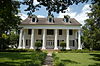
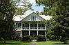
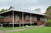
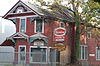
The following properties are listed on the National Register of Historic Places in Orleans Parish, Louisiana. Orleans Parish is synonymous with the city of New Orleans.

<span class="mw-page-title-main">National Register of Historic Places listings in East Feliciana Parish, Louisiana</span>

This is a list of the National Register of Historic Places listings in East Feliciana Parish, Louisiana.

<span class="mw-page-title-main">National Register of Historic Places listings in Avoyelles Parish, Louisiana</span>

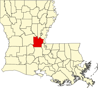
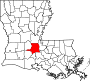
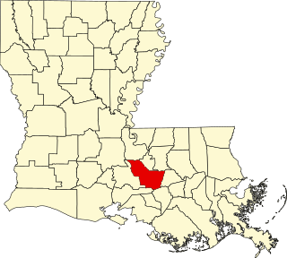
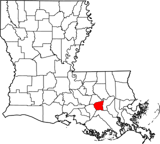
This is a list of the National Register of Historic Places listings in Avoyelles Parish, Louisiana.

<span class="mw-page-title-main">National Register of Historic Places listings in Iberville Parish, Louisiana</span>

This is a list of the National Register of Historic Places listings in Iberville Parish, Louisiana.

<span class="mw-page-title-main">National Register of Historic Places listings in St. James Parish, Louisiana</span>

This is a list of the National Register of Historic Places listings in St. James Parish, Louisiana.

<span class="mw-page-title-main">National Register of Historic Places listings in St. Martin Parish, Louisiana</span>

This is a list of the National Register of Historic Places listings in St. Martin Parish, Louisiana.

<span class="mw-page-title-main">National Register of Historic Places listings in St. Mary Parish, Louisiana</span>

This is a list of the National Register of Historic Places listings in St. Mary Parish, Louisiana.

<span class="mw-page-title-main">National Register of Historic Places listings in St. Tammany Parish, Louisiana</span>

This is a list of the National Register of Historic Places listings in St. Tammany Parish, Louisiana.

<span class="mw-page-title-main">National Register of Historic Places listings in Tangipahoa Parish, Louisiana</span>

This is a list of the National Register of Historic Places listings in Tangipahoa Parish, Louisiana.

<span class="mw-page-title-main">National Register of Historic Places listings in St. John the Baptist Parish, Louisiana</span>

This is a list of the National Register of Historic Places listings in St. John the Baptist Parish, Louisiana.

<span class="mw-page-title-main">National Register of Historic Places listings in Terrebonne Parish, Louisiana</span>

This is a list of the National Register of Historic Places listings in Terrebonne Parish, Louisiana.

<span class="mw-page-title-main">National Register of Historic Places listings in Vermilion Parish, Louisiana</span>

This is a list of the National Register of Historic Places listings in Vermilion Parish, Louisiana.

<span class="mw-page-title-main">National Register of Historic Places listings in Tensas Parish, Louisiana</span>

This is a list of the National Register of Historic Places listings in Tensas Parish, Louisiana.

<span class="mw-page-title-main">National Register of Historic Places listings in Assumption Parish, Louisiana</span>

This is a list of the National Register of Historic Places listings in Assumption Parish, Louisiana.

<span class="mw-page-title-main">National Register of Historic Places listings in St. Charles Parish, Louisiana</span>

This is a list of the National Register of Historic Places listings in St. Charles Parish, Louisiana.

<span class="mw-page-title-main">National Register of Historic Places listings in Acadia Parish, Louisiana</span>

This is a list of the National Register of Historic Places listings in Acadia Parish, Louisiana.

<span class="mw-page-title-main">National Register of Historic Places listings in Evangeline Parish, Louisiana</span>

This is a list of the National Register of Historic Places listings in Evangeline Parish, Louisiana.

<span class="mw-page-title-main">National Register of Historic Places listings in LaSalle Parish, Louisiana</span>

This is a list of the National Register of Historic Places listings in LaSalle Parish, Louisiana.

<span class="mw-page-title-main">National Register of Historic Places listings in Morehouse Parish, Louisiana</span>

This is a list of the National Register of Historic Places listings in Morehouse Parish, Louisiana.

<span class="mw-page-title-main">National Register of Historic Places listings in St. Bernard Parish, Louisiana</span>

This is a list of the National Register of Historic Places listings in St. Bernard Parish, Louisiana.

References

  1. The latitude and longitude information provided in this table was derived originally from the National Register Information System, which has been found to be fairly accurate for about 99% of listings. Some locations in this table may have been corrected to current GPS standards.
  2. National Park Service, United States Department of the Interior, "National Register of Historic Places: Weekly List Actions", retrieved January 26, 2024.
  3. 1 2 Numbers represent an alphabetical ordering by significant words. Various colorings, defined here, differentiate National Historic Landmarks and historic districts from other NRHP buildings, structures, sites or objects.
  4. "National Register Information System". National Register of Historic Places . National Park Service. March 13, 2009.
  5. The eight-digit number below each date is the number assigned to each location in the National Register Information System database, which can be viewed by clicking the number.
  6. "Arson suspected in fires at Civil War-era governor's mansion, second Opelousas historic building".
  7. Historical Marker located at school https://www.hmdb.org/marker.asp?marker=107477
  8. "Home lands new life". The Daily Advertiser . August 9, 2003. p. 1B. Retrieved July 5, 2022 via Newspapers.com.