National Register of Historic Places listings in Ascension Parish, Louisiana

Last updated

Location of Ascension Parish in Louisiana Map of Louisiana highlighting Ascension Parish.svg
Location of Ascension Parish in Louisiana

This is a list of the National Register of Historic Places listings in Ascension Parish, Louisiana.

Contents

This is intended to be a complete list of the properties and districts on the National Register of Historic Places in Ascension Parish, Louisiana, United States. The locations of National Register properties and districts for which the latitude and longitude coordinates are included below, may be seen in a map. [1]

There are 17 properties and districts listed on the National Register in the parish. Another three properties were once listed but have been removed.


    This National Park Service list is complete through NPS recent listings posted July 22, 2022. [2]

Map all coordinates using: OpenStreetMap  
Download coordinates as: KML

Current listings

[3] Name on the Register [4] ImageDate listed [5] Location City or townDescription
1 Ashland
Ashland Ashland (Belle Helene).jpg
Ashland
May 4, 1979
(#79001050)
On Ashland Road, about 400 yards (370 m) northeast of intersection with Louisiana Highway 75
30°10′34″N90°59′54″W / 30.17618°N 90.99837°W / 30.17618; -90.99837 (Ashland)
Geismar Also known as Belle Helene
2 Bocage
Bocage Bocage Plantation.JPG
Bocage
June 20, 1991
(#91000705)
On River Road, about 100 yards (91 m) north of intersection with St. Elmo Street
30°07′25″N90°57′19″W / 30.12367°N 90.95541°W / 30.12367; -90.95541 (Bocage)
Darrow
3 Dixon House
Dixon House Dixon House.JPG
Dixon House
May 27, 1999
(#99000634)
On Louisiana Highway 42, about 50 yards (46 m) east of intersection with North Lake Drive
30°19′12″N90°58′19″W / 30.31999°N 90.97192°W / 30.31999; -90.97192 (Dixon House)
Prairieville Also known as Moore House. The dormer's balcony has been removed since the time of listing.
4 Donaldsonville Historic District
Donaldsonville Historic District DVilleCourt2.jpg
Donaldsonville Historic District
January 19, 1984
(#84001248)
Roughly bounded by Bayou LaFourche, the Mississippi River levee, Jackson Street, Marchand Drive, Monroe Street and Church Street
30°06′10″N90°59′17″W / 30.1028°N 90.98798°W / 30.1028; -90.98798 (Donaldsonville Historic District)
Donaldsonville The 125 acres (51 ha) area historic district comprises 492 contributing properties built between 1806 and 1933. Photo shows the Ascension Parish Courthouse on Houmas Street, built c. 1890
5 Evan Hall Slave Cabins
Evan Hall Slave Cabins EvanHall.JPG
Evan Hall Slave Cabins
September 20, 1983
(#83000484)
Along Louisiana Highway 405, about 150 yards (140 m) northeast of intersection with Louisiana Highway 1
30°07′05″N91°02′41″W / 30.11818°N 91.04479°W / 30.11818; -91.04479 (Evan Hall Slave Cabins)
Donaldsonville
6 Fort Butler
Fort Butler FortButler2.JPG
Fort Butler
February 25, 1999
(#99000183)
Address restricted [6]
Donaldsonville Monument marks the location of a Fort and a Civil War battle fought on the 28th of June 1863.
7 Helvetia Dependency June 4, 1992
(#92000570)
At the end of a dirt road, about 1.5 miles (2.4 km) east of Darrow and 0.3 miles (0.48 km) north of River Road
30°07′03″N90°57′40″W / 30.11753°N 90.9612°W / 30.11753; -90.9612 (Helvetia Dependency)
Darrow Part of Louisiana's French Creole Architecture MPS.
8 The Hermitage April 13, 1973
(#73000859)
At the end of a dirt road, about 1.5 miles (2.4 km) east of Darrow and 0.25 miles (0.40 km) north of River Road
30°07′00″N90°57′43″W / 30.1168°N 90.9619°W / 30.1168; -90.9619 (The Hermitage)
Darrow Built in 1812, originally L'Hermitage in French named after Andrew Jackson's Tennessee home The Hermitage. General & Mrs. Jackson reportedly visited here during an 1820s trip to New Orleans.
9 The Houmas
The Houmas The Houmas 01.jpg
The Houmas
September 27, 1980
(#80001694)
About 0.63 miles (1.01 km) west of intersection of River Road and Louisiana Highway 44
30°08′28″N90°56′03″W / 30.14115°N 90.93421°W / 30.14115; -90.93421 (The Houmas)
Burnside Large Greek Revival mansion built in 1840, adjacent to an earlier Federal-style house and several other ancillary structures including octagonal garconnieres
10 Landry Tomb
Landry Tomb LandryTomb.JPG
Landry Tomb
August 11, 1982
(#82002752)
Ascension Catholic Church Cemetery, corner of St. Vincent Street and Claiborne Street
30°05′58″N90°59′09″W / 30.09942°N 90.98596°W / 30.09942; -90.98596 (Landry Tomb)
Donaldsonville Circa-1845 family monument attributed to architect James H. Dakin. Also a contributing property to Donaldsonville Historic District
11 The Lemann Store
The Lemann Store Lemann Block 2.JPG
The Lemann Store
August 11, 1982
(#82002753)
314-318 Mississippi Street
30°06′22″N90°59′15″W / 30.10617°N 90.98742°W / 30.10617; -90.98742 (The Lemann Store)
Donaldsonville Also a contributing property to Donaldsonville Historic District
12 Mulberry Grove
Mulberry Grove Mulberry Grove Plantation.JPG
Mulberry Grove
October 14, 1993
(#93001118)
Along Louisiana Highway 405, about 7 miles (11 km) northeast of White Castle
30°11′29″N91°02′06″W / 30.19148°N 91.03489°W / 30.19148; -91.03489 (Mulberry Grove)
White Castle
13 Palo Alto Dependency
Palo Alto Dependency PaloAltoDep1.JPG
Palo Alto Dependency
June 4, 1992
(#92000579)
Along Louisiana Highway 944, about 280 yards (260 m) west of intersection with Louisiana Highway 1
30°05′29″N91°01′55″W / 30.0914°N 91.03193°W / 30.0914; -91.03193 (Palo Alto Dependency)
Donaldsonville
14 Palo Alto Plantation
Palo Alto Plantation PaloAltoWM.JPG
Palo Alto Plantation
April 13, 1977
(#77000665)
Northwest of the junction of Louisiana Highway 1 with Louisiana Highway 944
30°05′27″N91°01′48″W / 30.09084°N 91.02995°W / 30.09084; -91.02995 (Palo Alto Plantation)
Donaldsonville
15 Rome House
Rome House RomeHouse.JPG
Rome House
March 8, 1990
(#90000323)
On Louisiana Highway 1, northeast of intersection with Delaney Road
30°06′32″N91°01′12″W / 30.10878°N 91.02013°W / 30.10878; -91.02013 (Rome House)
Smoke Bend
16 St. Emma
St. Emma StEmmaWM.JPG
St. Emma
June 30, 1980
(#80001695)
Along Louisiana Highway 1, about 300 yards (270 m) south of intersection with Louisiana Highway 943
30°05′03″N91°01′50″W / 30.08419°N 91.03067°W / 30.08419; -91.03067 (St. Emma)
Donaldsonville
17 Robert Penn Warren House
Robert Penn Warren House Penn House.JPG
Robert Penn Warren House
January 7, 1993
(#92001732)
16381 Old Jefferson Highway
30°18′30″N90°58′25″W / 30.30823°N 90.9736°W / 30.30823; -90.9736 (Robert Penn Warren House)
Prairieville Also known as Twin Oaks

Former listings

[3] Name on the RegisterImageDate listedDate removedLocationCity or townDescription
1 Kraemer House August 2, 1984
(#84001250)
July 22, 2016South of Louisiana Highway 929, about 0.5 miles (0.80 km) east of intersection with U.S. Route 61
30°17′54″N90°57′44″W / 30.29829°N 90.96227°W / 30.29829; -90.96227 (Kraemer House)
Prairieville Demolished some time after 1984. [7] [8]
2 St. Joseph's School
St. Joseph's School St.Joseph Burnside front.JPG
St. Joseph's School
November 17, 1988
(#88002651)
June 9, 2010Northwest corner of Louisiana Highway 22 and Louisiana Highway 44
30°09′00″N90°55′24″W / 30.14995°N 90.92334°W / 30.14995; -90.92334 (St. Joseph's School)
Burnside
3 Tezcuco
Tezcuco Tezcuco site.JPG
Tezcuco
March 3, 1983
(#83000485)
January 31, 2019Along Louisiana Highway 44, about 1.7 miles (2.7 km) southeast of Burnside
30°06′56″N90°54′37″W / 30.11543°N 90.91015°W / 30.11543; -90.91015 (Tezcuco)
Burnside Completely destroyed by fire in May 2002 [9]

See also

Related Research Articles

National Register of Historic Places listings in East Feliciana Parish, Louisiana

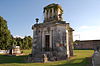
This is a list of the National Register of Historic Places listings in East Feliciana Parish, Louisiana.

National Register of Historic Places listings in West Feliciana Parish, Louisiana

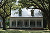
This is a list of the National Register of Historic Places listings in West Feliciana Parish, Louisiana.

National Register of Historic Places listings in Iberia Parish, Louisiana

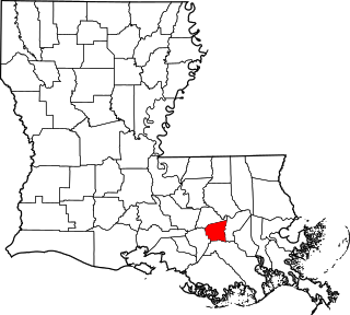
This is a list of the National Register of Historic Places listings in Iberia Parish, Louisiana.

National Register of Historic Places listings in Lafourche Parish, Louisiana

This is a list of the National Register of Historic Places listings in Lafourche Parish, Louisiana.

National Register of Historic Places listings in Lincoln Parish, Louisiana

This is a list of the National Register of Historic Places listings in Lincoln Parish, Louisiana.

National Register of Historic Places listings in Ouachita Parish, Louisiana

This is a list of the National Register of Historic Places listings in Ouachita Parish, Louisiana.

National Register of Historic Places listings in St. James Parish, Louisiana

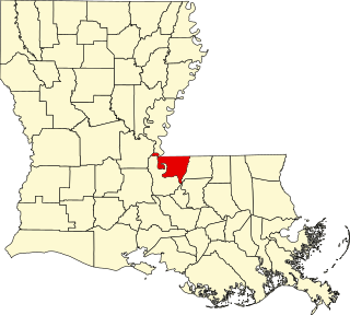
This is a list of the National Register of Historic Places listings in St. James Parish, Louisiana.

National Register of Historic Places listings in St. Martin Parish, Louisiana

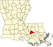
This is a list of the National Register of Historic Places listings in St. Martin Parish, Louisiana.

National Register of Historic Places listings in Tangipahoa Parish, Louisiana

This is a list of the National Register of Historic Places listings in Tangipahoa Parish, Louisiana.

National Register of Historic Places listings in Madison Parish, Louisiana

This is a list of the National Register of Historic Places listings in Madison Parish, Louisiana.

National Register of Historic Places listings in Webster Parish, Louisiana

This is a list of the National Register of Historic Places listings in Webster Parish, Louisiana.

National Register of Historic Places listings in St. John the Baptist Parish, Louisiana

This is a list of the National Register of Historic Places listings in St. John the Baptist Parish, Louisiana.

National Register of Historic Places listings in Vernon Parish, Louisiana

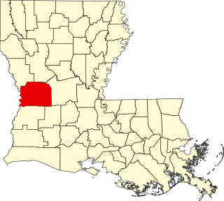
This is a list of the National Register of Historic Places listings in Vernon Parish, Louisiana.

National Register of Historic Places listings in Washington Parish, Louisiana

This is a list of the National Register of Historic Places listings in Washington Parish, Louisiana.

National Register of Historic Places listings in Bienville Parish, Louisiana

This is a list of the National Register of Historic Places listings in Bienville Parish, Louisiana.

National Register of Historic Places listings in Catahoula Parish, Louisiana

This is a list of the National Register of Historic Places listings in Catahoula Parish, Louisiana.

National Register of Historic Places listings in Concordia Parish, Louisiana

This is a list of the National Register of Historic Places listings in Concordia Parish, Louisiana.

National Register of Historic Places listings in St. Charles Parish, Louisiana

This is a list of the National Register of Historic Places listings in St. Charles Parish, Louisiana.

National Register of Historic Places listings in Caldwell Parish, Louisiana

This is a list of the National Register of Historic Places listings in Caldwell Parish, Louisiana.

National Register of Historic Places listings in Grant Parish, Louisiana

This is a list of the National Register of Historic Places listings in Grant Parish, Louisiana.

References

  1. The latitude and longitude information provided in this table was derived originally from the National Register Information System, which has been found to be fairly accurate for about 99% of listings. Some locations in this table may have been corrected to current GPS standards.
  2. National Park Service, United States Department of the Interior, "National Register of Historic Places: Weekly List Actions", retrieved July 22, 2022.
  3. 1 2 Numbers represent an alphabetical ordering by significant words. Various colorings, defined here, differentiate National Historic Landmarks and historic districts from other NRHP buildings, structures, sites or objects.
  4. "National Register Information System". National Register of Historic Places . National Park Service. March 13, 2009.
  5. The eight-digit number below each date is the number assigned to each location in the National Register Information System database, which can be viewed by clicking the number.
  6. Federal and state laws and practices restrict general public access to information regarding the specific location of this resource. In some cases, this is to protect archeological sites from vandalism, while in other cases it is restricted at the request of the owner. See: Knoerl, John; Miller, Diane; Shrimpton, Rebecca H. (1990), Guidelines for Restricting Information about Historic and Prehistoric Resources, National Register Bulletin, National Park Service, U.S. Department of the Interior, OCLC   20706997 .
  7. "Tezcuco plantation destroyed by fire". The Daily Review . May 13, 2002. p. 4. Retrieved July 5, 2022 via Newspapers.com.
  8. National Park Service (June 8, 2016). "National Register of Historic Places Evaluation/Return Sheet: Removal Request" (PDF). Retrieved March 19, 2018.
  9. National Park Service web page about Tezcuco, with photos Accessed 07 May 2015.