National Register of Historic Places listings in Avoyelles Parish, Louisiana

Last updated

Location of Avoyelles Parish in Louisiana Map of Louisiana highlighting Avoyelles Parish.svg
Location of Avoyelles Parish in Louisiana

This is a list of the National Register of Historic Places listings in Avoyelles Parish, Louisiana.

Contents

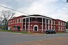
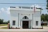
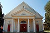
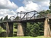
This is intended to be a complete list of the properties and districts on the National Register of Historic Places in Avoyelles Parish, Louisiana, United States. The locations of National Register properties and districts for which the latitude and longitude coordinates are included below, may be seen in a map. [1]

There are 30 properties and districts listed on the National Register in the parish, including 1 National Historic Landmark. Another two properties were once listed but have been removed.


    This National Park Service list is complete through NPS recent listings posted October 21, 2022. [2]

Map all coordinates using: OpenStreetMap  
Download coordinates as: KML

Current listings

[3] Name on the Register [4] ImageDate listed [5] Location City or townDescription
1 Bailey Hotel
Bailey Hotel BAILEY HOTEL, BUNKIE, AVOYELLES PARISH, LA.jpg
Bailey Hotel
August 5, 1999
(#99000929)
200 West Magnolia Street
30°57′13″N92°11′06″W / 30.95355°N 92.18507°W / 30.95355; -92.18507 (Bailey Hotel)
Bunkie
2 Bailey Theatre July 26, 1979
(#79001052)
North side of West Oak Street, between Walnut Street and Northwest Main Street
30°57′17″N92°11′06″W / 30.95475°N 92.18493°W / 30.95475; -92.18493 (Bailey Theatre)
Bunkie Building demolished or destroyed sometime after its listing. [6]
3 Bayou Rouge Baptist Church
Bayou Rouge Baptist Church Bayou Rouge Baptist Church.jpg
Bayou Rouge Baptist Church
December 3, 1980
(#80001696)
Corner of Church Street and Barron Lane
30°57′19″N92°06′11″W / 30.95535°N 92.10304°W / 30.95535; -92.10304 (Bayou Rouge Baptist Church)
Evergreen Greek Revival-style church built in 1859.
4 Alfred H. Bordelon House November 6, 1986
(#86003133)
511 North Washington Street
31°07′45″N92°03′48″W / 31.12904°N 92.06337°W / 31.12904; -92.06337 (Alfred H. Bordelon House)
Marksville Greek Revival house from 1872, also known as E.M. Michel House and Belle Oak
5 Hypolite Bordelon House
Hypolite Bordelon House Hypolite Bordelon.jpg
Hypolite Bordelon House
October 16, 1980
(#80001698)
242 Tunica Drive West
31°07′33″N92°04′22″W / 31.12585°N 92.07267°W / 31.12585; -92.07267 (Hypolite Bordelon House)
Marksville
6 Bordelonville Floodgate
Bordelonville Floodgate Floodgate1.jpg
Bordelonville Floodgate
March 14, 1991
(#91000277)
Siding Floodgate Crossing, north of Louisiana Highway 451, about 2.6 miles (4.2 km) east of Bordelonville
31°06′01″N91°51′51″W / 31.10024°N 91.86417°W / 31.10024; -91.86417 (Bordelonville Floodgate)
Bordelonville
7 Calliham Plantation House July 22, 1982
(#82002754)
Old Louisiana Highway 1, shortly west of Noling Crossing
31°01′30″N91°55′45″W / 31.0251°N 91.92921°W / 31.0251; -91.92921 (Calliham Plantation House)
Hamburg
8 Central Bank and Trust Co.
Central Bank and Trust Co. Hessmer Bank 1.jpg
Central Bank and Trust Co.
May 8, 1998
(#98000439)
2472 Main Street
31°03′32″N92°07′18″W / 31.05885°N 92.12167°W / 31.05885; -92.12167 (Central Bank and Trust Co.)
Hessmer Also known as the Old Post Office. Building currently host a law office.
9 Central Bank and Trust Company, Mansura
Central Bank and Trust Company, Mansura Mansuar Bank Building.jpg
Central Bank and Trust Company, Mansura
September 1, 2005
(#05000933)
2057 L'Eglise Street
31°03′30″N92°02′56″W / 31.05831°N 92.04878°W / 31.05831; -92.04878 (Central Bank and Trust Company, Mansura)
Mansura Currently known as the Mansura Senior Citizens Center
10 Dr. Jules Charles Des Fosse House
Dr. Jules Charles Des Fosse House Defosse 2.jpg
Dr. Jules Charles Des Fosse House
April 23, 1976
(#76000961)
On High School, about 90 yards (82 m) west of L'Eglise Street
31°03′44″N92°03′06″W / 31.0623°N 92.05155°W / 31.0623; -92.05155 (Dr. Jules Charles Des Fosse House)
Mansura
11 Fort DeRussy
Fort DeRussy Fort DeRussy, LA.jpg
Fort DeRussy
September 23, 2016
(#16000669)
379 Fort DeRussy Road, about 3.3 miles (5.3 km) north of Marksville
31°10′35″N92°03′39″W / 31.17629°N 92.06086°W / 31.17629; -92.06086 (Fort DeRussy)
Marksville
12 Fort No. 2 at Yellow Bayou
Fort No. 2 at Yellow Bayou Yellow Bayou 1.jpg
Fort No. 2 at Yellow Bayou
April 17, 1997
(#97000337)
Along western bank of Yellow Bayou, intersection of Louisiana Highway 1 and Louisiana Highway 1183
30°59′23″N91°50′33″W / 30.98976°N 91.84251°W / 30.98976; -91.84251 (Fort No. 2 at Yellow Bayou)
Simmesport Also known as Fort Humbug and Fort Scurry
13 Frithland
Frithland FRITHLAND, BUNKIE, AVOYELLES PARISH, LA.jpg
Frithland
May 9, 1985
(#85000969)
On Louisiana Highway 29, about 1.1 miles (1.8 km) south of Bunkie
30°56′19″N92°11′27″W / 30.9386°N 92.19086°W / 30.9386; -92.19086 (Frithland)
Bunkie
14 Joffrion House
Joffrion House Joffrion House.jpg
Joffrion House
August 11, 1982
(#82002755)
605 North Monroe Street
31°07′52″N92°03′53″W / 31.13102°N 92.06483°W / 31.13102; -92.06483 (Joffrion House)
Marksville
15 Thomas A. Lemoine House July 18, 1985
(#85001589)
Along Louisiana Highway 451
31°01′55″N91°55′58″W / 31.03186°N 91.93291°W / 31.03186; -91.93291 (Thomas A. Lemoine House)
Hamburg Italianate cottage built in 1885 by builder Thomas A. Lemoine. Originally located in Moreauville, it was moved to Hamburg in 1978.
16 Thomas A. Lemoine House
Thomas A. Lemoine House Lemoine Moreauville.jpg
Thomas A. Lemoine House
July 18, 1985
(#85001588)
Along Louisiana Highway 451
31°02′23″N91°58′37″W / 31.03971°N 91.97696°W / 31.03971; -91.97696 (Thomas A. Lemoine House)
Moreauville High fashion house built in 1916 by builder Thomas A. Lemoine. Designed by Favrot & Livaudais.
17 Lone Pine October 28, 1982
(#82000430)
About 430 yards (390 m) west of Louisiana Highway 361, 0.5 miles (0.80 km) southeast of Evergreen
30°56′42″N92°06′11″W / 30.94511°N 92.10297°W / 30.94511; -92.10297 (Lone Pine)
Evergreen
18 Louisiana Railway and Navigation Company Depot
Louisiana Railway and Navigation Company Depot Mansura Depot.jpg
Louisiana Railway and Navigation Company Depot
November 1, 1996
(#96001264)
Corner of Depot Street and Cleco Street
31°03′24″N92°03′03″W / 31.05659°N 92.05094°W / 31.05659; -92.05094 (Louisiana Railway and Navigation Company Depot)
Mansura
19 Marksville Commercial Historic District
Marksville Commercial Historic District Marksville District.jpg
Marksville Commercial Historic District
March 16, 1983
(#83000489)
Roughly bounded by Monroe Street, Washington Street, Ogden Street, and Bontempt Street
31°07′37″N92°03′59″W / 31.12697°N 92.0665°W / 31.12697; -92.0665 (Marksville Commercial Historic District)
Marksville The 20 acres (8.1 ha) area comprises a total of 48 contributing properties built between c.1850 and 1933
20 Marksville Prehistoric Indian Site
Marksville Prehistoric Indian Site Marksville State Historic Site Burial Mound.jpg
Marksville Prehistoric Indian Site
October 15, 1966
(#66000372)
Marksville Prehistoric Indian Park State Monument
31°07′29″N92°02′52″W / 31.12463°N 92.0479°W / 31.12463; -92.0479 (Marksville Prehistoric Indian Site)
Marksville
21 Moreauville High School
Moreauville High School Avoyelles High School, Moreauville.jpg
Moreauville High School
February 14, 2008
(#08000019)
287 Main Street
31°02′08″N91°58′23″W / 31.03544°N 91.97315°W / 31.03544; -91.97315 (Moreauville High School)
Moreauville
22 Oak Hall
Oak Hall OAK HALL, BUNKIE, AVOYELLES PARISH, LA.jpg
Oak Hall
November 6, 1986
(#86003134)
Along Louisiana Highway 29, about 4.5 miles (7.2 km) south of Bunkie
30°53′31″N92°12′42″W / 30.89205°N 92.21166°W / 30.89205; -92.21166 (Oak Hall)
Bunkie
23 Oakwold Plantation House July 23, 1980
(#80001697)
End of Oakwood Lane, shortly west of Evergreen off Louisiana Highway 29
30°57′07″N92°06′51″W / 30.95188°N 92.11408°W / 30.95188; -92.11408 (Oakwold Plantation House)
Evergreen
24 Adam Ponthieu Store-Big Bend Post Office
Adam Ponthieu Store-Big Bend Post Office Big bend store.jpg
Adam Ponthieu Store-Big Bend Post Office
January 24, 2002
(#01001490)
8554 Louisiana Highway 451
31°04′25″N91°47′37″W / 31.07371°N 91.79365°W / 31.07371; -91.79365 (Adam Ponthieu Store-Big Bend Post Office)
Big Bend Now hosting the Big Bend Museum
25 Dr. Thomas A. Roy Sr. House May 9, 1985
(#85000971)
2032 L'Eglise Street
31°03′31″N92°02′59″W / 31.05856°N 92.04979°W / 31.05856; -92.04979 (Dr. Thomas A. Roy Sr. House)
Mansura Contributing 1901 Doctor's Office seems to be no more in existence.
26 St. Anthony of Padua Catholic Church July 6, 2021
(#100006721)
209 South Holly St.
30°57′10″N92°11′15″W / 30.9528°N 92.1875°W / 30.9528; -92.1875 (St. Anthony of Padua Catholic Church)
Bunkie
27 St. Mary's Assumption Church
St. Mary's Assumption Church St. Mary Cottonport.jpg
St. Mary's Assumption Church
May 1, 1989
(#89000330)
Front Street, between St. Mary Street and Cottonport Avenue
30°59′13″N92°03′20″W / 30.987°N 92.0555°W / 30.987; -92.0555 (St. Mary's Assumption Church)
Cottonport
28 St. Paul Lutheran Church
St. Paul Lutheran Church St. Pauls Lutheran.jpg
St. Paul Lutheran Church
March 1, 1990
(#90000353)
Along Louisiana Highway 107, about 2.1 miles (3.4 km) north of Mansura
31°05′21″N92°02′54″W / 31.0891°N 92.04842°W / 31.0891; -92.04842 (St. Paul Lutheran Church)
Mansura
29 Sarto Bridge
Sarto Bridge SARTO Bridge 1.jpg
Sarto Bridge
November 21, 1989
(#89002027)
Off Louisiana Highway 451, crossing over Bayou Des Glaises
31°04′26″N91°47′33″W / 31.0739°N 91.7926°W / 31.0739; -91.7926 (Sarto Bridge)
Big Bend
30 Texas and Pacific Railroad Depot
Texas and Pacific Railroad Depot Bunkie TX & Pac. RR.jpg
Texas and Pacific Railroad Depot
March 22, 1991
(#91000345)
North corner of West Main Street and East Oak Street
30°57′19″N92°11′04″W / 30.95526°N 92.18449°W / 30.95526; -92.18449 (Texas and Pacific Railroad Depot)
Bunkie

Former listings

[3] Name on the RegisterImageDate listedDate removedLocationCity or townDescription
1 Clarendon Plantation House May 9, 1985
(#85000970)
July 22, 2016On Louisiana Highway 29, about 1.3 miles (2.1 km) west of Evergreen
30°57′05″N92°07′53″W / 30.95148°N 92.13131°W / 30.95148; -92.13131 (Clarendon Plantation House)
Evergreen House was demolished in May 1991. [7]
2 Edwin Epps House
Edwin Epps House Epps House.JPG
Edwin Epps House
April 12, 1984
(#84001255)
June 12, 2017 U.S. Route 71
30°57′41″N92°11′38″W / 30.96127°N 92.19386°W / 30.96127; -92.19386 (Edwin Epps House)
Bunkie House was moved and restored in 1999. Now it's located on the grounds of LSU-Alexandria Campus. [8]
3 Lacour's Fish and Ice Company Building September 8, 1983
(#83000488)
March 31, 2015403 Main Street
30°59′16″N91°48′36″W / 30.98766°N 91.8099°W / 30.98766; -91.8099 (Lacour's Fish and Ice Company Building)
Simmesport Building no more existing. A plaque reading "Louisiana Ice & Utilities Bunkie Div.", visible in StreetView, is still standing on a fence along Main Street.

See also

Related Research Articles

<span class="mw-page-title-main">National Register of Historic Places listings in Caddo Parish, Louisiana</span>

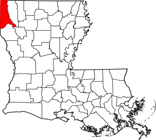
This is a list of the National Register of Historic Places listings in Caddo Parish, Louisiana.

<span class="mw-page-title-main">National Register of Historic Places listings in East Baton Rouge Parish, Louisiana</span>

This is a list of the National Register of Historic Places listings in East Baton Rouge Parish, Louisiana.

<span class="mw-page-title-main">National Register of Historic Places listings in Natchitoches Parish, Louisiana</span>

This is a list of the National Register of Historic Places listings in Natchitoches Parish, Louisiana.

<span class="mw-page-title-main">National Register of Historic Places listings in East Feliciana Parish, Louisiana</span>

This is a list of the National Register of Historic Places listings in East Feliciana Parish, Louisiana.

<span class="mw-page-title-main">National Register of Historic Places listings in Iberia Parish, Louisiana</span>

This is a list of the National Register of Historic Places listings in Iberia Parish, Louisiana.

<span class="mw-page-title-main">National Register of Historic Places listings in DeSoto Parish, Louisiana</span>

This is a list of the National Register of Historic Places listings in DeSoto Parish, Louisiana.

<span class="mw-page-title-main">National Register of Historic Places listings in Lafayette Parish, Louisiana</span>

This is a list of the National Register of Historic Places listings in Lafayette Parish, Louisiana.

<span class="mw-page-title-main">National Register of Historic Places listings in Iberville Parish, Louisiana</span>

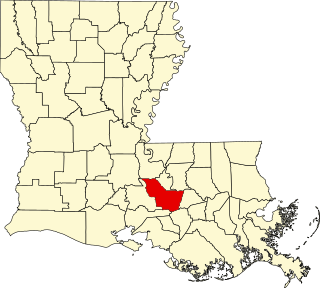
This is a list of the National Register of Historic Places listings in Iberville Parish, Louisiana.

<span class="mw-page-title-main">National Register of Historic Places listings in St. James Parish, Louisiana</span>

This is a list of the National Register of Historic Places listings in St. James Parish, Louisiana.

<span class="mw-page-title-main">National Register of Historic Places listings in St. Martin Parish, Louisiana</span>

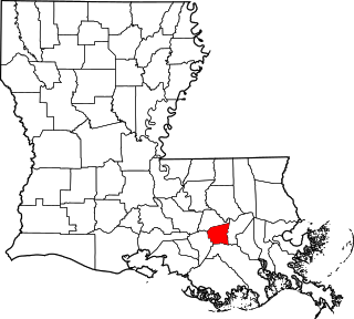
This is a list of the National Register of Historic Places listings in St. Martin Parish, Louisiana.

<span class="mw-page-title-main">National Register of Historic Places listings in St. Tammany Parish, Louisiana</span>

This is a list of the National Register of Historic Places listings in St. Tammany Parish, Louisiana.

<span class="mw-page-title-main">National Register of Historic Places listings in Webster Parish, Louisiana</span>

This is a list of the National Register of Historic Places listings in Webster Parish, Louisiana.

<span class="mw-page-title-main">National Register of Historic Places listings in Calcasieu Parish, Louisiana</span>

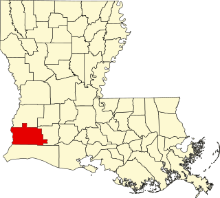
This is a list of the National Register of Historic Places listings in Calcasieu Parish, Louisiana.

<span class="mw-page-title-main">National Register of Historic Places listings in Jefferson Parish, Louisiana</span>

This is a list of the National Register of Historic Places listings in Jefferson Parish, Louisiana.

<span class="mw-page-title-main">National Register of Historic Places listings in Jefferson Davis Parish, Louisiana</span>

This is a list of the National Register of Historic Places listings in Jefferson Davis Parish, Louisiana.

<span class="mw-page-title-main">National Register of Historic Places listings in St. John the Baptist Parish, Louisiana</span>

This is a list of the National Register of Historic Places listings in St. John the Baptist Parish, Louisiana.

<span class="mw-page-title-main">National Register of Historic Places listings in Franklin Parish, Louisiana</span>

This is a list of the National Register of Historic Places listings in Franklin Parish, Louisiana.

<span class="mw-page-title-main">National Register of Historic Places listings in East Carroll Parish, Louisiana</span>

This is a list of the National Register of Historic Places listings in East Carroll Parish, Louisiana.

<span class="mw-page-title-main">National Register of Historic Places listings in Claiborne Parish, Louisiana</span>

This is a list of the National Register of Historic Places listings in Claiborne Parish, Louisiana.

<span class="mw-page-title-main">National Register of Historic Places listings in Caldwell Parish, Louisiana</span>

This is a list of the National Register of Historic Places listings in Caldwell Parish, Louisiana.

References

  1. The latitude and longitude information provided in this table was derived originally from the National Register Information System, which has been found to be fairly accurate for about 99% of listings. Some locations in this table may have been corrected to current GPS standards.
  2. National Park Service, United States Department of the Interior, "National Register of Historic Places: Weekly List Actions", retrieved October 21, 2022.
  3. 1 2 Numbers represent an alphabetical ordering by significant words. Various colorings, defined here, differentiate National Historic Landmarks and historic districts from other NRHP buildings, structures, sites or objects.
  4. "National Register Information System". National Register of Historic Places . National Park Service. March 13, 2009.
  5. The eight-digit number below each date is the number assigned to each location in the National Register Information System database, which can be viewed by clicking the number.
  6. Louisiana State Historic Preservation Office (October 2004). "Preservation in Print, Volume 31, Number 7". p. 17. Retrieved 20 March 2018.
  7. "National Register of Historic Places Evaluation/Return Sheet: Clarendon Plantation House" (PDF). National Park Service. June 8, 2016. Retrieved March 22, 2018. With 2 maps and a newspaper article regarding demolition of the house
  8. "Epps House". LSU-Alexandria Website. Retrieved 22 March 2018.