Related Research Articles

The Bakerloo line is a London Underground line that goes from Harrow & Wealdstone in suburban north-west London to Elephant & Castle in south London, via the West End. Printed in brown on the Tube map, it serves 25 stations, 15 of which are underground, over 14.4 miles (23.2 km). It runs partly on the surface and partly in deep-level tube tunnels.

The Colne Valley Railway is a heritage railway based at Castle Hedingham Station, near Halstead in Essex, England. The railway consists of a 1 mile (1.6 km) long running line, with a fully reconstructed station, signal box and railway yard.

Hedingham Castle, in the village of Castle Hedingham, Essex, is arguably the best preserved Norman keep in England. The castle fortifications and outbuildings were built around 1100, and the keep around 1140. However, the keep is the only major medieval structure that has survived, albeit less two turrets. It is a Grade I listed building and a scheduled monument. The keep is open to the public.

Castle Hedingham is a village in northern Essex, England, located four miles west of Halstead and 3 miles southeast of Great Yeldham in the Colne Valley on the ancient road from Colchester, Essex, to Cambridge.

Hedingham & Chambers is a bus operator, part of the larger Go East Anglia unit within Go-Ahead, consisting of the Hedingham and Chambers brands. The group was formed when Go-Ahead purchased the two firms in June 2012. Since the sale, the two brands have been retained with assets, such as depots, shared along with the launch of a unified website in 2021.

Saffron Walden is a constituency in Essex represented in the House of Commons of the UK Parliament since 2017 by Kemi Badenoch, a Conservative.

The River Colne is a small river that runs through Essex, England and passes through Colchester. It is not a tributary of any other river, instead having an estuary that joins the sea near Brightlingsea. The river's name is of Celtic origin, combining the word for rock "cal" with a remnant of the word "afon", or river, giving the meaning "stony river". However, another authority states that the river's name was originally Colonia Fluvius, the "waterway of the Colonia": a reference to Colchester's status in Roman times. There are two other rivers in the UK that share the same name.

Ovington is a small village in north Essex, England. The village is situated about three miles (5 km) from the village of Clare. It consists of St. Mary's Church, and a few houses. There is the air traffic of Ridgewell Airfield. The population of the village is included in the civil parish of Tilbury Juxta Clare.

The London and North Eastern Railway (LNER) Thompson Class B2 was a class of 4-6-0 steam locomotive. It was introduced in 1945 as a two-cylinder rebuild of the three-cylinder LNER Class B17. Ten were rebuilt from Class B17 but no more were rebuilt because of the success of the LNER Thompson Class B1.

Cressing railway station is on the Braintree Branch Line in the East of England, serving the villages of Cressing and Black Notley, Essex. It is 42 miles 75 chains (69.10 km) down the line from London Liverpool Street via Witham and it is situated between White Notley to the south and Braintree Freeport to the north. Its three-letter station code is CES. The platform has an operational length for nine-coach trains.

Cotherstone railway station was situated on the Tees Valley Railway between Barnard Castle and Middleton-in-Teesdale. It served the village of Cotherstone. The station opened to passenger traffic on 12 May 1868, and closed on 30 November 1964.
Dummy, the Witch of Sible Hedingham was the pseudonym of an unidentified elderly man who was one of the last people to be accused of witchcraft in England in the 19th century. He died after being beaten and thrown into a river by witch-hunters.
The Colne Valley and Halstead Railway (CVHR) is a closed railway between Haverhill, Suffolk and Chappel and Wakes Colne, Essex, in England.

Sible Hedingham is a large village and civil parish in the Colne Valley in the Braintree District of Essex, in England. It has a population of 3,994 according to the 2011 census. Sible Hedingham lies in the northern corner of Essex, close to both the Suffolk and Cambridgeshire borders. The village covers some 2,123 hectares.

Buntingford railway station is a former station in Buntingford, Hertfordshire, England. It served as the terminus of a branch from the Hertford East Branch Line.

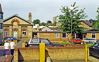
Halstead railway station was located in Halstead, Essex. It was 56 miles 34 chains (90.81 km) from London Liverpool Street via Marks Tey. It closed in 1962.

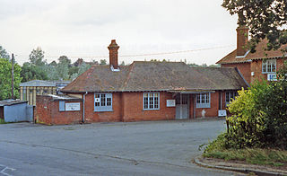
Earls Colne railway station was located in Earls Colne, Essex. It was 53 miles 77 chains (86.84 km) from London Liverpool Street via Marks Tey.
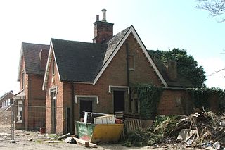
Awre for Blakeney railway station is a closed railway station in Gloucestershire, England, which served both the village of Awre and the town of Blakeney.

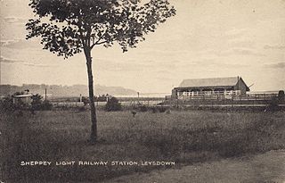
Leysdown is a disused railway station in Leysdown-on-Sea. It opened in 1901 and closed in 1950. There are no remains of the station.
The Yeovil–Taunton line was a railway line in England, built by the Bristol and Exeter Railway (B&ER) to connect its main line with the market town of Yeovil in Somerset. It opened in 1853 using the broad gauge of 7 ft 1⁄4 in and was the first railway to serve Yeovil. It ran from a junction at Durston although in later years passenger trains on the line ran through to and from Taunton where better main and branch line connections could be made.
References
- 1 2 3 4 Butt, R. V. J. (October 1995). The Directory of Railway Stations: details every public and private passenger station, halt, platform and stopping place, past and present (1st ed.). Sparkford: Patrick Stephens Ltd. pp. 56, 212. ISBN 978-1-85260-508-7. OCLC 60251199. OL 11956311M.
- ↑ "ELR: COV mileages".