Silver Grove, Kentucky

Last updated

Silver Grove, Kentucky
Silver-Grove-KY547-ky.jpg
Four Mile Pike (KY 547)
Campbell County Kentucky Incorporated and Unincorporated areas Silver Grove Highlighted 2170644.svg
Location of Silver Grove in Campbell County, Kentucky.
Coordinates: 39°02′25″N84°23′55″W / 39.04028°N 84.39861°W / 39.04028; -84.39861
CountryUnited States
State Kentucky
County Campbell
IncorporationDecember 29, 1950 [1]
Government
  Type Mayor-Council
  MayorNeal Bedel [2] (R)
Area
[3]
  Total1.64 sq mi (4.25 km2)
  Land1.13 sq mi (2.93 km2)
  Water0.51 sq mi (1.32 km2)
Elevation
[4]
495 ft (151 m)
Population
 (2020)
  Total1,154
  Density1,021.24/sq mi (394.13/km2)
Time zone UTC-5 (Eastern (EST))
  Summer (DST) UTC-4 (EDT)
ZIP code
41085
Area code 859
FIPS code 21-70644
GNIS feature ID2405465 [4]
Website cityofsilvergroveky.com

Silver Grove is a home rule-class city [5] along the Ohio River in Campbell County, Kentucky, in the United States. The population was 1,154 at the 2020 census.

Contents

History

Silver Grove is a railroad town founded in 1911 for the Chesapeake and Ohio Railway. In 1914, a newspaper described it as a modern town, because it boasted electric lights, an urban water and sewer system, a modernized fire department, a school, and a spacious park. In 1948, C&O wanted out of the city. In 1951, Gerald Losey was selected as the first mayor. [6]

Geography

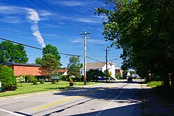
Silver Grove is located in northeastern Campbell County on the south bank of the Ohio River. [7] Kentucky Route 8 passes through the city, leading northwest (downstream) along the river 8 miles (13 km) to Dayton and southeast 32 miles (51 km) to Augusta. Downtown Cincinnati, Ohio, is 10 miles (16 km) to the northwest via Interstate 471.

According to the United States Census Bureau, Silver Grove has a total area of 1.7 square miles (4.3 km2), of which 1.1 square miles (2.9 km2) is land and 0.54 square miles (1.4 km2), or 31.61%, is water. [8]

Demographics

Historical population
CensusPop.Note
1960 1,207
1970 1,36513.1%
1980 1,260−7.7%
1990 1,102−12.5%
2000 1,21510.3%
2010 1,102−9.3%
2020 1,1544.7%
U.S. Decennial Census [9]

As of the census [10] of 2010, there were 1,102 people, [11] 417 households, [11] and 260 families residing in the city. [11] The population density was 999.8 inhabitants per square mile (386.0/km2). There were 496 housing units [11] at an average density of 408.1 per square mile (157.6/km2). The racial makeup of the city was 98% White, [11] 0.1% African American, [11] 0.1% Asian, [11] 0.4% from other races, [11] and 1.5% from two or more races. [11] Hispanic or Latino of any race were 0.2% of the population. [11]

There were 417 households, out of which 31.4% had children under the age of 18 living with them, [11] 42.2% were married couples living together, [11] 11.5% had a female householder with no husband present, [11] and 37.6% were non-families. [11] 30.2% of all households were made up of individuals, and 6.71% had someone living alone who was 65 years of age or older. [11] The average household size was 2.63 and the average family size was 3.31. [11]

In the city, the population was spread out, with 28.1% under the age of 18, 10.0% from 18 to 24, 32.4% from 25 to 44, 18.0% from 45 to 64, and 11.4% who were 65 years of age or older. The median age was 32 years. For every 100 females, there were 115.0 males. For every 100 females age 18 and over, there were 109.4 males.

The median income for a household in the city was $32,448, and the median income for a family was $41,691. Males had a median income of $36,083 versus $23,977 for females. The per capita income for the city was $15,129. About 8.8% of families and 10.7% of the population were below the poverty line, including 12.2% of those under age 18 and 12.9% of those age 65 or over.

In the 2012 U.S. presidential election, unlike most of Kentucky, the city supported the Democratic candidate Barack Obama. [12]

Education

Silver Grove had its own K-12 school district (all grades housed in one building) until 2019, when the Silver Grove Board of Education voted to merge with Campbell County Schools.

See also

Related Research Articles

<span class="mw-page-title-main">Pendleton County, Kentucky</span> County in Kentucky, United States

Pendleton County is a county located in the U.S. state of Kentucky. As of the 2020 census, the population was 14,644. Its county seat is Falmouth. The county was founded December 13, 1798. Pendleton County is included in the Cincinnati-Middletown, OH-KY-IN Metropolitan Statistical Area.

<span class="mw-page-title-main">Campbell County, Kentucky</span> County in Kentucky, United States

Campbell County is a county located in the northern part of the U.S. state of Kentucky. As of the 2020 census, the population was 93,076. Its county seats are Alexandria and Newport. The county was formed on December 17, 1794, from sections of Scott, Harrison, and Mason Counties and was named for Colonel John Campbell (1735–1799), a Revolutionary War soldier and Kentucky legislator. Campbell County, with Boone and Kenton Counties, is part of the Northern Kentucky metro community, and the Cincinnati-Middletown, OH-KY-IN Metropolitan Statistical Area.

<span class="mw-page-title-main">Alexandria, Kentucky</span> City in Kentucky, United States

Alexandria is a home rule-class city in Campbell County, Kentucky, in the United States. Along with Newport, it is one of the dual seats of the county. The population was 10,341 at the 2020 census.

<span class="mw-page-title-main">California, Kentucky</span> City in Kentucky, United States

California is a home rule-class city in Campbell County, Kentucky, United States. The population was 83 at the 2020 census.

<span class="mw-page-title-main">Claryville, Kentucky</span> Census-designated place in Kentucky, United States

Claryville is an unincorporated community and census-designated place (CDP) in Campbell County, Kentucky, United States. The population was 2,992 at the 2020 census.

<span class="mw-page-title-main">Cold Spring, Kentucky</span> City in Kentucky, United States

Cold Spring is a home rule-class city in Campbell County, Kentucky, in the United States. The population was 6,216 at the 2020 census. It is part of the Cincinnati-Northern Kentucky metropolitan area.

<span class="mw-page-title-main">Crestview, Kentucky</span> City in Kentucky, United States

Crestview is a home rule-class city in Campbell County, Kentucky, in the United States. The population was 452 at the 2020 census.

<span class="mw-page-title-main">Dayton, Kentucky</span> City in Kentucky, United States

The City of Dayton, Kentucky, is a home rule-class city along a bend of the Ohio River in Campbell County, Kentucky, United States. The population was 5,666 at the 2020 census. It is less than 3 miles (5 km) from downtown Cincinnati, Ohio.

<span class="mw-page-title-main">Melbourne, Kentucky</span> City in Kentucky, United States

Melbourne is a home rule-class city in Campbell County, Kentucky, United States, along the south bank of the Ohio River. The population was 458 at the 2020 census. St. Anne Convent is located in Melbourne; scenes from the movie Rain Man were filmed there.

<span class="mw-page-title-main">Mentor, Kentucky</span> City in Kentucky, United States

Mentor is a home rule-class city in Campbell County, Kentucky, United States. The population was 218 as of the 2020 census.

<span class="mw-page-title-main">Woodlawn, Kentucky</span> City in Kentucky, United States

Woodlawn is a home rule-class city in Campbell County, Kentucky, United States. The population was 212 at the 2020 census.

Fort Campbell North is a census-designated place (CDP) in Christian County, Kentucky, United States. It contains most of the housing for the Fort Campbell Army base within the Kentucky portion of the base. The population was 13,685 at the 2010 census, down from 14,338 in 2000.

<span class="mw-page-title-main">Oak Grove, Kentucky</span> City in Kentucky, United States

Oak Grove is a home rule-class city adjacent to the Fort Campbell army base in Christian County, Kentucky, in the United States. The population was 7,489 as of the 2010 U.S. Census. It is part of the Clarksville, Tennessee metropolitan area.

<span class="mw-page-title-main">Raceland, Kentucky</span> City in Kentucky, United States

Raceland is a home rule-class city in Greenup County, Kentucky, United States, in the Ohio River valley. As of the 2010 census, the population was 2,424. It is part of the Huntington–Ashland metropolitan area.

<span class="mw-page-title-main">Vine Grove, Kentucky</span> City in Kentucky, United States

Vine Grove is a home rule-class city in Hardin County, Kentucky, United States. The population was 4,520 at the 2010 census, up from 4,169 at the 2000 census. It is part of the Elizabethtown–Fort Knox Metropolitan Statistical Area.

<span class="mw-page-title-main">Old Brownsboro Place, Kentucky</span> City in Jefferson County, Kentucky, United States

Old Brownsboro Place is a home rule-class city in Jefferson County, Kentucky, United States, and a part of the united Metro government. The population was 353 at the 2010 census.

<span class="mw-page-title-main">Independence, Kentucky</span> City in Kentucky, United States

Independence is a home rule-class city in Kenton County, Kentucky, in the United States. It is one of its county's two seats of government. The population was 24,757 at the time of the 2010 U.S. census, up from 14,982 at the 2000 census. It is the third largest city in Northern Kentucky after Covington and Florence.

<span class="mw-page-title-main">Villa Hills, Kentucky</span> City in Kentucky, United States

Villa Hills is a home rule-class city in Kenton County, Kentucky along the Ohio River. The population was 7,310 at the 2020 census.

<span class="mw-page-title-main">Concord, Kentucky</span> City in Kentucky, United States

Concord is a home rule-class city in Lewis County, Kentucky, in the United States. The population was 35 at the 2010 census. It is part of the Maysville Micropolitan Statistical Area.

<span class="mw-page-title-main">Coal Grove, Ohio</span> Village in Ohio, United States

Coal Grove is a village in Lawrence County, Ohio, United States, along the Ohio River. The population was 1,889 at the 2020 census. It borders the city of Ironton and lies across the Ohio River from Ashland, Kentucky. It is linked to Ashland by the Ben Williamson Memorial Bridge and Simeon Willis Memorial Bridge.

References

  1. Commonwealth of Kentucky. Office of the Secretary of State. Land Office. "Silver Grove, Kentucky". Accessed 26 August 2013.
  2. Clarity Elections.com. "Campbell Co. Election Results".
  3. "2020 U.S. Gazetteer Files". United States Census Bureau. Retrieved March 18, 2022.
  4. 1 2 U.S. Geological Survey Geographic Names Information System: Silver Grove, Kentucky
  5. "Summary and Reference Guide to House Bill 331 City Classification Reform" (PDF). Kentucky League of Cities. Retrieved December 30, 2014.
  6. Northern Kentucky.com. "City of Silver Grove, Kentucky Archived 2008-09-26 at the Wayback Machine ". Accessed 17 October 2011.
  7. "US Gazetteer files: 2010, 2000, and 1990". United States Census Bureau. February 12, 2011. Retrieved April 23, 2011.
  8. "Geographic Identifiers: 2010 Demographic Profile Data (G001): Silver Grove city, Kentucky". U.S. Census Bureau, American Factfinder. Archived from the original on February 12, 2020. Retrieved August 6, 2014.
  9. "Census of Population and Housing". Census.gov. Retrieved June 4, 2015.
  10. "U.S. Census website". United States Census Bureau . Retrieved January 31, 2008.
  11. 1 2 3 4 5 6 7 8 9 10 11 12 13 14 15 16 United States Census
  12. "Campbell - Election Results".