
Changi is a planning area located in the East Region of Singapore. Sharing borders with Pasir Ris and Tampines to the west, Changi Bay to the southeast, the South China Sea to the east and the Serangoon Harbour to the north. Changi, excluding the two water catchments and islands of Singapore, is the largest planning area by land size.
Simei is a subzone located in the eastern part of Singapore, situated within the town of Tampines. The name Simei is pinyin for "Four Beauties" in Chinese. Formerly known as Tampines South, it was officially renamed to Simei in 1985.

The Tampines Expressway is a highway in the north-eastern fringe of Singapore, joining the Pan Island Expressway (PIE) near Singapore Changi Airport in the east with the Central Expressway (CTE) and Seletar Expressway (SLE) in the north of the island.

Expo MRT station (DT35/CG1) is a Mass Rapid Transit (MRT) interchange station on the Changi Airport Branch Line of the East West Line and the Downtown Line in the Tampines planning area, Singapore. This station is located in between Changi City Point and the Singapore Expo, which this station is named after.
Changi Village is a modern village situated at the northern tip of Changi which is at the eastern end of Singapore. It is the usual connecting point for travellers heading to Pulau Ubin or Malaysia by ferry. Fishermen in the kelongs located in the Serangoon Harbour offshore also use this jetty as a drop off point to come onto mainland. The place also has many resorts and leisure facilities to cater for a weekend getaway for many Singaporeans. The area is classified by Urban Redevelopment Authorities as under the planning area of Changi and in the subzone of Changi Point. It is also classified under District 17 for property indexing.
The Bedok Police Division is one of the seven land division of the Singapore Police Force. Bedok Division covers approximately 114 square kilometres of the eastern sector of Singapore. The building became operational on 1 August 1987 when the former Joo Chiat Police Station at East Coast Road was closed down.

The East Region of Singapore is one of the five regions in the city-state. The region is the 2nd most densely populated among the five, and has the smallest land area. Bedok is the region's most populous town and Tampines is the regional centre of the area. Comprising 11,000 hectares, it includes six planning areas and is also home to Singapore's Changi Airport and Paya Lebar Airbase
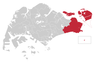
East Coast Group Representation Constituency is a four-member Group Representation Constituency in the eastern area of Singapore. The areas of the Group Representation Constituency consists of East Coast, Bedok, Changi-Simei, Siglap, Tampines, Pasir Ris, Kampong Chai Chee, Changi Airport and the offshore islands of Pulau Tekong, Pulau Ubin and Pedra Branca. The GRC also covers a large portion of Singapore's eastern territorial waters.

The Changi Business Park is a business park located in Changi South, in the eastern part of Singapore.
The Outer Ring Road System, or more commonly known as ORRS, is a network of major arterial roads in Singapore that forms a ring road through the towns along the city fringe. The ORRS is a semi-expressway, just like the West Coast Highway. Since 1994, roads along the ORRS have been upgraded in stages to provide a smoother route to travel across the island. Roads and interchanges along the ORRS are constantly being upgraded to cater to the ever increasing traffic demand. It starts as Portsdown Avenue in Queenstown and ends as Tampines Avenue 10 in Tampines. The series of roads passes through the areas of Queenstown, Bukit Timah, Central Catchment Nature Reserve, Bishan, Toa Payoh, Geylang and Tampines.

Loyang is a subzone region located in the town of Pasir Ris in the East Region of Singapore. The region consists of three subzones, Loyang West, Loyang East and Flora Drive.
Each year, various parts of Singapore are inundated by a series of floods, usually in the form of flash floods that came about due to intense rainfall over a short period of time.

Upper Changi MRT station (DT34) is an underground Mass Rapid Transit station on the Downtown Line in Tampines planning area, Singapore, located under Upper Changi Road East.

Tampines East MRT station (DT33) is an underground Mass Rapid Transit station on the Downtown Line in Tampines, Singapore, located along Tampines Avenue 7, near the junction with Tampines Avenue 2. This station, like most of the other Downtown Line stations, also serves as a Civil Defence Shelter.

Sree Ramar Temple is a temple for the Hindu god Rama, who is the presiding deity. It is located on the Changi Village Road on the east coast of Singapore.
Upper Changi Road East is a major two-way road in eastern Singapore that goes from Bedok Road via Simei Avenue, Simei Road to Tampines Expressway/Pan Island Expressway interchange. It had bus lanes from Bedok Road to Simei Avenue. It also passes through Singapore Expo and Singapore University of Technology and Design.

Xilin MRT station (DT36) is an underground Mass Rapid Transit station on the Downtown Line in Tampines planning area, Singapore.
New Upper Changi Road is a major two-way road in Bedok, Singapore, serving as the boundary of Bedok North and Bedok South. The road begins in the west at its traffic junction with Sims Avenue East and Changi Road, and ends in the east at the junction of Simei Avenue and Xilin Avenue. The road continues in the northeastern direction as Upper Changi Road East.


