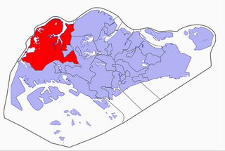
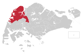
Lim Chu Kang is a planning area located in the northwestern part of the North Region of Singapore, bordering the Western Water Catchment to the west and south, Sungei Kadut to the east and the Straits of Johor to the north.
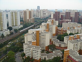
Bukit Batok, often abbreviated as Bt Batok, is a planning area and matured residential town located along the eastern boundary of the West Region of Singapore. Bukit Batok statistically ranks in as the 25th largest, the 12th most populous and the 11th most densely populated planning area in the Republic. It is bordered by six other planning areas - Choa Chu Kang to the north and northwest, Bukit Panjang to the northeast and east, Clementi to the south, Bukit Timah to the southeast, Jurong East to the southwest and Tengah to the west.
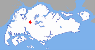
Gombak, also known as Bukit Gombak, is a subzone of Bukit Batok, Singapore. It is a hilly neighbourhood in the west-central area of the Southeast Asian city-state of Singapore. In the Malay language, bukit means hill and gombak a bunch or collection of something. The neighbourhood consists of two hills. One of them stands at 133m while the other stands at 113m. They are Singapore's second and third highest natural point after Bukit Timah Hill.
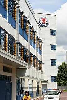
The Jurong Police Division is one of the seven land divisions of the Singapore Police Force. Jurong Division first came into existence as the ‘Rural West’ Division on 24 Sep 1965 and operated from a standalone building located at Bukit Panjang. As the communities in the west grew, police posts were built in Ama Keng, Mandai and Kranji.

Bukit Batok Interchange is an interchange bus station located at Block 631 Bukit Batok Central, Singapore, near West Mall Shopping Centre and Bukit Batok MRT Station. The sheltered concourse is built underneath a multi-storey carpark similar in design to the old Serangoon Interchange.
Hong Kah Group Representation Constituency was a five-member Group Representation Constituency located in the western area of Singapore. The constituency covered the areas of Bukit Batok, Choa Chu Kang, Upper Bukit Timah, Jurong West and Lim Chu Kang. Hong Kah GRC was formed in 1988 and dissolved in 2011 and had always been held by the People's Action Party.

Jurong Group Representation Constituency is a five-member Group Representation Constituency located in the western area of Singapore. The GRC consists of a large section of Jurong, sections of Bukit Batok and areas near Upper Bukit Timah Road. The subdivisions of the GRC are Bukit Batok East, Jurong Central, Taman Jurong and parts of Hong Kah. Clementi, a division under the West Coast GRC, was absorbed to the ward in the recent general election. Two former divisions, namely Yuhua and Bukit Batok, had been crafted out as Single Member Constituencies for the 2011 general elections and 2015 general elections, respectively.
Singapore has about 65 species of mammals, 390 species of birds, 110 species of reptiles, 30 species of amphibians, more than 300 butterfly species, 127 dragonfly species and over 2,000 recorded species of marine wildlife.

The South West Community Development Council is one of five Community Development Councils (CDCs) set up across the Republic of Singapore to aid in local administration of governmental policies and schemes. They are funded in part by the government although they are free to engage in fund-raising activities.
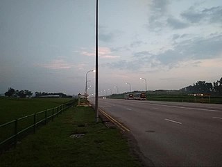
Tengah is a planning area and future HDB town located within the West Region of Singapore. It is bounded to by Choa Chu Kang to the northeast, Jurong East and Jurong West to the south, Bukit Batok to the east and the Western Water Catchment to its west and north.

The Branch MRT line was originally the third Mass Rapid Transit (MRT) line in Singapore, initially operated as a branch to the existing East West line. The line was 6.5 km long with 4 stations, and was operated by the SMRT Corporation. Travelling from one end of this line to the other end took about ten minutes, and this line was coloured brown and khaki on the rail map. The line is now part of the North South line, making it the very first and only defunct line in Singapore.
Wenya is a subzone of Jurong West, Singapore.
The Park Connector Network (PCN) of Singapore is a network of walking/running/cycling paths that connects the various parks and other green spaces in Singapore. Both the parks and the PCN are managed by National Parks Board (NParks).
Choa Chu Kang MRT/LRT station (NS4/JS1/BP1) is an above-ground Mass Rapid Transit (MRT) and Light Rail Transit (LRT) interchange station in Choa Chu Kang, Singapore. It is an interchange between the North South line and Bukit Panjang LRT, serving as the western terminus of the latter.
Chua Chu Kang Group Representation Constituency is a four-member Group Representation Constituency located in the western area of Singapore.

