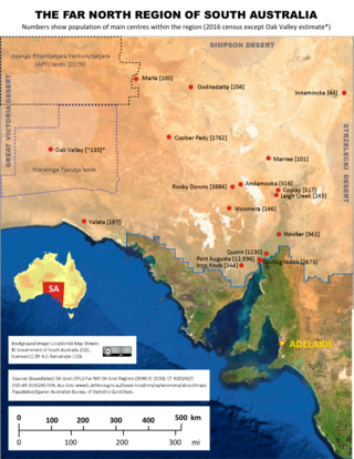
The Far North is a large region of South Australia close to the Northern Territory border. Colloquial usage of the term in South Australia refers to that part of South Australia north of a line roughly from Ceduna through Port Augusta to Broken Hill. The South Australian Government defines the Far North region similarly with the exception of the Maralinga Tjarutja Lands, the Yalata Aboriginal community and other unincorporated crown lands in the state's far west, which are officially considered part of the Eyre and Western region.
The Munga-Thirri–Simpson Desert Regional Reserve was a protected area located in the Australian state of South Australia within the gazetted locality of Simpson Desert. The regional reserve's name was altered on 2 August 2018 by the Government of South Australia. The regional reserve was classified as an IUCN Category VI protected area.

Munga-Thirri–Simpson Desert National Park, part of which was formerly Munga-Thirri–Simpson Desert Conservation Park, Simpson Desert Conservation Park, and Simpson Desert National Park, is a protected area located in the far north of the Australian state of South Australia, near its border with Queensland and the Northern Territory. As of November 2021 it is the largest national park in Australia, covering 3,600,000 ha (14,000 sq mi).

The Simpson Desert Important Bird Area comprises some 22,848 km2 of land within the Simpson Desert in south-western Queensland and north-eastern South Australia. It consists of five large contiguous reserves subject to little grazing pressure and good habitat management that are either known, or likely, to provide suitable habitat for Eyrean grasswrens.
A Regional Reserve is a type of protected area used in the Australian states of South Australia and Tasmania that allows the use of natural resources in conjunction with the protected area’s conservation function.
Yellabinna is a locality in the Australian state of South Australia located to the north of the town of Ceduna in the western part of the state.
Ediacara is a locality in the Australian state of South Australia located about 500 kilometres north of the state capital of Adelaide and about 30 kilometres to the south west of the town of Leigh Creek.
Danggali is a locality in the Australian state of South Australia located about 70 kilometres north of the town of Renmark and about 230 kilometres north east of the state capital of Adelaide.
Calperum Station is a locality in the Australian state of South Australia located on the northern side of the Murray River about 10 kilometres to the north of the town of Renmark and about 250 kilometres east of the centre of the capital city of Adelaide.

Stuarts Creek is a remote locality in the Australian state of South Australia in the states's Far North region. The name and boundaries were formalised on 26 April 2013, named after Stuart Creek Station, in respect of the long established local name.

Lake Gilles is a locality in the Australian state of South Australia located on the Eyre Peninsula about 278 kilometres north west of the state capital of Adelaide and about 35 kilometres to the north-east of the town of Kimba.

Flinders Ranges is a locality in the Australian state of South Australia located in the mountain range of the same name, about 380 km (240 mi) north of the state capital of Adelaide, about 86 km (53 mi) north-east of the municipal seat in Quorn and about 131 km (81 mi) north-east of the regional centre of Port Augusta.

Lake Eyre is a locality in the Australian state of South Australia located about 718 kilometres north of the state capital of Adelaide and 134 kilometres north of the town of Marree and which is associated with the occasional body of water known as Lake Eyre.
Gidgealpa is a locality in the Australian state of South Australia located about 780 kilometres north-east of the capital city of Adelaide and about 58 kilometres south-west of the town of Innamincka.
Etadunna is a locality in the Australian state of South Australia located about 684 kilometres north of the capital city of Adelaide and about 108 kilometres north-east of the town of Marree.
Pureba is a locality in the Australian state of South Australia located on the west coast of Eyre Peninsula and on land to the immediate north of the peninsula about 528 kilometres north-west of the state capital of Adelaide and about 52 kilometres north-east and 90 kilometres north respectively of the municipal seats of Ceduna and Streaky Bay.
Mount Willoughby is a locality in the Australian state of South Australia located about 837 kilometres north-west of the capital city of Adelaide and about 84 kilometres north-west of the town of Coober Pedy.
Simpson Desert is a desert located in central Australia.
Allandale Station is a locality in the Australian state of South Australia located about 848 kilometres (527 mi) north of the state capital of Adelaide and about 20 kilometres (12 mi) south-east of the town of Oodnadatta.

The Simpson Desert Bike Challenge (SDBC) is an annual staged mountain bike race held in the Simpson Desert of Australia. First held in 1987, the SDBC is run by the non-profit organisation Desert Challenge Inc

