This article needs additional citations for verification .(June 2017) (Learn how and when to remove this template message) |
Sirpur | |
|---|---|
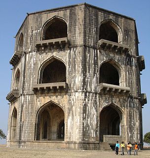
 Sirpur Town Fort | |
| Nickname(s): Sirpur town | |
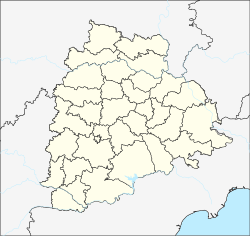 Sirpur Location in Telangana, India | |
| Coordinates: 19°29′00″N79°36′00″E / 19.4833°N 79.6000°E Coordinates: 19°29′00″N79°36′00″E / 19.4833°N 79.6000°E | |
| Country | India |
| State | Telangana |
| District | Kumaram Bheem Asifabad |
| Mandal | Sirpur (T) |
| Government | |
| • Type | Gram Panchayat |
| • Body | Sirpur Town Major Gram Panchayat |
| Area | |
| • Total | 8.88 km2 (3.43 sq mi) |
| Elevation | 184 m (604 ft) |
| Population (2011) | |
| • Total | 19,183 |
| Languages | |
| • Official | Telugu, Urdu, English |
| • Others | gondi, Bengali, Hindi, Marathi |
| Time zone | UTC+5:30 (IST) |
| PIN | 504299 |
| Telephone code | 08738 |
| Vehicle registration | TS 01 |
Sirpur is a village in east part of Kumaram Bheem Asifabad district of the Indian state of Telangana. Kumaram Bheem Asifabad district is a part of the Adilabad district prior to the re-organisation of districts in the state. It is located in Sirpur (T) mandal of Kaghaznagar revenue division. [2] Sirpur-T is a village and a Mandal in Kumaram Bheem Asifabad district, It is notable for Sirpur paper mills.bIt rests on the banks of river Wardha. Sirpur is around 160 km west of Adilabad city. Sirpur, formerly known as Suryapuram, was ruled by the Gond King, Ballala. Sipurt Fort is a major tourist attraction, The Gond King, Bhim Ballal Sing built Sirpur Fort in 9th century AD. The modern town grew around the fort. Distinction of the town is the Sirpur Paper Mills, one of the biggest paper mills in India and hence the name Sirpur Kagaznagar. Hyderabad Airport is the nearest airport. Sirpur Town Railway Station and Sirpur Kagaznagar Railway Station serve the town.

Komaram Bheem Asifabad is a district in the Indian state of Telangana. It was a part of the Adilabad district prior to the re-organisation of districts in the state.

India, also known as the Republic of India, is a country in South Asia. It is the seventh-largest country by area, the second-most populous country, and the most populous democracy in the world. Bounded by the Indian Ocean on the south, the Arabian Sea on the southwest, and the Bay of Bengal on the southeast, it shares land borders with Pakistan to the west; China, Nepal, and Bhutan to the northeast; and Bangladesh and Myanmar to the east. In the Indian Ocean, India is in the vicinity of Sri Lanka and the Maldives; its Andaman and Nicobar Islands share a maritime border with Thailand and Indonesia.

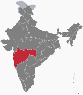
Telangana is a state in India situated on the centre-south stretch of the Indian peninsula on the high Deccan Plateau. It is the twelfth largest state and the twelfth-most populated state in India with a geographical area of 112,077 km2 (43,273 sq mi) and 35,193,978 residents as per 2011 census. On 2 June 2014, the area was separated from the northwestern part of Andhra Pradesh as the newly formed 29th state with Hyderabad as its historic permanent capital. Its other major cities include Warangal, Nizamabad, Khammam and Karimnagar. Telangana is bordered by the states of Maharashtra to the north, Chhattisgarh to the east, Karnataka to the west, and Andhra Pradesh to the east and south. The terrain of Telangana region consists mostly of hills, mountain ranges, and thick dense forests distribution of 27,292 sq. km. As of 2019, the state of Telangana is divided into 33 districts.