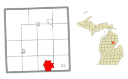
Skidway Lake, Michigan

Last updated

Skidway Lake, Michigan
Skidway Lake, Michigan (CDP).jpg
Skidway Lake along Greenwood Road
Skidway Lake (CDP), MI location.png
Location within Ogemaw County
USA Michigan location map.svg
Red pog.svg
Skidway Lake
Location within the state of Michigan
Usa edcp location map.svg
Red pog.svg
Skidway Lake
Location within the United States
Coordinates: 44°11′00″N84°02′07″W / 44.18333°N 84.03528°W / 44.18333; -84.03528
CountryUnited States
State Michigan
County Ogemaw
Township Mills
Area
[1]
  Total11.79 sq mi (30.52 km2)
  Land11.29 sq mi (29.24 km2)
  Water0.49 sq mi (1.28 km2)
Elevation
797 ft (243 m)
Population
 (2020)
  Total3,082
  Density272.96/sq mi (105.39/km2)
Time zone UTC-5 (Eastern (EST))
  Summer (DST) UTC-4 (EDT)
ZIP code(s)
48610 (Alger)
48756 (Prescott)
Area code 989
FIPS code 26-74200 [2]
GNIS feature ID0638056 [3]

Skidway Lake is an unincorporated community and census-designated place (CDP) in Ogemaw County in the U.S. state of Michigan. The population was 3,392 at the 2010 census, which makes it the most populated community in Ogemaw County. Skidway Lake is located within Mills Township.

Contents

History

Skidway Lake had its own post office from 1959 to 1999. [4]

Geography

According to the U.S. Census Bureau, the CDP has a total area of 11.78 square miles (30.51 km2), of which 11.29 square miles (29.24 km2) is land and 0.49 square miles (1.27 km2) (4.16%) is water. [5]

The community takes its name from Skidway Lake, although the census-designated place contains numerous other smaller lakes including Black Lake, Bush Lake, Elbow Lake, Feeding Ground Lake, Little Feeding Ground Lake, Lost Lake, Norway Lake, and Turtle Lake. The Rifle River forms the western border of the census-designated place, while the smaller Silver Creek runs through the center of the community.

Demographics

Historical population
CensusPop.Note
2020 3,082
U.S. Decennial Census [6]

As of the census [2] of 2000, there were 3,147 people, 1,326 households, and 883 families residing in the CDP. The population density was 277.8 inhabitants per square mile (107.3/km2). There were 2,562 housing units at an average density of 226.2 per square mile (87.3/km2). The racial makeup of the CDP was 95.68% White, 0.35% African American, 1.68% Native American, 0.03% from other races, and 2.26% from two or more races. Hispanic or Latino of any race were 1.43% of the population.

There were 1,326 households, out of which 25.3% had children under the age of 18 living with them, 49.0% were married couples living together, 11.8% had a female householder with no husband present, and 33.4% were non-families. 27.7% of all households were made up of individuals, and 14.1% had someone living alone who was 65 years of age or older. The average household size was 2.37 and the average family size was 2.84.

In the CDP, the population was spread out, with 22.6% under the age of 18, 7.4% from 18 to 24, 24.4% from 25 to 44, 26.6% from 45 to 64, and 19.1% who were 65 years of age or older. The median age was 42 years. For every 100 females, there were 100.7 males. For every 100 females age 18 and over, there were 97.3 males.

The median income for a household in the CDP was $20,806, and the median income for a family was $24,637. Males had a median income of $24,659 versus $15,850 for females. The per capita income for the CDP was $11,405. About 20.4% of families and 25.3% of the population were below the poverty line, including 30.0% of those under age 18 and 14.7% of those age 65 or over.

Related Research Articles

<span class="mw-page-title-main">Ogemaw County, Michigan</span> County in Michigan, United States

Ogemaw County is a county located in the U.S. state of Michigan. As of the 2020 Census, the population was 20,770. The county seat is West Branch.

<span class="mw-page-title-main">Lake Asbury, Florida</span> Census-designated place in Florida, United States

Lake Asbury is an unincorporated community and census-designated place (CDP) in Clay County, Florida, United States. The population was 8,700 at the 2010 census, which calls it Asbury Lake.

<span class="mw-page-title-main">Hubbard Lake, Alcona County, Michigan</span> Census-designated place & unincorporated community in Michigan, United States

Hubbard Lake is an unincorporated community and census-designated place (CDP) in Alcona County in the U.S. state of Michigan. The population was 857 at the 2020 census. Hubbard Lake occupies portions of Alcona, Caledonia, and Hawes township.

<span class="mw-page-title-main">Lost Lake Woods, Michigan</span> Census-designated place & unincorporated community in Michigan, United States

Lost Lake Woods is an unincorporated community and census-designated place (CDP) in Alcona County in the U.S. state of Michigan. The population was 367 at the 2020 census. It is located within Alcona Township.

<span class="mw-page-title-main">Lake Michigan Beach, Michigan</span> Census-designated place & unincorporated community in Michigan, United States

Lake Michigan Beach is an unincorporated community in Berrien County in the U.S. state of Michigan. It is a census-designated place (CDP) for statistical purposes, without any legal status as a municipality. The population was 1,216 at the 2010 census.

<span class="mw-page-title-main">Indian River, Michigan</span> Census-designated place & unincorporated community in Michigan, United States

Indian River is an unincorporated community and census-designated place (CDP) in Cheboygan County in the U.S. state of Michigan. The population was 1,950 at the 2020 census. The CDP is located in Tuscarora Township between Burt Lake and Mullett Lake.

<span class="mw-page-title-main">Argentine, Michigan</span> Census-designated place & unincorporated community in Michigan, United States

Argentine is an unincorporated community and census-designated place (CDP) in Argentine Township, Genesee County, in the U.S. state of Michigan. The population was 2,685 as of the 2020 census, up from 2,525 at the 2010 census. It was first settled in 1836.

<span class="mw-page-title-main">Lake Fenton, Michigan</span> Census-designated place & unincorporated community in Michigan, United States

Lake Fenton is a census-designated place (CDP) in Fenton Charter Township, Genesee County in the U.S. state of Michigan. As of the 2010 census the population was 5,559, up from 4,876 at the 2000 census. The CDP includes the unincorporated communities of Bayport Park and Lakeside.

<span class="mw-page-title-main">Michigan Center, Michigan</span> Census-designated place & unincorporated community in Michigan, United States

Michigan Center is an unincorporated community and census-designated place (CDP) in Jackson County in the U.S. state of Michigan. The population was 4,672 at the 2010 census. The CDP is located within Leoni Township on the eastern border of the city of Jackson.

<span class="mw-page-title-main">Vandercook Lake, Michigan</span> Census-designated place & unincorporated community in Michigan, United States

Vandercook Lake is an unincorporated community and census-designated place (CDP) in Jackson County in the U.S. state of Michigan. The population of the CDP was 4,721 at the 2010 census. It is located within Summit Township.

<span class="mw-page-title-main">Michigamme, Michigan</span> Place in Michigan, United States

Michigamme is an unincorporated community in Marquette County in the U.S. state of Michigan. It is located within Michigamme Township on the north shores of Lake Michigamme. For statistical purposes, the United States Census Bureau has defined Michigamme as a census-designated place (CDP). The CDP had a population of 255 at the 2020 census.

<span class="mw-page-title-main">Stony Point, Michigan</span> Census-designated place & unincorporated community in Michigan, United States

Stony Point is an unincorporated community and census-designated place (CDP) in Monroe County in the U.S. state of Michigan. The population was 1,784 at the 2020 census. The CDP is located within Frenchtown Charter Township.

<span class="mw-page-title-main">Woodland Beach, Michigan</span> Census-designated place & unincorporated community in Michigan, United States

Woodland Beach is a census-designated place (CDP) and unincorporated community in Monroe County in the U.S. state of Michigan. The population was 1,899 at the 2020 census. The CDP is located within Frenchtown Charter Township.

<span class="mw-page-title-main">Wolf Lake, Michigan</span> Census-designated place & unincorporated community in Michigan, United States

Wolf Lake is an unincorporated community home of Oakridge high school in Egelston Township of Muskegon County in the U.S. state of Michigan. It is a census-designated place (CDP) for statistical purposes, but has no official status as an incorporated municipality. The population was 4,455 at the 2000 census. The area included in the CDP includes the entire shoreline of Wolf Lake and extends south of the lake to include an area south of M-46/E. Apple Ave.

<span class="mw-page-title-main">Mills Township, Ogemaw County, Michigan</span> Civil township in Michigan, United States

Mills Township is a civil township of Ogemaw County in the U.S. state of Michigan. The population was 4,291 at the 2010 census, making it the county's most populated municipality.

<span class="mw-page-title-main">Rose Township, Ogemaw County, Michigan</span> Civil township in Michigan, United States

Rose Township is a civil township of Ogemaw County in the U.S. state of Michigan. The population was 1,368 at the 2010 census.

<span class="mw-page-title-main">West Branch Township, Ogemaw County, Michigan</span> Civil township in Michigan, United States

West Branch Township is a civil township of Ogemaw County in the U.S. state of Michigan. The population was 2,593 at the 2010 census. The city of West Branch is mostly surrounded by the township, but the two are administered autonomously.

<span class="mw-page-title-main">Ogemaw Township, Michigan</span> Civil township in Michigan, United States

Ogemaw Township is a civil township of Ogemaw County in the U.S. state of Michigan. The population was 1,223 at the 2010 census.

<span class="mw-page-title-main">Whitmore Lake, Michigan</span> Census-designated place & unincorporated community in Michigan, United States

Whitmore Lake is a census-designated place (CDP) and unincorporated community in the U.S. state of Michigan. The community spans the boundary between Green Oak Township in Livingston County and Northfield Township in Washtenaw County. The population of the CDP was 7,584 at the 2020 census.

<span class="mw-page-title-main">Cross Village, Michigan</span> Census-designated place & unincorporated community in Michigan, United States

Cross Village is an unincorporated community and census-designated place (CDP) in Emmet County in the U.S. state of Michigan. As of the 2010 census, the CDP had a population of 93. It is located within Cross Village Township on the shores of Lake Michigan.

References

  1. "2020 U.S. Gazetteer Files". United States Census Bureau. Retrieved May 21, 2022.
  2. 1 2 "U.S. Census website". United States Census Bureau . Retrieved January 31, 2008.
  3. U.S. Geological Survey Geographic Names Information System: Skidway Lake, Michigan
  4. U.S. Geological Survey Geographic Names Information System: Skidway Lake Post Office
  5. "Michigan: 2010 Population and Housing Unit Counts 2010 Census of Population and Housing" (PDF). 2010 United States Census . United States Census Bureau. September 2012. p. 37 Michigan. Archived (PDF) from the original on October 19, 2012. Retrieved November 7, 2020.
  6. "Census of Population and Housing". Census.gov. Retrieved June 4, 2016.