Cumming Township, Michigan

Last updated

Cumming Township, Michigan
Cumming Township, Michigan.jpg
Cumming Township Hall
Cumming Township, MI location.png
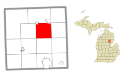
Location within Ogemaw County (red) and an administered portion of the Lupton CDP (pink)
USA Michigan location map.svg
Red pog.svg
Cumming Township
Location within the state of Michigan
Usa edcp location map.svg
Red pog.svg
Cumming Township
Location within the United States
Coordinates: 44°23′32″N84°03′51″W / 44.39222°N 84.06417°W / 44.39222; -84.06417
CountryUnited States
State Michigan
County Ogemaw
Government
  SupervisorRonald Quackenbush
   Clerk Robert Barber
Area
  Total35.37 sq mi (91.61 km2)
  Land34.49 sq mi (89.33 km2)
  Water0.88 sq mi (2.28 km2)
Elevation
883 ft (269 m)
Population
 (2020)
  Total717
  Density20/sq mi (7.8/km2)
Time zone UTC-5 (Eastern (EST))
  Summer (DST) UTC-4 (EDT)
ZIP code(s)
48635 (Lupton)
48654 (Rose City)
48661 (West Branch)
Area code 989
FIPS code 26-19260 [1]
GNIS feature ID1626149 [2]

Cumming Township is a civil township of Ogemaw County in the U.S. state of Michigan. The population was 717 at the 2020 census.

Contents

Communities

Geography

According to the U.S. Census Bureau, the township has a total area of 35.37 square miles (91.61 km2), of which 34.49 square miles (89.33 km2) is land and 0.88 square miles (2.28 km2) (2.47%) is water. [5]

Lakes

The township includes all or portions of the following lakes:

  • Cummings Lake [6]
  • Devils Washbasin [7]
  • Devoe Lake [8]
  • Eagle Lake (also known as Houghton Lake) [9]
  • Grebe Lake [10]
  • Grousehaven Lake [11]
  • Henderson Lake [12]
  • Jewett Lake [13]
  • Lodge Lake [14]
  • Lost Lake [15]
  • Mallard Pond [16]
  • Pintail Pond [17]
  • South Pond [18]
  • Scaup Lake [19]

Rivers

Most of the township is within the Rifle River drainage basin and the township includes all or portions of the following streams:

Demographics

Historical population
CensusPop.Note
2000 796
2010 698−12.3%
2020 7172.7%
U.S. Decennial Census [32] [33]

As of the census [1] of 2000, there were 796 people, 303 households, and 226 families residing in the township. The population density was 23.0 inhabitants per square mile (8.9/km2). There were 530 housing units at an average density of 15.3 per square mile (5.9/km2). The racial makeup of the township was 98.74% White, 0.13% African American, 0.13% Native American, and 1.01% from two or more races. Hispanic or Latino of any race were 0.63% of the population.

There were 303 households, out of which 32.3% had children under the age of 18 living with them, 64.7% were married couples living together, 6.6% had a female householder with no husband present, and 25.1% were non-families. 20.8% of all households were made up of individuals, and 10.9% had someone living alone who was 65 years of age or older. The average household size was 2.63 and the average family size was 3.06.

In the township the population was spread out, with 27.6% under the age of 18, 6.4% from 18 to 24, 25.9% from 25 to 44, 23.6% from 45 to 64, and 16.5% who were 65 years of age or older. The median age was 40 years. For every 100 females, there were 104.1 males. For every 100 females age 18 and over, there were 105.7 males.

The median income for a household in the township was $32,143, and the median income for a family was $38,594. Males had a median income of $33,229 versus $21,094 for females. The per capita income for the township was $15,971. About 10.1% of families and 14.8% of the population were below the poverty line, including 24.0% of those under age 18 and 13.3% of those age 65 or over.

Related Research Articles

Leighton Township is a civil township of Allegan County in the U.S. state of Michigan. The population was 7,001 at the 2020 census, up from 4,934 at the 2010 census.

Hope Township is a civil township of Barry County in the U.S. state of Michigan. The population was 3,154 at the 2020 census.

Clarence Township is a civil township located in northeast Calhoun County in the U.S. state of Michigan. It is part of the Battle Creek, Michigan Metropolitan Statistical Area. The population was 1,903 at the 2020 census. The township was originally named Pinkney Township.

<span class="mw-page-title-main">Emmett Charter Township, Michigan</span> Charter township in Michigan, United States

Emmett Charter Township is a charter township of Calhoun County in the U.S. state of Michigan. It is part of the Battle Creek Metropolitan Statistical Area. The population was 11,744 at the 2020 census.

<span class="mw-page-title-main">Beaver Creek Township, Michigan</span> Civil township in Michigan, United States

Beaver Creek Township is a civil township of Crawford County in the U.S. state of Michigan. As of the 2010 census, the township population was 1,736.

<span class="mw-page-title-main">Oscoda Township, Michigan</span> Charter township in Michigan, United States

Oscoda Township is a charter township of Iosco County in the U.S. state of Michigan. The population was 6,788 at the 2020 census. The Wurtsmith Air Force Base is located within the township.

<span class="mw-page-title-main">Henrietta Township, Michigan</span> Civil township in Michigan, United States

Henrietta Township is a civil township of Jackson County in the U.S. state of Michigan. The population was 4,705 at the 2010 census.

<span class="mw-page-title-main">South Gull Lake, Michigan</span> Census-designated place & unincorporated community in Michigan, United States

South Gull Lake is a census-designated place (CDP) in Ross Township, Kalamazoo County, in the U.S. state of Michigan. It includes the unincorporated communities of Yorkville, Gull Lake, and Midland Park and does not have any legal status as an incorporated municipality. The population of the CDP was 1,182 at the 2010 census, down from 1,526 at the 2000 census.

<span class="mw-page-title-main">Hamburg Township, Michigan</span> Civil township in Michigan, United States

Hamburg Township is a civil township of Livingston County in the U.S. state of Michigan. As of the 2020 census, the township population was 21,259. It is the most populated municipality in Livingston County.

<span class="mw-page-title-main">Hartland Township, Michigan</span> Civil township in Michigan, United States

Hartland Township is a civil township of Livingston County in the U.S. state of Michigan. The population was 15,256 at the 2020 census, up from 14,663 at the 2010 census.

<span class="mw-page-title-main">London Township, Michigan</span> Civil township in Michigan, United States

London Township is a civil township of Monroe County in the U.S. state of Michigan. The population was 2,984 at the 2020 census.

<span class="mw-page-title-main">Chester Township, Otsego County, Michigan</span> Civil township in Michigan, United States

Chester Township is a civil township of Otsego County in the U.S. state of Michigan. The population was 1,292 at the 2010 census.

<span class="mw-page-title-main">Otsego Lake Township, Michigan</span> Civil township in Michigan, United States

Otsego Lake Township is a civil township of Otsego County in the U.S. state of Michigan. The population was 2,847 at the 2010 census.

<span class="mw-page-title-main">Richfield Township, Roscommon County, Michigan</span> Civil township in Michigan, United States

Richfield Township is a civil township of Roscommon County in the U.S. state of Michigan. The population was 3,545 at the 2020 census.

<span class="mw-page-title-main">Swan Creek Township, Michigan</span> Civil township in Michigan, United States

Swan Creek Township is a civil township of Saginaw County in the U.S. state of Michigan. The population was 2,456 at the 2010 Census.

<span class="mw-page-title-main">Freedom Township, Michigan</span> Civil township in Michigan, United States

Freedom Township is a civil township of Washtenaw County in the U.S. state of Michigan. The population was 1,332 at the 2020 census.

<span class="mw-page-title-main">Lima Township, Michigan</span> Civil township in Michigan, United States

Lima Township is a civil township of Washtenaw County in the U.S. state of Michigan. The population was 4,024 at the 2020 census.

<span class="mw-page-title-main">Springville Township, Michigan</span> Civil township in Michigan, United States

Springville Township is a civil township of Wexford County in the U.S. state of Michigan. The population was 1,739 at the 2020 census.

<span class="mw-page-title-main">Ira Township, Michigan</span> Civil township in Michigan, United States

Ira Township is a civil township of St. Clair County in the U.S. state of Michigan. The population was 5,178 at the 2010 Census.

<span class="mw-page-title-main">Bear Lake Township, Kalkaska County, Michigan</span> Civil township in Michigan, United States

Bear Lake Township is a civil township of Kalkaska County in the U.S. state of Michigan. As of the 2020 census, the township population was 668.

References

  1. 1 2 "U.S. Census website". United States Census Bureau . Retrieved January 31, 2008.
  2. U.S. Geological Survey Geographic Names Information System: Cumming Township, Michigan
  3. U.S. Geological Survey Geographic Names Information System: Camp Lu Lay Lea
  4. U.S. Geological Survey Geographic Names Information System: Fayettes Corner
  5. "Michigan: 2010 Population and Housing Unit Counts 2010 Census of Population and Housing" (PDF). 2010 United States Census . United States Census Bureau. September 2012. p. 37 Michigan. Archived (PDF) from the original on October 19, 2012. Retrieved November 7, 2020.
  6. U.S. Geological Survey Geographic Names Information System: Cummings Lake
  7. U.S. Geological Survey Geographic Names Information System: Devils Washbasin
  8. U.S. Geological Survey Geographic Names Information System: Devoe Lake
  9. U.S. Geological Survey Geographic Names Information System: Eagle Lake
  10. U.S. Geological Survey Geographic Names Information System: Grebe Lake
  11. U.S. Geological Survey Geographic Names Information System: Grousehaven Lake
  12. U.S. Geological Survey Geographic Names Information System: Cumming Township, Michigan
  13. U.S. Geological Survey Geographic Names Information System: Jewett Lake
  14. U.S. Geological Survey Geographic Names Information System: Lodge Lake
  15. U.S. Geological Survey Geographic Names Information System: Lost Lake
  16. U.S. Geological Survey Geographic Names Information System: Mallard Pond
  17. U.S. Geological Survey Geographic Names Information System: Pintail Pond
  18. U.S. Geological Survey Geographic Names Information System: South Pond
  19. U.S. Geological Survey Geographic Names Information System: Scaup Lake
  20. U.S. Geological Survey Geographic Names Information System: Ammond Creek
  21. U.S. Geological Survey Geographic Names Information System: Bailor Creek
  22. U.S. Geological Survey Geographic Names Information System: Clear Creek
  23. U.S. Geological Survey Geographic Names Information System: Gamble Creek
  24. U.S. Geological Survey Geographic Names Information System: Houghton Creek
  25. U.S. Geological Survey Geographic Names Information System: Mayhue Creek
  26. U.S. Geological Survey Geographic Names Information System: Oyster Creek
  27. U.S. Geological Survey Geographic Names Information System: Prior Creek
  28. U.S. Geological Survey Geographic Names Information System: Rifle River
  29. U.S. Geological Survey Geographic Names Information System: Skunk Creek
  30. U.S. Geological Survey Geographic Names Information System: Vaughn Creek
  31. U.S. Geological Survey Geographic Names Information System: Wilkins Creek
  32. "Census of Population and Housing". Census.gov. Retrieved June 4, 2016.
  33. U.S. Census Bureau, 2020 census results, Cumming township, Michigan. https://www.census.gov/search-results.html?searchType=web&cssp=SERP&q=Cumming%20township,%20Ogemaw%20County,%20Michigan