Rose City, Michigan

Last updated
Rose City, Michigan
City of Rose City
Rose City, Michigan (August 2021).jpg
Looking north along M-33 toward Main Street
Rose City, MI location.png
Location within Ogemaw County
USA Michigan location map.svg
Red pog.svg
Rose City
Location within the state of Michigan
Usa edcp location map.svg
Red pog.svg
Rose City
Location within the United States
Coordinates: 44°25′16″N84°06′55″W / 44.42111°N 84.11528°W / 44.42111; -84.11528
CountryUnited States
State Michigan
County Ogemaw
Settled1875
Incorporated1910
Government
  Type Mayor–council
   Mayor Dave Reasner
   Clerk Cindy Rosebrugh
Area
[1]
  Total1.08 sq mi (2.81 km2)
  Land1.08 sq mi (2.79 km2)
  Water0.01 sq mi (0.02 km2)
Elevation
958 ft (292 m)
Population
 (2020)
  Total577
  Density535.75/sq mi (206.90/km2)
Time zone UTC-5 (Eastern (EST))
  Summer (DST) UTC-4 (EDT)
ZIP code(s)
48654
Area code 989
FIPS code 26-69680 [2]
GNIS feature ID636193 [3]
Website Official website

Rose City is a city in Ogemaw County in the U.S. state of Michigan. The population was 653 at the 2010 census, which ranks it as the seventh-smallest city by population in the state.

Contents

History

Churchill was the original name of this lumbering town, which was located 0.5 miles (0.8 km) from its present location. [4] [5] Hiram Hodge was the first resident of the community. He built a hotel, but later left the area. The Rose family, including Allan S. Rose, his father and two brothers, came from New York State in 1875. [5] Allan S. Rose formed a partnership with M.H. French, known as the "French and Rose Land Company", and started a new settlement. The many lumber operations were after the giant pine and old timber found in the area. They cleared land and built a general store, settler's cabins, and boarding houses. A post office opened with the name Churchill on September 8, 1875.

On July 23, 1892, the settlement was moved to the east, and the post office's name was changed to Rose City, [5] [6] in honor of the Rose family. Rose City was incorporated as a fourth-class city in 1905. In 1910, the city suffered a major fire that destroyed the business section within an hour, with thirty buildings burning down. This fire caused the end of Rose City's lumbering center, as many businesses decided not to rebuild.

The area began to see several improvements from 1945 to 1960, including the construction of a sewer system, paved streets, and streetlights. There are many artesian wells found in Rose City's main water supply still today, and Rose City was once referred to as "The Home of Artesian Wells". [7] In October 1962, Rose City's school district was combined with that of neighboring West Branch to become the West Branch-Rose City Area Schools district.

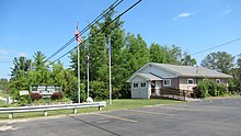
In 2002, the city of Rose City and the site of its historic fire were designated as Michigan State Historic Sites, with a double-sided historic marker erected in Rose City Park. [8] Near Rose City Park is the Cleveland Park Pavilion, which is also a registered historic site. [9]

Geography

According to the United States Census Bureau, the city has a total area of 1.09 square miles (2.82 km2), of which 1.08 square miles (2.80 km2) is land and 0.01 square miles (0.03 km2) (0.74%) is water. [10]

Houghton Creek, a tributary of the Rifle River, runs through part of the city limits. The Rifle River State Recreation Area, which can be used for year-round activities like canoeing, swimming, fishing, and snowmobiling, is about 3 miles (4.8 km) to the east. There are 75 lakes within 15 miles of the city limits.

Demographics

Historical population
CensusPop.Note
1910 542
1920 331−38.9%
1930 3382.1%
1940 3555.0%
1950 44625.6%
1960 435−2.5%
1970 53021.8%
1980 66124.7%
1990 6863.8%
2000 7215.1%
2010 653−9.4%
2020 577−11.6%
U.S. Decennial Census [11]

2010 census

At the 2010 census there were 653 people in 238 households, including 154 families, in the city. The population density was 604.6 inhabitants per square mile (233.4/km2). There were 288 housing units at an average density of 266.7 per square mile (103.0/km2). The racial makeup of the city was 96.9% White, 0.2% African American, 1.2% Native American, 0.3% Asian, 0.5% from other races, and 0.9% from two or more races. Hispanic or Latino of any race were 1.7%. [12]

Of the 238 households 35.7% had children under the age of 18 living with them, 36.1% were married couples living together, 21.4% had a female householder with no husband present, 7.1% had a male householder with no wife present, and 35.3% were non-families. 30.7% of households were one person and 14.3% were one person aged 65 or older. The average household size was 2.36 and the average family size was 2.87.

The median age was 44.6 years. 23.3% of residents were under the age of 18; 7.4% were between the ages of 18 and 24; 19.6% were from 25 to 44; 25% were from 45 to 64; and 24.8% were 65 or older. The gender makeup of the city was 48.4% male and 51.6% female.

2000 census

At the 2000 census there were 721 people in 241 households, including 155 families, in the city. The population density was 665.7 inhabitants per square mile (257.0/km2). There were 283 housing units at an average density of 261.3 per square mile (100.9/km2). The racial makeup of the city was 96.26% White, 0.14% African American, 0.83% Native American, 0.97% from other races, and 1.80% from two or more races. Hispanic or Latino of any race were 1.39%. [2]

Of the 241 households 35.3% had children under the age of 18 living with them, 40.7% were married couples living together, 21.2% had a female householder with no husband present, and 35.3% were non-families. 30.7% of households were one person and 13.3% were one person aged 65 or older. The average household size was 2.51 and the average family size was 3.16.

The age distribution was 26.4% under the age of 18, 6.8% from 18 to 24, 23.3% from 25 to 44, 17.2% from 45 to 64, and 26.4% 65 or older. The median age was 39 years. For every 100 females, there were 82.1 males. For every 100 females age 18 and over, there were 75.2 males.

The median household income was $25,192 and the median family income was $31,042. Males had a median income of $24,861 versus $18,417 for females. The per capita income for the city was $10,684. About 18.3% of families and 24.7% of the population were below the poverty line, including 33.5% of those under age 18 and 3.1% of those age 65 or over.

Images

Related Research Articles

<span class="mw-page-title-main">Roscommon County, Michigan</span> County in Michigan, United States

Roscommon County is a county located in the U.S. state of Michigan. As of the 2020 Census, the population was 23,459. The county seat is Roscommon. The county was founded in 1840 and organized in 1875.

<span class="mw-page-title-main">Ogemaw County, Michigan</span> County in Michigan, United States

Ogemaw County is a county located in the U.S. state of Michigan. As of the 2020 Census, the population was 20,770. The county seat is West Branch.

<span class="mw-page-title-main">Crawford County, Michigan</span> County in Michigan, United States

Crawford County is a county in the U.S. state of Michigan. Its population was 12,988 as of the 2020 census. The county seat of Crawford County is Grayling, the county's only incorporated community.

<span class="mw-page-title-main">Brighton, Michigan</span> City in Michigan, United States

Brighton is a city in the Detroit metropolitan area in southeastern Livingston County, Michigan, United States. As of the 2020 census, the city population was 7,446. Brighton forms part of the South Lyon-Howell-Brighton Urban Area. It is one of two incorporated cities in Livingston County, and incorporates land that was part of Brighton, Green Oak and Genoa townships.

<span class="mw-page-title-main">Churchill Township, Michigan</span> Civil township in Michigan, United States

Churchill Township is a civil township of Ogemaw County in the U.S. state of Michigan. The population was 1,713 at the 2010 census.

<span class="mw-page-title-main">Edwards Township, Michigan</span> Civil township in Michigan, United States

Edwards Township is a civil township of Ogemaw County in the U.S. state of Michigan. The population was 1,413 at the 2010 census.

<span class="mw-page-title-main">Foster Township, Michigan</span> Civil township in Michigan, United States

Foster Township is a civil township of Ogemaw County in the U.S. state of Michigan. The population was 843 at the 2010 census.

<span class="mw-page-title-main">Hill Township, Michigan</span> Civil township in Michigan, United States

Hill Township is a civil township of Ogemaw County in the U.S. state of Michigan. As of the 2010 census, the township population was 1,361.

<span class="mw-page-title-main">Horton Township, Michigan</span> Civil township in Michigan, United States

Horton Township is a civil township of Ogemaw County in the U.S. state of Michigan. The population was 927 at the 2010 census.

<span class="mw-page-title-main">Klacking Township, Michigan</span> Civil township in Michigan, United States

Klacking Township is a civil township of Ogemaw County in the U.S. state of Michigan. The population was 614 at the 2010 census.

<span class="mw-page-title-main">Logan Township, Ogemaw County, Michigan</span> Civil township in Michigan, United States

Logan Township is a civil township of Ogemaw County in the U.S. state of Michigan. The population was 551 at the 2010 census.

<span class="mw-page-title-main">Mills Township, Ogemaw County, Michigan</span> Civil township in Michigan, United States

Mills Township is a civil township of Ogemaw County in the U.S. state of Michigan. The population was 4,291 at the 2010 census, making it the county's most populated municipality.

<span class="mw-page-title-main">Prescott, Michigan</span> Village in Michigan, United States

Prescott is a village in Ogemaw County of the U.S. state of Michigan. The population was 266 at the 2010 census. The village is located within Richland Township.

<span class="mw-page-title-main">Richland Township, Ogemaw County, Michigan</span> Civil township in Michigan, United States

Richland Township is a civil township of Ogemaw County in the U.S. state of Michigan. The population was 914 at the 2010 census.

<span class="mw-page-title-main">Rose Township, Ogemaw County, Michigan</span> Civil township in Michigan, United States

Rose Township is a civil township of Ogemaw County in the U.S. state of Michigan. The population was 1,368 at the 2010 census.

<span class="mw-page-title-main">West Branch, Michigan</span> City in Michigan, United States

West Branch is a city in the U.S. state of Michigan. As of the 2010 census, the city population was 2,139. It is the county seat of Ogemaw County. West Branch is mostly surrounded by West Branch Township, but the two are administered autonomously.

<span class="mw-page-title-main">West Branch Township, Ogemaw County, Michigan</span> Civil township in Michigan, United States

West Branch Township is a civil township of Ogemaw County in the U.S. state of Michigan. The population was 2,593 at the 2010 census. The city of West Branch is mostly surrounded by the township, but the two are administered autonomously.

<span class="mw-page-title-main">Rogers City, Michigan</span> City in Michigan, United States

Rogers City is a city in the U.S. state of Michigan. The population was 2,827 at the 2010 census. It is the county seat of Presque Isle County. The city is adjacent to Rogers Township, but is politically independent.

<span class="mw-page-title-main">Ogemaw Township, Michigan</span> Civil township in Michigan, United States

Ogemaw Township is a civil township of Ogemaw County in the U.S. state of Michigan. The population was 1,223 at the 2010 census.

<span class="mw-page-title-main">Skidway Lake, Michigan</span> Census-designated place & unincorporated community in Michigan, United States

Skidway Lake is an unincorporated community and census-designated place (CDP) in Ogemaw County in the U.S. state of Michigan. The population was 3,392 at the 2010 census, which makes it the most populated community in Ogemaw County. Skidway Lake is located within Mills Township.

References

  1. "2020 U.S. Gazetteer Files". United States Census Bureau. Retrieved May 21, 2022.
  2. 1 2 "U.S. Census website". United States Census Bureau . Retrieved 2008-01-31.
  3. U.S. Geological Survey Geographic Names Information System: Rose City, Michigan
  4. "The 18 tiniest cities in Michigan". Flint Journal. Mlive Media Group. December 4, 2016. p. 14. Retrieved December 5, 2016.
  5. 1 2 3 Romig, Walter (October 1, 1986) [1973]. Michigan Place Names: The History of the Founding and the Naming of More Than Five Thousand Past and Present Michigan Communities (Paperback). Great Lakes Books Series. Detroit, Michigan: Wayne State University Press. p. 485. ISBN   081431838X.
  6. U.S. Geological Survey Geographic Names Information System: Rose City Post Office
  7. visitrosecity.com. "Area History".
  8. MichMarkers.com (2021). "Rose City / The Big Fire: Registered Site L2107" . Retrieved August 22, 2021.
  9. MichMarkers.com (2021). "Cleveland Park Pavilion: Registered Site L2092" . Retrieved August 22, 2021.
  10. "2019 U.S. Gazetteer Files". United States Census Bureau. Retrieved July 25, 2020.
  11. "Census of Population and Housing". Census.gov. Retrieved June 4, 2015.
  12. "U.S. Census website". United States Census Bureau . Retrieved 2012-11-25.