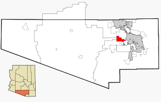
Skowhegan (CDP), Maine

Last updated

Skowhegan, Maine
CDP
Courthouse, Skowhegan, ME.jpg
Somerset County Superior Court
USA Maine location map.svg
Red pog.svg
Skowhegan, Maine
Location within the state of Maine
Coordinates: 44°46′13″N69°42′54″W / 44.77028°N 69.71500°W / 44.77028; -69.71500 Coordinates: 44°46′13″N69°42′54″W / 44.77028°N 69.71500°W / 44.77028; -69.71500
CountryUnited States
State Maine
County Somerset
Area
[1]
  Total14.09 sq mi (36.49 km2)
  Land13.37 sq mi (34.62 km2)
  Water0.72 sq mi (1.87 km2)
Elevation
171 ft (52 m)
Population
 (2020)
  Total6,404
  Density479.16/sq mi (185.00/km2)
Time zone UTC-5 (Eastern (EST))
  Summer (DST) UTC-4 (EDT)
ZIP code
04976
Area code 207
FIPS code 23-68875
GNIS feature ID0575529

Skowhegan is a census-designated place (CDP) in the town of Skowhegan in Somerset County, Maine, in the United States. The population was 6,696 at the 2000 census.

Contents

Geography

Skowhegan is located at 44°46′13″N69°42′54″W / 44.77028°N 69.71500°W / 44.77028; -69.71500 (44.770308, −69.715087). [2]

According to the United States Census Bureau, the CDP has a total area of 14.1 square miles (36.5 km2), of which, 13.4 square miles (34.7 km2) of it is land and 0.7 square miles (1.8 km2) of it (5.04%) is water. Skowhegan is drained by the Wesserunsett Stream and Kennebec River.

Demographics

Historical population
CensusPop.
2020 6,404
U.S. Decennial Census [3]

As of the census [4] of 2000, there were 6,696 people, 2,883 households, and 1,764 families residing in the CDP. The population density was 500.2 inhabitants per square mile (193.1/km2). There were 3,193 housing units at an average density of 238.5 per square mile (92.1/km2). The racial makeup of the CDP was 97.66% White, 0.24% Black or African American, 0.45% Native American, 0.52% Asian, 0.16% from other races, and 0.97% from two or more races. Hispanic or Latino of any race were 0.70% of the population.

There were 2,883 households, out of which 28.2% had children under the age of 18 living with them, 42.5% were married couples living together, 14.4% had a female householder with no husband present, and 38.8% were non-families. 31.9% of all households were made up of individuals, and 13.1% had someone living alone who was 65 years of age or older. The average household size was 2.24 and the average family size was 2.76.

In the CDP, the population was spread out, with 22.5% under the age of 18, 8.6% from 18 to 24, 27.7% from 25 to 44, 22.9% from 45 to 64, and 18.2% who were 65 years of age or older. The median age was 39 years. For every 100 females, there were 88.6 males. For every 100 females age 18 and over, there were 84.5 males.

The median income for a household in the CDP was $26,726, and the median income for a family was $33,081. Males had a median income of $26,484 versus $20,714 for females. The per capita income for the CDP was $14,742. About 13.9% of families and 17.4% of the population were below the poverty line, including 23.3% of those under age 18 and 12.4% of those age 65 or over.

Related Research Articles

<span class="mw-page-title-main">Swift Trail Junction, Arizona</span> CDP in Graham County, Arizona

Swift Trail Junction is a census-designated place (CDP) in Graham County, Arizona, United States. The population was 2,935 at the 2010 census, up from 2,195 in 2000. It is part of the Safford Micropolitan Statistical Area.

<span class="mw-page-title-main">Tucson Estates, Arizona</span> CDP in Arizona, United States

Tucson Estates is a census-designated place (CDP) in Pima County, Arizona, United States. The population was 9,755 at the 2000 census.

<span class="mw-page-title-main">Las Lomas, California</span> Census-designated place in California, United States

Las Lomas is an unincorporated community and census-designated place (CDP) in Monterey County, California, United States. Las Lomas is located 7 miles (11 km) north-northwest of Prunedale. The elevation is 43 feet (13 m). The population was 3,046 at the 2020 census.

<span class="mw-page-title-main">Matlacha, Florida</span> Census-designated place in Florida, United States

Matlacha is a census-designated place (CDP) in Lee County, Florida, United States. As of the 2020 census, the CDP had a population of 598. It is part of the Cape Coral-Fort Myers, Florida Metropolitan Statistical Area.

<span class="mw-page-title-main">Channel Lake, Illinois</span> Census-designated place in Illinois, United States

Channel Lake is an unincorporated community and census-designated place (CDP) in Antioch Township, Lake County, Illinois, United States. Per the 2020 census, the population was 1,581.

Fox Lake Hills is an unincorporated community and census-designated place (CDP) in Lake Villa Township, Lake County, Illinois, United States. Per the 2020 census, the population was 2,684.

<span class="mw-page-title-main">Clinton, Montana</span> CDP in Montana, United States

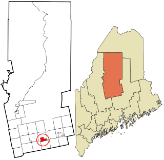
Clinton is a census-designated place (CDP) in Missoula County, Montana, United States. It is part of the 'Missoula, Montana Metropolitan Statistical Area'. The CDP was named for General Sir Henry Clinton. The population was 1,052 at the 2010 census, an increase from its population of 549 in 2000.

<span class="mw-page-title-main">Joplin, Montana</span> Unincorporated community in Montana, United States

Joplin is a unincorporated community and census-designated place (CDP) in Liberty County, Montana, United States. The population was 157 at the 2010 census.

<span class="mw-page-title-main">Greentree, New Jersey</span> Census-designated place in New Jersey, United States

Greentree is an unincorporated community and census-designated place (CDP) located within Cherry Hill Township, in Camden County, New Jersey, United States. As of the 2010 United States Census, the CDP's population was 11,367.

<span class="mw-page-title-main">Pine Ridge at Crestwood, New Jersey</span> Census-designated place in New Jersey, United States

Pine Ridge at Crestwood is an unincorporated community and census-designated place (CDP) located within Manchester Township, in Ocean County, New Jersey, United States. As of the 2010 United States Census, the CDP's population was 2,369.

Central Valley is a hamlet in Orange County, New York, United States. The population was 1,857 at the 2000 census, at which time it was a census-designated place. It is part of the Poughkeepsie–Newburgh–Middletown, NY Metropolitan Statistical Area as well as the larger New York–Newark–Bridgeport, NY-NJ-CT-PA Combined Statistical Area.

Flat Rock is a census-designated place (CDP) in Surry County, North Carolina, United States. The name "Flat Rock" stems from the community's granite quarry. The granite quarry is the largest open-face granite quarry in the world, and has been mined continuously since 1889 by the North Carolina Granite Corporation.

Mount Cobb is an unincorporated community and census-designated place (CDP) in Lackawanna County, Pennsylvania, United States. The population was 1,799 at the 2010 census.

<span class="mw-page-title-main">Monarch Mill, South Carolina</span> CDP in South Carolina, United States

Monarch Mill is a census-designated place (CDP) in Union County, South Carolina, United States. The population was 1,811 at the 2010 census.

<span class="mw-page-title-main">Farmington (CDP), Maine</span> Census-designated place in Maine, United States

Farmington is a census-designated place (CDP) comprising the center of the town of Farmington, which is the county seat of Franklin County in Maine, United States. The population of the CDP was 4,288 at the 2010 census, out of 7,760 people in the town as a whole. The University of Maine at Farmington is located within the CDP.

Newport is a census-designated place (CDP) consisting of the main area of settlement within the town of Newport in Penobscot County, Maine, United States. The population of the CDP was 1,776 at the 2010 census.

Anson is a census-designated place (CDP) in the town of Anson in Somerset County, Maine, United States. The population was 818 at the 2000 census.

Hartland is a census-designated place (CDP) in the town of Hartland in Somerset County, Maine, United States. The population was 872 at the 2000 census.

Madison is a census-designated place (CDP) in the town of Madison in Somerset County, Maine, United States. The population was 2,733 at the 2000 census.

Norridgewock is a census-designated place (CDP) in the town of Norridgewock in Somerset County, Maine, United States. The population was 1,557 at the 2000 census.

References

  1. "2020 U.S. Gazetteer Files". United States Census Bureau. Retrieved April 8, 2022.
  2. "US Gazetteer files: 2010, 2000, and 1990". United States Census Bureau. February 12, 2011. Retrieved April 23, 2011.
  3. "Census of Population and Housing". Census.gov. Retrieved June 4, 2016.
  4. "U.S. Census website". United States Census Bureau . Retrieved January 31, 2008.