
The Colchester Village Historic District encompasses most of the historic village center of Colchester, Connecticut. It is located at the junction of Route 16, Route 85, and Norwich Avenue. Roughly, the district extends to the northwest along Broadway Street as far as Jaffe Terrace; east along Norwich Avenue to just short of Pleasant Street; south along South Main Street to just north of Hall Hill Road; west along Linwood Avenue to just east of Kmick Lane. The historic district was listed on the National Register of Historic Places (NRHP) in 1994.
The Somersville Historic District encompasses the historic components of the mill village of Somersville in western Somers, Connecticut, United States. The district is centered on a mill complex on the Scantic River, which divides the district. The most significant years of development were between about 1835 and 1935, although the area has a history dating to the 1760s. The district was listed on the National Register of Historic Places in 1995. The Mill itself has since burned down and as of October 2018 is currently open field, although the canal structure remains in place.

The Agawam Center Historic District is a historic district that encompasses part of the historic center of Agawam, Massachusetts. The district covers most of the buildings along Elm Street and Main Street radiating out from their intersection in both directions. The district is predominantly residential in character, although it does contain a number of commercial, industrial, and civic buildings. Many of the buildings in the district stand at a uniform setback from the street, giving the district a coherent feel.

The Brimfield Center Historic District is a historic district encompassing the historic center of Brimfield, Massachusetts. The district is centered on the town common, and includes properties radiating out from that center on Main Street, Brookfled, Wales, Sturbridge and Warren Roads. Brimfield Center was first laid out in 1721 along a Native American trail that ran through the area, and developed over the years into what is now US Route 20, or Main Street. The district includes properties ranging from early colonial houses to the town hall, built in 1878. The center has retained some coherence because the Brimfield Fair, a major antiques market that takes place three times a year, takes up significant open space in the areas near the center. The district was listed on the National Register of Historic Places in 2006.

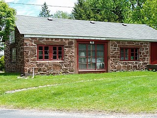
The East Plymouth Historic District is a historic district in the town of Plymouth, Connecticut. It encompasses a small rural village in the northeastern part of the town, whose main focus is the 1792 St. Matthew's Church, one of the oldest surviving Episcopal church buildings in the state. The district runs along East Plymouth Road on either side of its junction with Marsh Road, and includes predominantly Greek Revival residential buildings erected in the early to mid-19th century. The district was listed on the National Register of Historic Places in 1985.

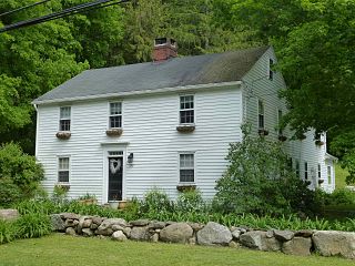
The Main Street Historic District encompasses the historic civic, commercial, and residential center of Durham, Connecticut. The district is primarily linear and runs along Main Street from between Higganum Road and Town House Road in the south to Talcott Lane in the north, and along Maple Avenue, which parallels Main Street. The district includes most of its colonial architecture, as well as many of its civic buildings. It was listed on the National Register of Historic Places in 1986.

The Granby Center Historic District is a predominantly residential historic district encompassing a portion of the village of Granby Center in Granby, Connecticut. The village developed in the 18th century as a farming center, and a now includes a variety of architectural styles from the late 18th to early 20th centuries. The district was listed on the National Register of Historic Places (NRHP) in 1985.
The Canton Center Historic District encompasses the historic rural town center of Canton, Connecticut. Extending mainly along Connecticut Route 179, near the geographic town center, is a well-preserved example of a rural agricultural center in Connecticut, a role served until about 1920. The district includes many examples of Late Victorian and Greek Revival architecture. It was listed on the National Register of Historic Places in 1997.

The Spring Hill Historic District encompasses a rural 19th-century village stretching along Storrs Road in Mansfield, Connecticut. Spring Hill developed as a rural waystation on an early 19th-century turnpike, and has seen only modest development since the late 19th century. The district was listed on the National Register of Historic Places in 1979.

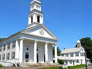
The Jaffrey Center Historic District encompasses the traditional civic heart of the small town of Jaffrey, New Hampshire. The district lies to the west of the Jaffrey's main business district, extending along Main Street from Harkness Road to the Jaffrey Common, and along Thorndike Pond Road northward from Main Street. It includes the town's oldest civic buildings, and was its main center until the mills of East Jaffrey eclipsed it. The district was listed on the National Register of Historic Places in 1975.

The Lyme Center Historic District encompasses a modest crossroads and industrial village in rural Lyme, New Hampshire. The predominantly residential district stretches along Dorchester Road, on either side of its junction with Baker Hill Road. The village's rise in development started in the early 19th century as it was at a crossroads of the east-west Dorchester Road, and the north-south Baker Hill Road and Acorn Hill Road. The village grew rapidly in the 1820s, with a number of simple Greek Revival houses, and in 1830 the Baptist Church was built. The other major civic building in the village is the Lyme Academy, built in 1839, albeit with more Federal than Greek Revival styling. Grant Brook, which runs parallel to Dorchester Road, provided a source of power for the growth of small industrial efforts, including a sawmill at the corner of Dorchester and Baker Hill Roads. This industry provided a second minor building boom in the late 19th to early 20th century. Most of the houses in the district are vernacular Greek Revival or Cape in their styling; probably the most elaborate Greek Revival house is the 1857 Beal-Pike House at 41 Dorchester Road.

The Lyme Common Historic District encompasses the original historic center of Lyme, New Hampshire. Established in 1781, it includes sixty historic buildings surrounding the town common and along surrounding roads, and is a well-preserved example of a 19th-century village center. The district was listed on the National Register of Historic Places in 1988.

The Orford Street Historic District encompasses a particularly attractive stretch of Orford Street in Orford, New Hampshire. It was described as early as the 18th century as "the most charming country village", with a tree-lined promenade that is still a focus of the town center. The district consists of about 0.5 miles (0.80 km) of Orford Street, between its junctions with New Hampshire Route 25A and Archertown Road, and was listed on the National Register of Historic Places in 1977.
The Plymouth Center Historic District encompasses historic early village center of Plymouth, Connecticut. Stretching along Main, North and South Streets from their junction, it flourished in the 19th century with small-scale industries, but declined late in the century with the separation of Thomaston and the more significant industrial development at Terryville. The district features colonial, Federal, and Greek Revival architecture and was added to the National Register of Historic Places in 1999, with a slight enlargement the following year.
Bridgewater Center Historic District encompasses the traditional town center of Bridgewater, Connecticut. Centered at the junction of Main Street with Clapboard and Hat Shop Hill Roads, it developed in the early 19th century as a civic center, even before the town's 1856 incorporation from New Milford. The architecture of the center is largely reflective of the first half of the 19th century, including Greek Revival and Federal style buildings. It was listed on the National Register of Historic Places in 2000.

The Sharon Historic District encompasses the historic civic center of Sharon, Connecticut. Centered around a mile-long town green are an array of public civic and religious buildings, as well as residences from the 18th to 20th centuries. The area south of the green on South Main Street is lined with country houses developed or improved in the late 19th and early 20th centuries, representing one of the highest concentrations of Colonial Revival estates in the state. The district was listed on the National Register of Historic Places in 1993.

The Putney Village Historic District encompasses most of the main village and town center of Putney, Vermont. Settled in the 1760s, the village saw its major growth in the late 18th and early 19th century, and includes a cohesive collection with Federal and Greek Revival buildings, with a more modest number of important later additions, including the Italianate town hall. The district was listed on the National Register of Historic Places in 1986.

The Whitingham Village Historic District encompasses much of the current village center of Whitingham, Vermont. It was developed mainly in the second half of the 19th century around industries powered by local water sources, and includes well-preserved architecture from that period. It was listed on the National Register of Historic Places in 2006.

The Danby Village Historic District encompasses much of the town center of Danby, Vermont. It is centered on a stretch of Main Street, roughly between Depot Street and Brook Road. The village has a cohesive collection of mid-19th century architecture, mostly residential, with a modest number of later additions. The district was listed on the National Register of Historic Places in 1983.

The Enfield Historic District encompasses a two-mile stretch of Enfield Street, the main north-south road of Enfield, Connecticut. Centered on the town common with its church and old town hall, it includes a diversity of residential architecture from the 18th to early 20th centuries. The district was listed on the National Register of Historic Places in 1979.


