
The Mechanic Street Historic District encompasses a historic 19th-century mill and mill village in a 14-block area of the Pawcatuck section of Stonington, Connecticut. Extending along the Pawcatuck River and south of West Broad Street, the area includes a large brick mill complex on the banks of the river, and a neighborhood of well-preserved worker housing on the road grid to its west. The district was listed on the National Register of Historic Places in 1988.

The Cheney Brothers Historic District was a center of the silk industry in Manchester, Connecticut, in the late 19th and early 20th century. The 175-acre (71 ha) district includes over 275 mill buildings, workers houses, churches, schools and Cheney family mansions. These structures represent the well-preserved company town of the Cheney Brothers silk manufacturing company, the first America-based silk company to properly raise and process silkworms, and to develop the difficult techniques of spinning and weaving silk. The area was declared a National Historic Landmark in 1978.

Quinebaug Mill–Quebec Square Historic District is a historic district roughly bounded by the Quinebaug River, Quebec Square, and Elm and S. Main Streets in the town of Brooklyn in Windham County, Connecticut. The district encompasses a well-preserved 19th-century mill village. It was added to the National Register of Historic Places in 1985.

The Lawton Mills Historic District in Plainfield, Connecticut encompasses a well-preserved early-20th-century mill village. The central focus of the district is the large brick mill complex to the south of Railroad Avenue on the banks of Horse Brook. The mill ownership developed the areas on either side of the mill complex with a substantial worker housing complex. The district includes more than 100 historically significant structures, most of which are worker house that has survived with generally only modest alterations. There are a few commercial buildings in the district, built to provide services to the works, and a community hall, which now serves as Plainfield's town hall. The district was listed on the National Register of Historic Places in 1996.

The Talcottville Historic District is a historic district in the town of Vernon, Connecticut. Centered on Elm Hill Road and Main Street, it encompasses a 19th-century mill village, including archaeological remnants of very early cotton-spinning facilities, an old stone dam, and a major wood-frame mill constructed by the Talcott brothers. Also included in the village are a significant number of mill worker housing units, many dating to the middle decades of the 19th century, and an 1891 lenticular pony truss bridge, built by the Berlin Iron Bridge Company. The district was listed on the National Register of Historic Places in 1989.

The South Britain Historic District encompasses the core of the unincorporated village of South Britain in Southbury, Connecticut, United States. The village arose in the 18th century as an industrial center serving the surrounding agricultural community, powered by the Pomperaug River, and rivalled the town center of Southbury in importance. The district was listed on the National Register of Historic Places in 1987.

East Windsor Hill Historic District is a historic district located in the northwestern corner of the town of South Windsor, Connecticut. It was listed on the National Register of Historic Places in 1986. The district runs along both sides of Main Street from the Scantic River south to the Edwards Cemetery. The district also includes areas west of Main Street to the Connecticut River, including properties along Ferry Lane. The district is located directly north of another historic district, Windsor Farms Historic District. The district encompasses a neighborhood of well-preserved largely folk vernacular buildings erected between about 1700 and 1860.
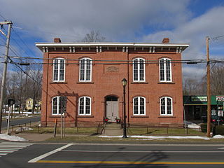
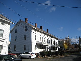
The Hazardville Historic District is a historic district in the Hazardville section of Enfield, Connecticut, United States, that is listed on the National Register of Historic Places.

Glenville Historic District, also known as Sherwood's Bridge, is a 33.9 acres (13.7 ha) historic district in the Glenville neighborhood of the town of Greenwich, Connecticut. It is the "most comprehensive example of a New England mill village within the Town of Greenwich". It "is also historically significant as one of the town's major staging areas of immigrants, predominantly Irish in the 19th century and Polish in the 20th century" and remains "the primary settlement of Poles in the town". Further, "[t]he district is architecturally significant because it contains two elaborate examples of mill construction, designed in the Romanesque Revival and a transitional Stick-style/Queen Anne; an excellent example of a Georgian Revival school; and notable examples of domestic and commercial architecture, including a Queen Anne mansion and an Italianate store building."

The Hotchkissville Historic District is a historic district in the town of Woodbury, Connecticut, that was listed on the National Register of Historic Places in 1995. The district encompasses most of the historic village of Hotchkissville, which is centered at the junction of Washington and Weekeepeemee roads. The village began as a dispersed rural agricultural community, but developed in the 19th century with the arrival of industry, primarily the manufacture of textiles. Despite this, the village has retained a significantly rural character, and includes a broad cross-section of 18th- and 19th-century architectural styles.
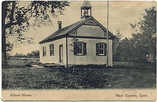
The West Goshen Historic District is a historic district in the village of West Goshen in the town of Goshen, Connecticut. It encompasses a well-preserved early 19th-century industrial village, with twenty historically significant properties in the village, most of which lie on Connecticut Route 4 between Beach Street and Thompson Road. The district was listed on the National Register of Historic Places in 1987.

The Central Village Historic District is a historic district in the Central Village area of Plainfield, Connecticut that was listed on the National Register of Historic Places (NRHP) in 1991. It encompasses a late 19th-century historic mill village, including a small commercial center where Connecticut Route 12 and 14 meet, a cluster of architecturally distinguished buildings built by mill owners and managers, and a collection of mill worker housing units. It includes the Plainfield Woolen Company Mill, which is separately listed, as well as archaeological remnants of other mill infrastructure. It also includes Plainfield's old town hall and high school. Other architecturally prominent buildings include the c. 1855 Italianate mansion of mill owner Arthur Fenner, and the 1845 Greek Revival Congregational Church.

The Cushman Village Historic District is a historic district encompassing a portion of the Cushman Village area of Amherst, Massachusetts, which was a significant mill village during the 19th century. It is centered on the triangle formed by Bridge, Henry, and Pine Streets in northeastern Amherst, and arose because of the presence of falls on the Mill River, whose water power was harnessed for mills as early as the mid-18th century. Two houses survive from the colonial period. The village, although it was defined for many years by the mills, no longer has any industrial buildings, as they were demolished or destroyed by fire. Most of the houses in the district were built before 1860, the peak of the village's industrial activity. The district was listed on the National Register of Historic Places in 1992.
The Somers Historic District encompasses the historic civic and social center of the town of Somers, Connecticut. It stretches along Main Street, with extensions along Springfield Road and Battle Street, and includes a significant number of vernacular Federal and Greek Revival houses. It includes the town's early churches, as well as important civic buildings, including the town hall and library. The district was listed on the National Register of Historic Places in 1982.
The Mansfield Center Historic District encompasses the historic early village center of Mansfield, Connecticut. First settled about 1692, it is one of the oldest settlements in Tolland County, and retains a strong sense of 18th century colonial layout. It extends along Storrs Street extending from Chaffeeville Road in the north to Centre Street in the south, and was listed on the National Register of Historic Places in 1972.

The Monadnock Mills are a historic mill complex in Claremont, New Hampshire. They extend along the southern bank of the Sugar River on both sides of Water Street, between the Broad Street bridge to the east, and the junction of Main and Water Streets in the west, where they abut the industrial area formerly associated with the Sullivan Machinery Company; there also a small number of surviving elements on the north side of the river opposite this area. The complex represents the surviving elements of what was once the largest manufacturing complex in the upper Connecticut River watershed area, and one of its oldest. The mills were listed on the National Register of Historic Places in 1979. Many of its buildings have been repurposed to other uses.

The Chester Village Historic District encompasses the historic southern portion of the main village of Chester, Vermont, US. Essentially a linear stretch of Main Street, this area includes some of the village's oldest buildings and has an architectural history spanning into the early 20th century. The district was listed on the National Register of Historic Places in 1985.

The Warren Village Historic District encompasses the village center of Warren, Vermont, United States. Stretched mainly along Main Street east of the Mad River, it is a well-preserved 19th-century mill village, although most of its period mill infrastructure has been lost. The district has good examples of Greek Revival, Italianate, and Second Empire architecture. It was listed on the National Register of Historic Places in 1992.
The Bigelow-Hartford Carpet Mills Historic District encompasses a company-built factory and residential area in the Thompsonville area of Enfield, Connecticut. In addition to the former factory buildings of the Bigelow-Hartford Carpet Mills, it includes more than 150 housing units built by the company between about 1830 and 1920. It is roughly bounded on the north by Lafayette Street and Alden Avenue, the east by Hartford Avenue and Lincoln Street, the south by High Street, and the west by River Street. It was listed on the National Register of Historic Places in 1994.

The Manchaug Village Historic District is a historic district encompassing the 19th century industrial village center of Manchaug in Sutton, Massachusetts. Developed in the 1820s around textile mills on the Mumford River, it was the largest industrial area in Sutton, with at least three mill complexes in operation. The district is centered on the junction of Main Street with Manchaug, Putnam Hill, and Whitins Roads.


