Jamui is a town and a municipality in Jamui district in the Indian state of Bihar. It is the district headquarter of Jamui district. Jamui was formed as a district on 21 February 1991 as a result of its separation from Munger. It is part of Munger Division. The town is situated about 60km South-West of Munger.

Nawada is a city and a municipality in Bihar, India. It is also the headquarters of the Nawada district. It is the headquarters of the subdivision of the same name, lying on both sides of the Khuri River( also known as Sakri river in some parts) at 24º 53’ N and 85º 33’ E. The name evolved from Nau-wada, meaning the new town. On 26 January 1973, Nawada was formed as a separate district from Gaya.
Jamui is a district among 38 districts of Bihar state, India. The district was formed on 21 February 1991, when it was separated from Munger district. It is located at a longitude of 86° 13'E and the latitude is 24° 55'N.
Bikramganj is a nagar panchayat city and corresponding community development block of Rohtas district, Bihar, India. At the time of the 2011 census, the city of Bikramganj had a population of 48,465, in 7,968 households, while the overall subdistrict had a population of 163,565. The main commodities produced in Bikramganj are rice and pulses. The city of Bikramganj has a slum called Dhangai which, in 2011 had a population of 3,955 in 637 households. Bikramganj is located at 25.2°N 84.25°E. It has an average elevation of 77 metres (252 feet).
Daudnagar is a town and the subdivisional headquarter of Daudnagar Subdivision in Aurangabad district in the state of Bihar, India under the Magadh division. Until 1991, there was only one Subdivision in the Aurangabad district: Aurangabad Sadar. On 31 March 1991, one other subdivision, Daudnagar, was created. Daudnagar is a 200-year-old historical city and its living proof is Daudnagar has an old historical fort situated on the eastern bank of the Son River. National Highway NH139 which connects Jharkhand's Palamu district to Patna, passes through the town.
Jhajha is a city and a notified area in Jamui district in the Indian state of Bihar. It lies in the southern part of Bihar very close to the Jharkhand border. It falls on the Howrah - Mughalsarai mainline about halfway between Madhupur Junction and Kiul Junction.It is a very important and Main Market for the Nearby People and the city's People
Makhdumpur is a town in the Bihar state of India. It is a major town of Jehanabad district and Patna-Gaya Corridor. The Barabar Hills/Barabar Caves tourist region is 10 KM South-East of Makhdumpur proper city.
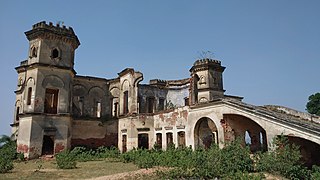
Naugachia is a town in Mithila region of India. It is a block and a division of the Bhagalpur district and also a police district.

Sugauli is a city and a notified area in East Champaran district in the Indian state of Bihar. It is the setting for Rudyard Kipling's story "Rikki-Tikki-Tavi", and the place where a treaty was signed with Nepal in 1816.
Warisaliganj is a town and a nagar parishad in Nawada district in the Indian state of Bihar.

Gidhaur is a small town in the Jamui District of Bihar. In the early-modern period, it was the centre of the Gidhaur chieftaincy.
Sihaul is a village with population of about 11,000 in the sub-district of Satar Kataiya, where it ranks as the third most populous village. The sub-district forms a part of Saharsa district in the state Bihar, India. The geographical area of the village is 9 km2 (3.5 sq mi) and it is the third biggest village by area in the sub-district. Population density of the village is 1287 persons per km2.

Lohra Village Jamui district, state of Bihar in eastern India.

Giridih railway station, station code GRD, is the main railway station serving the city of Giridih, the headquarters of Giridih district in the Indian state of Jharkhand. Giridih station also serves as a gateway for the Jain pilgrims visiting Parasnath. Giridih is located at 24.18°N 86.3°E. It has an elevation of 289 metres (948 ft).
Katoria is a community development block in Banka district, Bihar, India. It is one of the part of 11 blocks that make up the Banka district. It is part of Banka Lok Sabha constituency along with other assembly constituencies; namely, Amarpur, Banka, Belhar and Dhoraiya. Katoria Block is bounded by Chandan Block towards South, Belhar Block towards North, Banka Block towards East, Sangrampur Block towards North. Banka, Deoghar, Jhajha, Amarpur are the nearby markets to Katoria. Katoria consists of 223 Villages and 16 Panchayats. Jamua is the smallest Village and Katoria is the biggest Village.
Kawakole is a small town and a Block in Nawada district in the Indian state of Bihar. It is situated about 40 km from Nawada City. The Block lies in the eastern side of Nawada district and is close to Jamui district and Giridih district of Jharkhand. The primary occupation of Kawakol's residents is agriculture, and this area is well known for its tourist attractions.
Nayadih is a village among a block of villages in Derhgaon of the Kashichak Block, Nawada District, in Bihar, India. The main villages of Nayadih, Derhgaon and Bishwanathpur together have been referred to as Derhgaon.
Mohanpur is a community development block that forms an administrative division in the Deoghar subdivision of the Deoghar district, Jharkhand state, India.

Mokar is a Village located in Sasaram tehsil of Rohtas district in Bihar, India. It is situated 5 km away from Sasaram, which is both district & sub-district headquarter of Mokar village. As per 2009 stats, Mokar village is also a gram panchayat.
Shamshernagar is a large village in the Daudnagar subdivision and block in Aurangabad district, located in Bihar, India. The town falls under the jurisdiction of the Magadh division. Situated on the bank of the Sone River, the National Highway 139 passes through the village. The Indrapuri Barrage canal is a local waterway. Shamshernagar is densely populated. It has adequate infrastructure, including a middle school, an intermediate high school, an additional Primary Health Centre, and a Regional Rural Bank (MBGB). Shamshernagar is an electrified village. and possesses a water tank for its water supply. It shares a border between Aurangabad and Arwal districts. Buses, auto-rickshaws and e-rickshaws provide regional transportation.
