Soroca District

Last updated

Soroca
District (Raion)
Flag of District Soroca.svg
Soroca rajon coa.gif
Soroca district, MDA.svg
CountryFlag of Moldova.svg  Republic of Moldova
Administrative center
(Oraş-reşedinţă)

Soroca
Government
  Raion PresidentVeaceslav Rusnac
Area
  Total1,043 km2 (403 sq mi)
Elevation
347 m (1,138 ft)
Population
 (2018) [1]
  Total100,078
  Density96/km2 (250/sq mi)
Time zone UTC+2 (EET)
  Summer (DST) UTC+3 (EEST)
Area code +373 230
Car plates SR
Website soroca.org.md

Soroca is a district in north-east Moldova. Its administrative center is the town of Soroca. In 2018, the population of the region was 100,078.

Contents

History

Soroca county Zemstvo, 1911 SorokiZemstvo.jpg
Soroca county Zemstvo, 1911

Ancient beginnings

Archeological evidence of prehistoric occupation dating to 35,000 to 50,000 years ago has been found in the Soroco region near the village of Rudi. In about 400 to 300 BC, ancient defensive walls were constructed. From the 9th century to the 12th century AD, two towns developed. They were called 'Farfuria Turceasca' and 'Germanariul'. In the 12th and 13th centuries, a Genoese fortress was expanded at Alchiona. In the period 1439–1457, villages are mentioned: Visoca, Vasilcău, Rudi and Pirlita.

The new town of Soroca

In the second half of the 16th century, Stephan the Great built a wooden fortress on the former Alchiona mount. The fortress was transformed into its present form between 1543 and 1546 during the reign of Peter IV Rareş. The creation of the town allowed for trade along the Nistru while providing protection from foreign invasion. For many years Soroca was a centre for arts and agricultural markets for the Principality of Moldova. At various points in time, Soroca was affected by wars with Tartars, Cossacks, Poles and Russians. Between 1684 and 1699, under control of the Poles, changes in Soroca were made. A deep moat was dug; a well was dug in the courtyard. 14 stone casemates inside [ clarification needed ]. Gradually over time, with more stable rule, the town and its region lost military importance.

Soroca in the 19th and 20th centuries

In 1812, Soroca was occupied by Russia. The population became more varied as Russians, Ukrainians and Jews moved to the region. From 1849 to 1917 Soroca was governed as part of the Bessarabia region of the Russian Empire. In 1918, at the conclusion of World War I, Bessarabia was made part of Romania. Until 1944, Soroca remained the administrative centre for this Romanian region. In 1944, as World War II reached its end, Soroca became part of the MSSR. Moldova became an independent state in 1991. Since then Soroca has regained the status of an administrative region of Moldova.

Natural history

Geography

The main geographical feature of Soroca is the Nistru Plateau. The terrain is hilly with deep valleys, dales and ravines. Other features include a gently rolling plain to the north west and the Raut and Nistru rivers. The highest points in Soroca are Vadeni Hill at 347m and the Visoca Hill at 330m.

Soil

The soil is grey or brown to the height of the Nistru prominence. In other areas, the soils are humic-calcareous, chernozem, alluvial soils or swampy. There are active processes of erosion, karst, torrents of mud and sometimes, landslides in the Soroca district.[ citation needed ]

Climate

The climate in Soroca is temperate-continental. Winter is usually mild and short with an average temperature of −5 to −6 °C (23 to 21 °F). Summer is long and warm with an average temperature of 20 to 21 °C (68 to 70 °F). The average annual rainfall is 485 mm. Soroca has a suitable climate for farming cereals, sugar beet, tobacco and also for horticulture.

Fauna

Fauna in the district is typical of steppe areas. In the Nistru basin there are 68 species of fish.[ citation needed ] Most of Moldova's 270 bird species are present. There is both natural and introduced wildlife. The introduced species include 19 types of mammal, 37 bird species and 7 types of reptile. Native creatures include foxes, hedgehogs, stone marten, deer, wild boar, raccoon dog and wolf.[ citation needed ]

Flora

7 percent of the district is forested. Common trees include oak, hornbeam, maple, linden, ash and elm. Beneath the trees are hawthorn, hazel, cocksfoot, honey bear and others.

Natural resources

Granite can be found in Cosauti and building stone at Ocland, Vărăncău and Visoca. Cretaceous limestones and iron ores were discovered near the village of Vărăncău. Limestone, for instance in Visoca, is mined for chalk and chalk dust (which is used to make paint). Banks of chalk are also found throughout the Nistru, including in Cremenciug, Soroca, Vasilcău, Vărăncău and Cerlina. The limestone is extracted in Visoca.

Protected areas

Rivers

The Nistru river creates 93 km of the eastern boundary of Soroca. The barrier of the Nistru plateau means the tributaries are short (15 to 25 km). Water from the Nistru river is used for irrigation, public supply and industry. Reservoirs have been constructed to meet public demand. There are also 64 natural reservoirs.

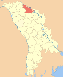
Administrative subdivisions

Soroca has sixty-eight subdivisional areas and thirty-three villages containing thirty-four commons. The administrative centre is the town of Soroca.

Demographics

On 1 January 2012, the district population was 100100. 37.5 percent live in urban areas and 63.5 percent in rural areas.

Ethnic groups

Ethnic group  % of total
Moldovans *88.7
Romanians *4.2
Ukrainians 3.8
Russians 2.0
Romani 1.0
Other0.2
Undeclared3.28

Footnote: * There is an ongoing controversy regarding the ethnic identification of Moldovans and Romanians.

Religion

Christians make up 98.4% of Soroca's population. The great majority (97.8%) are of the orthodox faith. Those of Protestant denominations make up 0.6% of the population while those of other religions or no religion constitute 1.6%.

Economy

Soroca hosts 24645 registered businesses. 62795 hectares (60.2 percent) of the total land area is used for agriculture. Arable land occupies 55 801 ha (53.5 percent) of the total agricultural land area:

Education

Soroca has about 58 educational institutions catering for preschool to tertiary students. The total number of students is approximately 12023. Among others, there is a boarding school in Visoca; a special school in Soloneţ; as well as a temporary placement centre for at risk children. In Azimut there is "The Icarus day center for disabled children". In Dacia there is "The house of hope" for youth. Specialised areas of education include sports, teachers' training, agricultural training and a school for the arts. A vocational school has about 308 students.

Politics

Soroca lies in the North Red electoral region. In elections of the first decade of the 21st century, the PCRM achieved 50% of the vote in Soroca. See the table below for the results of the 2010 election. District is one of the founding members of Euroregion Dniester.

Summary of 28 November 2010 Parliament of Moldova election results in Soroca District
Parties and coalitionsVotes%+/−
Party of Communists of the Republic of Moldova 20,59546.29−2.36
Liberal Democratic Party of Moldova 9,81622.06+8.68
Democratic Party of Moldova 6,32214.21-1.88
Liberal Party 2,5655.76−2.20
Party Alliance Our Moldova 2,0974.71−5.86
European Action Movement 9372.11+2.11
Other Party2,1804.86+1.51
Total (turnout 60.25%)44,867100.00

Culture

The Soroca region hosts a number of cultural centres and libraries. There are also museums, art galleries and monuments. The region preserves objects of national importance and local importance. There are two monasteries: The Monastery of the Assumption in Cosuti and the Monastery of Rudi.

Health

Soroca has a general hospital with about 375 beds. It is complemented by general practitioners, health centres and specialists.

Personalities

See also

Related Research Articles

<span class="mw-page-title-main">Soroca</span> City in Soroca District, Moldova

Soroca is a city and municipality in Moldova, situated on the Dniester River about 160 km (99 mi) north of Chișinău. It is the administrative center of the Soroca District.

<span class="mw-page-title-main">Cimișlia District</span> District in Republic of Moldova

Cimișlia is a district in southern Moldova, situated between the capital of Chișinău and the autonomous territorial unit of Gagauzia, with its administrative center being the town of Cimișlia. On 1 January 2011, its population was officially recorded to be 61,700.

<span class="mw-page-title-main">Ocnița District</span> District in Republic of Moldova

Ocnița is a district in the north of Moldova, with the administrative center at Ocnița. The other major cities are Otaci and Frunză. As of 1 January 2011, its population was 56,100.

<span class="mw-page-title-main">Telenești District</span> District in Moldova

Telenești is a district in central Moldova, with the administrative center at Telenești.

<span class="mw-page-title-main">Dondușeni District</span> District in Republic of Moldova

Dondușeni District is a district (raion) in the north of Moldova. Its administrative center is the city of Dondușeni. As of 2011, its population was 45,100.

<span class="mw-page-title-main">Florești District</span> District in Republic of Moldova

Florești is a district in the north-east of Moldova, with the administrative center at Florești. The other major cities are Ghindeşti and Mărculeşti. As of 1 January 2011, its population was 90,000.

<span class="mw-page-title-main">Leova District</span> District in Republic of Moldova

Leova District is a district in the central part of Moldova, bordering Romania, with the administrative center at Leova. As of 2014, its population was 44,702.

<span class="mw-page-title-main">Rezina District</span> District in Republic of Moldova

Rezina is a district in the east of Moldova, with the administrative center at Rezina. Rezina is situated on the western bank of the Nistru river. As of 1 January 2011, its population was 52,600.

<span class="mw-page-title-main">Sîngerei District</span> District in Moldova

Sîngerei is a district in the north of Moldova, with the administrative center at Sîngerei. The other major city is Biruința. As of 1 January 2011, its population was 93,400.

<span class="mw-page-title-main">Șoldănești District</span> District in Republic of Moldova

Șoldănești is a district in the north-east of Moldova, with the administrative center at Șoldănești. As of 2014, its population was 36,743.

<span class="mw-page-title-main">Ștefan Vodă District</span> District in Moldova

Ștefan Vodă is a district in the south-east of Moldova, with the administrative center at Ștefan Vodă. As of 1 January 2011, its population was 71,900. The district is situated 100 km from Chișinău and 100 km from Odesa, Ukraine.

<span class="mw-page-title-main">Călărași District</span> District in the Republic of Moldova

Călărași is a district in the centre of Moldova, with the administrative headquarters in Călărași. As of January 1, 2011, its population was 78,800.

<span class="mw-page-title-main">Căușeni District</span> District in Republic of Moldova

Căușeni District is a district in the central part of Moldova, with the administrative center at Căușeni. The other major city in the district is Căinari. According to the 2014 Moldovan Census, the population of the district is 81,185.

<span class="mw-page-title-main">Criuleni District</span> District in Republic of Moldova

Criuleni is a district in the central part of Moldova, with the administrative center at Criuleni. As of January 1, 2011, its population was 73,100.

<span class="mw-page-title-main">Glodeni District</span> District in Republic of Moldova

Glodeni District is a district in northwestern Moldova, with its administrative center at Glodeni. As of 1 January 2011, its population was 61,900. The district consists of 35 localities, 18 communes, 16 villages and one city (Glodeni).

<span class="mw-page-title-main">Hîncești District</span> District in Republic of Moldova

Hîncești is a district of Moldova, with the city of Hîncești as its administrative center. As of 1 January 2011, its population was 122,000.

<span class="mw-page-title-main">Ialoveni District</span> District in Moldova

Ialoveni is a district in the central part of Moldova, with the administrative center at Ialoveni. As of 2014, its population was 93,154.

<span class="mw-page-title-main">Orhei District</span> District in Republic of Moldova

Orhei is a district in central Moldova, with its administrative center in the city of Orhei. As of 2014 Moldovan Census its population was 101,502.

<span class="mw-page-title-main">Strășeni District</span> District in Republic of Moldova

Strășeni is an administrative district in the central part of Moldova. Its administrative center and leading city is Strășeni. As of 1 January 2011, its population was 91,100. The other principal town is Bucovăț, 26 km (16 mi) to the north of the Moldovan capital. Otherwise, the district is divided between rural communities.

<span class="mw-page-title-main">Bessarabia Governorate</span> 1812–1917 unit of Russia

The Bessarabia Governorate was a province (guberniya) of the Russian Empire, with its administrative centre in Kishinev (Chișinău). It consisted of an area of 45,632.42 square kilometres (17,618.78 sq mi) and a population of 1,935,412 inhabitants. The Bessarabia Governorate bordered the Podolia Governorate to the north, the Kherson Governorate to the east, the Black Sea to the south, Romania to the west, and Austria to the northwest. It roughly corresponds to what is now most of Moldova and some parts of Chernivtsi and Odesa Oblasts of Ukraine.

References

  1. "Results of Population and Housing Census in the Republic of Moldova in 2014". National Bureau of Statistics of the Republic of Moldova. 2017. Retrieved 1 May 2017.

48°10′N28°15′E / 48.167°N 28.250°E / 48.167; 28.250