
Minneapolis–Saint Paul International Airport, also less commonly known as Wold–Chamberlain Field, is a joint civil-military public use international airport. It is located in unincorporated Hennepin County, Minnesota, United States, within 10 miles of both downtown Minneapolis and downtown Saint Paul. MSP is the largest and busiest airport in the six-state Upper Midwest region of Minnesota, Iowa, Nebraska, North Dakota, South Dakota, and Wisconsin. A joint civil-military airport, MSP is also home to the Minneapolis–Saint Paul International Airport Joint Air Reserve Station, supporting both Air Force Reserve Command and Air National Guard flight operations.

Hither Hills State Park is a 1,755-acre (7.10 km2) state park located on the eastern end of the South Fork of Long Island near the hamlet of Montauk, New York.

Scott Road is an elevated station on the Expo Line of Metro Vancouver's SkyTrain rapid transit system. The station is located near the south end of the Pattullo Bridge in the South Westminster neighbourhood of Surrey, British Columbia, Canada. The station also serves the Bridgeview neighbourhood of Whalley, and the interchange between King George Boulevard and Scott Road is located to the north of the station.

Coast Mountain Bus Company (CMBC) is the contract operator for bus transit services in Metro Vancouver and is a wholly owned subsidiary of the South Coast British Columbia Transportation Authority, known locally as TransLink, the entity responsible for public transit in the region. The buses form part of the integrated transit network of the Lower Mainland.

Concord is a Bay Area Rapid Transit station in Concord, California. The station is located between the downtown business district to the west and residential neighborhoods to the east. Concord station has a single elevated island platform.

Surrey Central is an elevated station on the Expo Line of Metro Vancouver's SkyTrain rapid transit system. The station is located in the Whalley / City Centre district of Surrey, British Columbia, Canada, just east of the North Surrey Recreation Centre. The station is within walking distance of the Central City shopping centre, Surrey City Hall, and SFU Surrey, the Surrey campus of Simon Fraser University.

The Arthur Laing Bridge is a crossing over the north arm of the Fraser River, and several minor roads, in Metro Vancouver.

Dublin/Pleasanton is a Bay Area Rapid Transit station on the border of Dublin and Pleasanton. The eastern end of the Dublin/Pleasanton–Daly City line, it is a major bus terminal served by six providers.

The Oak Street Bridge is a crossing over the north arm of the Fraser River, the Canada Line, and several roads, in Metro Vancouver.
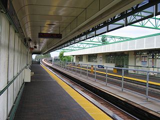
22nd Street is an elevated station on the Expo Line of Metro Vancouver's SkyTrain rapid transit system. It is located on 7th Avenue and 22nd Street in the Connaught Heights neighbourhood of New Westminster, British Columbia, Canada. Due to its proximity to the Queensborough interchange, where the Queensborough Bridge meets with Stewardson and Marine Ways, the station serves as a hub for regional bus routes.

Marpole Loop is a public transit exchange in Vancouver, British Columbia, Canada. The exchange is a part of Metro Vancouver's TransLink transit network. It is the southernmost transit exchange located within the city of Vancouver.

White Rock Centre is a major transit exchange on the border between Surrey and White Rock, British Columbia. Opened on April 4, 1975, it is the southern-most major transit hub in the Metro Vancouver area. Part of the TransLink system, it is home to routes serving White Rock and South Surrey, as well as some express routes to downtown Surrey and Richmond.
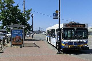
Langley Centre is the major public transit exchange serving the City of Langley and the Township of Langley in British Columbia, Canada. Opened on October 31, 1975, it is home to Langley's bus routes and community shuttle routes; some of Langley's bus routes connect to the SkyTrain system at Surrey Central station.
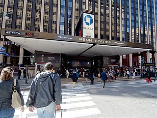
A transport hub is a place where passengers and cargo are exchanged between vehicles or/and between transport modes. Public transport hubs include train stations, rapid transit stations, bus stops, tram stop, airports and ferry slips. Freight hubs include classification yards, airports, seaports and truck terminals, or combinations of these. For private transport, the parking lot functions as a hub.
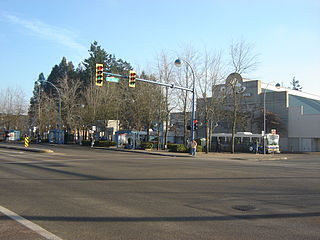
Newton Exchange is a bus loop and transit exchange in Surrey, British Columbia, Canada. Opened on May 30, 1975, it is the central transit hub for Newton Town Centre. Part of the TransLink system, it is the terminus of buses serving Surrey, White Rock, Delta, and Richmond.
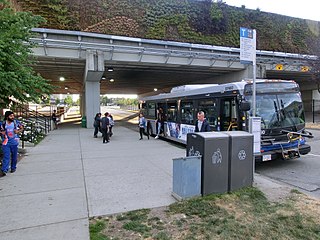
Guildford Exchange is a major public transit exchange serving Guildford Town Centre in Surrey, British Columbia, Canada. Opened on May 30, 1975, it is a connection point for routes serving the Whalley, Fleetwood, Guildford and Cloverdale areas of Surrey, as well as Langley Centre. A number of routes using the exchange serve the SkyTrain system via Surrey Central Station.
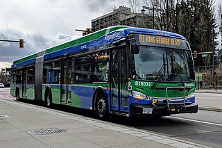
The R1 King George Blvd is an express bus service with bus rapid transit elements in Metro Vancouver, British Columbia, Canada. Part of TransLink's RapidBus network, it travels along King George Boulevard and 104 Avenue in Surrey and connects Guildford, Whalley / City Centre, and Newton. The service replaced the 96 B-Line on January 6, 2020. It is operated by Coast Mountain Bus Company and funded by TransLink.
Provincial (State) Highway 91 was part of the New Zealand state highway network before briefly becoming part of SH 92 in 1990–91. It ran for 13 kilometres through South Otago in the southern South Island. SH 92 itself had its status revoked a year later.
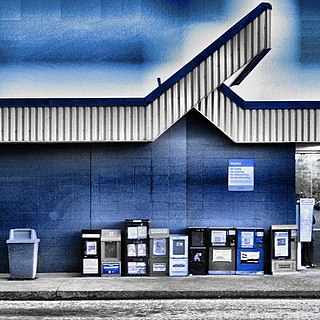
The Ladner Exchange is a major transit exchange in the community of Ladner within the municipality of Delta, British Columbia. Opened on November 24, 1978, it is the primary transit hub for South Delta, serving as a terminus for all but two routes and includes connections to SkyTrain stations in Richmond and Surrey. There is a 200 space park and ride and kiss and ride adjacent to the exchange.
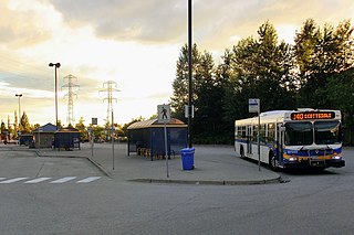
Scottsdale Exchange is a major transit exchange located in the Strawberry Hill neighbourhood of Newton in Surrey, British Columbia. Opened on May 30, 1975, it is home to bus routes serving the South of Fraser region including the municipalities of Delta and Langley, as well as Richmond. It is a terminus for most of these routes, which provide connections to SkyTrain stations in Surrey and Richmond.


