
Berhampore is a suburb of Wellington, New Zealand. It lies towards the south of the city, four kilometres from the city centre, and two kilometres from the coast of Cook Strait. It is surrounded by the suburbs of Vogeltown, Newtown, Melrose, Island Bay, Kingston, and Mornington. The suburb was named after Berhampore in Bengal, one of the battlefields at the start of the Battle of Plassey of 1757. Also surrounding Berhampore is the Berhampore Golf Course as well as a very extensive green belt with many walkways and tracks connecting outlying areas. The suburb also boasts some of Wellington's best all weather sports fields, on Adelaide Road and the national hockey stadium. Alongside the golf course there is a skateboard/bmx park, right by a kids mountain bike track. Berhampore School opened in 1915.

Waltham is an inner suburb of Christchurch, New Zealand, located approximately 2 kilometres south-east of the city centre. State Highway 76, part of Christchurch's ring road system, and known there as Brougham Street, runs through the suburb, as does the Lyttelton Line rail corridor. Amenities include Lancaster Park, Christchurch's former sports venue, now a community park, and Waltham pool.
Penrose is an industrial suburb in Auckland, New Zealand. It is located to the southeast of the city centre, at a distance of about nine kilometres, between the suburbs of Oranga and Mount Wellington, and close to the Mangere Inlet, an arm of the Manukau Harbour.

Lincoln is a suburb in West Auckland, New Zealand. It is also the filming location of Shortland Street. The suburb is sometimes called Lincoln North or treated as part of Henderson North to avoid confusion with Lincoln in Canterbury.
Papakōwhai is a suburb of Porirua City. It lies approximately 22 kilometres (14 mi) north of Wellington in New Zealand.

Belmont, a suburb of Lower Hutt, to the north of Wellington in the North Island of New Zealand, lies on the west bank of the Hutt River, on State Highway 2, the Wellington-Hutt main road, and across the river from the centre of Lower Hutt.

Rongotai is a suburb of Wellington, New Zealand, located southeast of the city centre. It is on the Rongotai isthmus, between the Miramar Peninsula and the suburbs of Kilbirnie and Lyall Bay. It is known mostly for being the location of the Wellington International Airport. It is roughly in the centre of the Rongotai electorate, which is much bigger than the suburb.

Wilton is a small suburb in Wellington. It is best known for Otari-Wilton's Bush, a large reserve that is situated in the suburb. Otari-Wilton's bush is the only public botanic garden in New Zealand dedicated solely to native plants. It features 14 km of walking tracks and a 'canopy walkway'. The canopy walkway is a raised walkway that provides a unique chance to view life in, and from, the top level of trees such as mature tawa, rewarewa and hinau.
Strowan is an affluent suburb of Christchurch, New Zealand, located approximately 5 km north-west of Christchurch's central business district. It had a population of 3,705 at the 2013 census. It is located between the suburbs of Merivale, Papanui, Bryndwr, Fendalton, and St Albans.

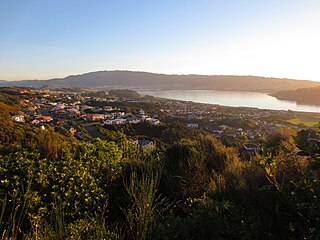
Sawyers Bay is a suburb of the New Zealand city of Dunedin. It is located 1.5 kilometres (0.93 mi) to the southwest of Port Chalmers in a wide valley on the shore of Mussel Bay, 13 kilometres (8.1 mi) to the northeast of Dunedin city centre.

Mornington is a suburb of the city of Dunedin, in the South Island of New Zealand. It is situated on hilly slopes 2 kilometres (1.2 mi) to the west of the city centre, the slopes forming part of a ridge which surrounds the heart of the city.

Ravensbourne is a suburb of the New Zealand city of Dunedin. It is located on Otago Harbour on the steep southeastern slopes of Signal Hill. It lies on the harbour's northern shore, 4.5 kilometres (2.8 mi) east-northeast of the city centre.
Maungaraki is a suburb of Lower Hutt. It is one of several Lower Hutt suburbs on the western hills of the Hutt Valley. It contains the largest suburban development on the Hutt Valley's western escarpment that runs along the Wellington Fault.

Grenada North is a small suburb in northern Wellington, New Zealand. It is 5 km south of Porirua's city centre, and 13 km north of Wellington's city centre. Its western boundary is formed by State Highway 1 and Takapu Road. The suburb itself was named after Grenada in the Caribbean, and most streets are named after Caribbean islands.
Grenada Village is one of the northern suburbs of Wellington, New Zealand, between Paparangi and Grenada North.

Maupuia on the Miramar Peninsula is an eastern suburb of Wellington to the north-west of Miramar. Developed in the 1970s, it is in the Eastern Ward.

Broadmeadows is a minor western suburb of Wellington, New Zealand. It is located to the north of Khandallah and south of Johnsonville. It is located 7 kilometres (4.3 mi) from the Wellington central business district. Despite its name suggesting that the area was once flat open fields, the suburb was created on steeply sloping hills and features the highest streets within Wellington City with a number of houses located more than 300m above sea level. Broadmeadows has a population of 1,635.
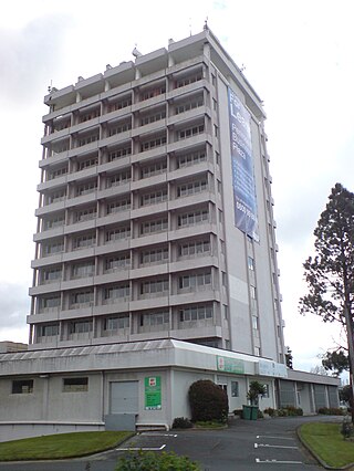
Porirua Central is the central business district and central suburb of Porirua, in the Wellington region of New Zealand's North Island.

Pipitea is a central suburb of Wellington, in the Wellington region of New Zealand's North Island.
Whalers Gate is a suburb of New Plymouth, in the western North Island of New Zealand. It is located to the southwest of the city centre.

