King City is a city in Monterey County, California, United States. King City is located on the Salinas River 51 miles (82 km) southeast of Salinas, at an elevation of 335 feet. It lies along U.S. Route 101 in the Salinas Valley of the Central Coast. King City is a member of the Association of Monterey Bay Area Governments. The population was 12,874 at the 2010 census. It is a small town which has experienced slow economic growth over the past 50 years.
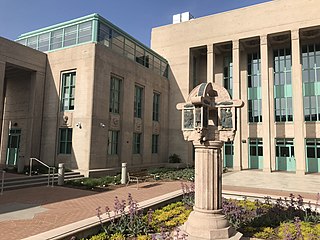
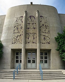
Salinas is a city in California and the county seat of Monterey County. With a population of 155,564, Salinas is the most populous city in Monterey County. Salinas is an urban area located in the Monterey Bay Area, just south of the San Francisco Bay Area and 10 miles (16 km) southeast of the mouth of the Salinas River. The city is located at the mouth of the Salinas Valley, roughly eight miles from the Pacific Ocean, and it has a climate more influenced by the ocean than the interior.

Soledad is a city in Monterey County, California, United States. Soledad is located 25 miles (40 km) southeast of Salinas, at an elevation of 190 feet. The population was 25,738 at the 2010 census.

The Central Coast is an area of California, United States, roughly spanning the coastal region between Point Mugu and Monterey Bay. It lies northwest of Los Angeles County and south of San Mateo and Santa Clara counties, and includes the rugged, undeveloped stetch of coastline known as Big Sur. From south to north, there are six counties that make up the Central Coast: Ventura, Santa Barbara, San Luis Obispo, Monterey, San Benito, and Santa Cruz.

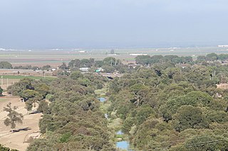
The Salinas Valley is one of the major valleys and most productive agricultural regions in California. It is located west of the San Joaquin Valley and south of San Francisco Bay and the Santa Clara Valley, or Silicon Valley.

Gilroy is a Caltrain station located in Gilroy, California. It is the southernmost terminus of the Caltrain system, and is only served during weekday rush hours in the peak direction, with trains going toward San Francisco in the morning and returning southbound in the evening. The station building was constructed by the Southern Pacific Railroad in 1913 and restored in 1998. Future plans call for extended Amtrak Capitol Corridor service to also stop at Gilroy. The station was named to the National Register of Historic Places in 2019 as Gilroy Southern Pacific Railroad Depot.

Cooper is an unincorporated community in Monterey County, California, United States. It is located on the Southern Pacific Railroad and California State Route 183 4.5 miles (7.2 km) northwest of Salinas and southeast of Castroville. The elevation is 23 feet.

Bolsa Knolls is an unincorporated community in Monterey County, California. It is located 4 miles (6.4 km) north-northeast of Salinas on San Juan Grade Road, at an elevation of 131 feet. It is named after the Rancho Bolsa de las Escorpinas.

Springtown is an unincorporated community in Monterey County, California, United States.

Corral de Tierra is an unincorporated community in Monterey County, California. It is located in the Corral de Tierra Valley, on the former land grant of Corral de Tierra, at an elevation of 404 feet.
Gabilan Acres is an unincorporated community in Monterey County, California. It is located on San Juan Grade Road northeast of Salinas and Bolsa Knolls and 6.5 miles (10 km) west of Fremont Peak, at an elevation of 203 feet.
Metz is an unincorporated community in the Salinas Valley, in Monterey County, California. It is located on the Southern Pacific Railroad and County Route G15, 3 miles (4.8 km) northeast of Greenfield, at an elevation of 236 feet.
Natividad is an unincorporated community in Monterey County, California. It is located 5 miles (8 km) northeast of Salinas, at an elevation of 164 feet.

Neponset is an unincorporated community in Monterey County, California. It is located on the Southern Pacific Railroad and California State Route 1 between Marina and Castroville, and 8.5 miles (14 km) west-northwest of Salinas, at an elevation of 23 feet.
Old Hilltown, formerly Hill Town, is an unincorporated community in Monterey County, California. It is located on the north side of the Salinas River 3 miles (4.8 km) south-southwest of Salinas on California State Route 68, at an elevation of 46 feet, approximately two miles from Spreckels, California The name is from James Bryant Hill, one of the first settler in the area. The first European land exploration of Alta California, the Spanish Portolá expedition, camped on the Salinas River in this vicinity on September 30, 1769, having followed the river from the south for several days. From this camp, the scouts went out to survey the route ahead and saw Monterey Bay for the first time. Unsure whether the point they could see at the southern end of the bay was the "Point of Pines" described by Sebastian Vizcaino in 1602, Portola decided that the party should investigate.
Watsonville Junction is an unincorporated community in Pajaro, Monterey County, California. It is named for the Union Pacific Railroad junction at Pajaro. It is located 1.3 miles (2.1 km) south of Watsonville and 5.5 miles (8.9 km) west of Aromas, at an elevation of 33 feet.
Rancho Encinal y Buena Esperanza was a 13,392-acre (54.20 km2) Mexican land grant in the Salinas Valley, in present-day Monterey County, California.
Rancho Llano de Buena Vista was a 8,446-acre (34.18 km2) Mexican land grant in the Salinas Valley, in present-day Monterey County, California, given in 1823 by Governor Luís Antonio Argüello to José Mariano Estrada. In English, the name means "Good View Plain". The grant extended along the north bank of the Salinas River across the river from the Estrada family's Rancho Buena Vista, and up the river from Hill Town. Rancho Llano de Buena Vista encompassed present-day Spreckels.

Trenton is an unincorporated community in Saline County, Kansas, United States. It is located northwest of Salina at the intersection of Gerald Road and Pleasant Hill Road, next to an abandoned railroad.
Pajaro/Watsonville is a proposed train station on Caltrain and Amtrak California's Capitol Corridor trains to serve both Pajaro and Watsonville, California. The station is expected to open after track improvements in the area and service commences to Salinas. It will be located in Watsonville Junction near the corner of Salinas Road and Lewis Road, adjacent to the former Southern Pacific Railroad depot and current Union Pacific Railroad office.

