Milton is an unincorporated community in Calaveras County, California. It lies at an elevation of 394 feet and is located at 38°01′55″N120°51′08″W. The community is in ZIP code 95684 and area code 209.

Blinzing is a former settlement in Butte County, California, United States. It was located 5 miles (8 km) north of Berry Creek on the Western Pacific Railroad, at an elevation of 915 feet. From 1909 to 1912 its railroad station served summer resorts on the Feather River. It is now under Lake Oroville.
Hume is a former settlement in Butte County, California. It was located 3.5 miles (5.6 km) east-northeast of Biggs on the now-abandoned Northern Electric Railroad (which became the Sacramento Northern, at an elevation of 112 feet. The settlement still appeared on maps as of 1912.
Shippee is an unincorporated community in Butte County, California. It lies at an elevation of 131 feet. It is 7.5 miles (12.1 km) west-northwest of Oroville on the Sacramento Northern Railroad and the Northern Electric Railroad.
Ambrose is a former settlement in Contra Costa County, California. It was located on the Atchison, Topeka and Santa Fe Railroad 3.5 miles (5.6 km) west of Pittsburg, at an elevation of 16 feet. It still appeared on maps as of 1918.
Algoso is an unincorporated community in Kern County, California. It is located on the railroad 4.5 miles (7.2 km) east-southeast of downtown Bakersfield, at an elevation of 430 feet (131.06 m).
Bannister is an unincorporated community in Kern County, California. It is located on the Sunset Railroad 9.5 miles (15 km) southwest of Bakersfield, at an elevation of 348 feet.
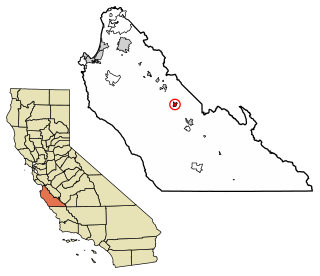
Bowerbank is an unincorporated community in Kern County, California. It is located on the Southern Pacific Railroad 3.5 miles (5.6 km) east of Buttonwillow, at an elevation of 299 feet (91 m).
Calico is an unincorporated community in Kern County, California. It is located on the Southern Pacific Railroad 3.5 miles (5.6 km) south-southeast of McFarland, at an elevation of 400 feet (121.9 m).
Elmo is an unincorporated community in Kern County, California. It is located on the Atchison, Topeka and Santa Fe Railroad 5.5 miles (8.9 km) north of Wasco, at an elevation of 302 feet (92 m).
Hazelton is an unincorporated community in Kern County, California. It is located on the Sunset Railroad 1.5 miles (2.4 km) southeast of Maricopa, at an elevation of 771 feet (235 m).
Landco is an unincorporated community in Kern County, California. It is located on the Atchison, Topeka and Santa Fe Railroad 3.5 miles (5.6 km) west of Bakersfield, at an elevation of 400 feet (122 m).
Marcel is an unincorporated community in Kern County, California. It is located on the railroad 3.5 miles (5.6 km) southeast of Keene, at an elevation of 3,245 feet (989 m).
Oil Junction is an unincorporated community in Kern County, California. It is located on the Southern Pacific Railroad 4.5 miles (7.2 km) northwest of downtown Bakersfield, at an elevation of 443 feet (135 m).
Sanborn is an unincorporated community in Kern County, California. It is located on the Atchison, Topeka and Santa Fe Railroad 5.5 miles (8.9 km) southeast of Mojave, at an elevation of 2,572 feet (784 m).
Sullivan is a former settlement in Kern County, California. It was located on the Southern Pacific Railroad 2.5 miles (4 km) east of Tehachapi, at an elevation of 4029 feet.
Zentner is an unincorporated community in Kern County, California. It is located on the Southern Pacific Railroad 3.5 miles (5.6 km) east-northeast of McFarland, at an elevation of 449 feet (137 m).
Rancho Butano was a 4,439-acre (17.96 km2) Mexican land grant in present-day San Mateo County, California given in 1838 by Governor Juan Alvarado and confirmed in 1844 by Governor Manuel Micheltorena to Ramona Sanchez. The name Butano can be traced back to 1816. It speculated that Californios called a drinking cup made from the horn of a bull or other animal a butano. A First American origin is possible but has not been established. At one time, the grant was in Santa Cruz County 1850-1868; a boundary adjustment transferred the land to San Mateo County. The grant extended along the Pacific coast between Rancho Pescadero and Rancho Punta del Año Nuevo, with Butano Creek on the north to Arroyo de los Frijoles on the south, and encompassed present-day Bean Hollow State Beach and Butano State Park.
Andover is a former settlement in Placer County, California. Andover is located on the first transcontinental railroad built by the Central Pacific Railroad, later the Southern Pacific Railroad, now the Union Pacific railroad, 11.5 miles (18.5 km) west of Martis Peak. It lay at an elevation of 6302 feet.
Troy is a former railroad town in Placer County, California. Troy was located on the Southern Pacific Railroad, 7.5 miles (12.1 km) west of Donner Pass. It lay at an elevation of 6345 feet.