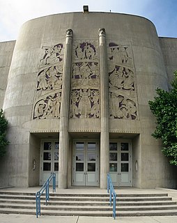
Elsa is a city in Hidalgo County, Texas, United States. The population was 5,660 at the 2010 census, and in 2016 the estimated population was 6,624. It is part of the McAllen–Edinburg–Mission and Reynosa–McAllen metropolitan areas.

Merrimac is an unincorporated community in Butte County, California located along Oroville-Quincy Road about 2.1 miles (3.4 km) south of the Plumas County line. It lies at an elevation of 3999 feet. While the location is shown as official in the National Geographic Names Database, it is not known if locals use this name to describe the place today. Nearby is Rogers Cow Camp, a campground in Lassen National Forest. The USGS feature ID for this populated place is 1659117. The US Postal Service does not show a ZIP Code for this community. The location is within area code 530.

Big Bar is an unincorporated community in Butte County, California, on the North Fork of the Feather River, 0.5 mi (0.8 km) east of Pulga. It lies at an elevation of 1414 feet.

Big Bend is an unincorporated community in Butte County, California, United States. It lies at an elevation of 2310 feet. A post office operated in Big Bend from 1883 to 1891.

Craig is a former settlement in Butte County, California. It was located 3 miles (4.8 km) east-southeast of Bidwell's Bar on the Feather River Railway, at an elevation of 981 feet. Craig still appeared on maps as of 1947.

Lomo is an unincorporated community in Butte County, California. It lies 4.5 miles (7.2 km) of Butte Meadows, at an elevation of 3779 feet. A post office operated at Lomo from 1878 to 1881.

Aerial Acres is a fly-in unincorporated community in Kern County, California. It is located 5.5 miles (9 km) east-southeast of Castle Butte, at an elevation of 2,428 feet (740 m). It was noted as "a desert town at Clay Mine Road and Sequoia in Peerless Valley, California.

Baker is a former unincorporated community in Kern County, California. It was located in the Mojave Desert, 3 miles (4.8 km) north-northwest of Boron, at an elevation of 2503 feet. Baker was 1.25 miles (2 km) east of West Baker, California.

Fruitvale is an unincorporated community in Kern County, California. It is located 4.5 miles (7.2 km) west of Bakersfield, at an elevation of 397 feet.

Goler Heights, also known simply as Goler, is an unincorporated community in Kern County, California. It is located 6.5 miles (10 km) northwest of Randsburg, at an elevation of 2,579 feet (786 m). The town is named after John Goller, a German immigrant who discovered a placer gold deposit that was later mined and named in his honor.

Magunden is an unincorporated community in Kern County, California. It is located 4 miles (6.4 km) east of downtown Bakersfield, at an elevation of 440 feet.

Meridian is an unincorporated community in Kern County, California. It is located 4.5 miles (7.2 km) northeast of Mettler, at an elevation of 433 feet (132 m).

Old Town is an unincorporated community in Kern County, California. It is located 3 miles (4.8 km) west-northwest of Tehachapi, at an elevation of 3829 feet.
Sand Canyon is an unincorporated community in Kern County, California. It is located on Cache Creek 7 miles (11 km) east of Tehachapi, at an elevation of 4,500 feet (1,400 m).

Sullivan is a former settlement in Kern County, California. It was located on the Southern Pacific Railroad 2.5 miles (4 km) east of Tehachapi, at an elevation of 4029 feet.

Twin Lakes is an unincorporated community in Kern County, California. It is located 4 miles (6.4 km) east-northeast of Liebre Twins, at an elevation of 5,171 feet (1,576 m).

Twin Oaks is an unincorporated community in Kern County, California. It is located 1.5 miles (2.4 km) east-northeast of Loraine, at an elevation of 2,825 feet (861 m).

West Baker is a former settlement in Kern County, California.

Glenblair is an unincorporated community in Mendocino County, California. It is located 15 miles (24 km) north-northwest of Comptche, at an elevation of 207 feet.

Elsanor is an unincorporated community in Baldwin County, Alabama, United States. Elsanor is located on U.S. Route 90, 7.7 miles (12.4 km) east of Robertsdale.


