
Monterey County, officially the County of Monterey, is a county located on the Pacific coast of the U.S. state of California. As of the 2010 census, the population was 415,057. The county seat and largest city is Salinas.

Limekiln State Park is a state park of California, United States, on the Big Sur coast. It contains four lime kilns from an 1887–1890 lime-calcining operation, plus a beach, redwood forest, and 100-foot (30 m) Limekiln Falls. It is located 2 miles (3.2 km) south of Lucia on State Route 1. The 711-acre (288 ha) park was established in 1994.
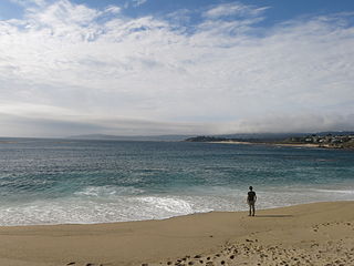
Carmel River State Beach is a state park unit in Carmel, California, United States, featuring a 1-mile-long (1.6 km) protected beach with a lagoon formed by the Carmel River. The lagoon attracts many migratory birds. The state beach includes Monastery Beach, which is popular with scuba divers. Sea kayakers also frequent the beach, which has easy access to the natural reserves of Point Lobos. The 297-acre (120 ha) park was established in 1953.

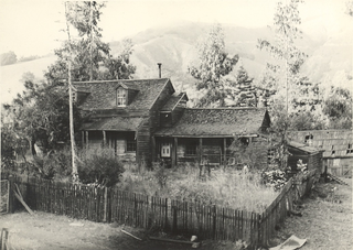
John Little State Natural Reserve is a state park unit of California, United States, protecting a section of steep, rugged cliffs on the Big Sur coast. The reserve flanks the mouth of Lime Creek and contains the 1917 cabin of Elizabeth K. Livermore, an early conservationist. It is located in Monterey County between California State Route 1 and the Pacific Ocean. The 21-acre (8.5 ha) park was established in 1953.

Carmel Highlands is an unincorporated community in Monterey County, California, United States. It is 3.5 miles (5.6 km) south of Carmel-by-the-Sea, at an elevation of 318 feet. Carmel Highlands is also located just south of the Point Lobos State Reserve, and serves as the northern gateway of the Big Sur coastline along California State Route 1. Carmel Highlands was laid out in 1916 by developers Frank Powers and Franklin Devendorf.

Lucia is an unincorporated community in Monterey County, California. It is located 1 mile (1.6 km) east of Lopez Point, at an elevation of 354 feet. Lucia is one of the three small settlements of restaurants, and motels located along State Route 1 on the Big Sur coast. The ZIP Code is 93920, but mail sent to Lucia must be addressed "Big Sur". The community is inside area code 831.

Gorda is an unincorporated community in Monterey County, California. It is located 3 miles (4.8 km) south of Cape San Martin, at an elevation of 148 feet. It is one of the three small settlements of filling stations, restaurants, and motels located along State Route 1 on the Big Sur coast. The ZIP Code is 93920, but mail must be addressed to Big Sur, and the community is inside area code 805.

Ambler Park is an unincorporated community in Monterey County, California. It lies at an elevation of 285 feet. It is located off San Benancio Road.
Bryson is an unincorporated community in Monterey County, California. It is located 12 miles (19 km) south-southeast of Jolon, at an elevation of 968 feet.

Springtown is an unincorporated community in Monterey County, California, United States.

Corral de Tierra is an unincorporated community in Monterey County, California. It is located in the Corral de Tierra Valley, on the former land grant of Corral de Tierra, at an elevation of 404 feet.
Jamesburg is an unincorporated community in Monterey County, California. It is located 7.5 miles (12 km) northeast of Ventana Cone, at an elevation of 1722 feet.

New Monterey is a former unincorporated community incorporated in Monterey in Monterey County, California. It is located north of the Presidio of Monterey, at an elevation of 56 feet. Monterey's famous Cannery Row is located in New Monterey neighborhood.
Old Hilltown, formerly Hill Town, is an unincorporated community in Monterey County, California. It is located on the north side of the Salinas River 3 miles (4.8 km) south-southwest of Salinas on California State Route 68, at an elevation of 46 feet, approximately two miles from Spreckels, California The name is from James Bryant Hill, one of the first settler in the area. The first European land exploration of Alta California, the Spanish Portolá expedition, camped on the Salinas River in this vicinity on September 30, 1769, having followed the river from the south for several days. From this camp, the scouts went out to survey the route ahead and saw Monterey Bay for the first time. Unsure whether the point they could see at the southern end of the bay was the "Point of Pines" described by Sebastian Vizcaino in 1602, Portola decided that the party should investigate.
Plaskett is a very small oceanside community in the Big Sur region of Monterey County, California. It lies at an elevation of 203 feet.
Posts is an Unincorporated community in the Big Sur region of Monterey County, California. It is located on Pacific Coast Highway, a.k.a. Highway 1 or the Cabrillo Highway near Post Creek, 0.5 miles (0.80 km) southeast of the unincorporated area of Loma Vista and 3 miles (4.8 km) east-southeast of Pfeiffer Point, at an elevation of 945 feet.
Robles Del Rio is an unincorporated community in Monterey County, California. It is located west of the Carmel River adjacent to Carmel Valley, at an elevation of 597 feet.
Sycamore Flat is an unincorporated community in Monterey County, California. It is located on Arroyo Seco 9 miles (14 km) west-southwest of Greenfield, at an elevation of 617 feet.
Tassajara Hot Springs is an unincorporated community in Monterey County, California, located 9 miles (14 km) east-northeast of Partington Point, at an elevation of 1637 feet.
Dave Potter is a California politician, having served at the state, county, and city levels.


