Monterey is a city located in Monterey County on the southern edge of Monterey Bay on California's Central Coast. Founded on June 3, 1770, it was the capital of Alta California under both Spain and Mexico. During this period, Monterey hosted California's first theater, public building, public library, publicly funded school, printing press, and newspaper. It was originally the only port of entry for all taxable goods in California. In 1846 during the Mexican–American War, the United States flag was raised over the Customs House. After California was ceded to the U.S. after the war, Monterey hosted California's first constitutional convention in 1849.

Monterey County, officially the County of Monterey, is a county located on the Pacific coast of the U.S. state of California. As of the 2010 census, the population was 415,057. The county seat and largest city is Salinas.
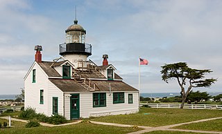
Pacific Grove is a coastal city in Monterey County, California in the United States. The 2010 United States Census population is 15,041. Pacific Grove is located between Point Pinos and Monterey.

Salinas is a city in Monterey County, California, United States. With a population of 155,564, Salinas is the most populous city in Monterey County, as well as its county seat. Salinas is an urban area located just outside the southern portion of the Greater Bay Area and 10 miles (16 km) southeast of the mouth of the Salinas River. The city is located at the mouth of the Salinas Valley, roughly eight miles from the Pacific Ocean, and it has a climate more influenced by the ocean than the interior.

Carmel Valley Village is a census-designated place (CDP) in Monterey County, California, United States. At the time of the 2010 census the population was 4,407, down from 4,700 at the 2000 census. In November 2009, a majority of residents voted against incorporation.

Limekiln State Park is a state park of California, United States, on the Big Sur coast. It contains four lime kilns from an 1887–1890 lime-calcining operation, plus a beach, redwood forest, and 100-foot (30 m) Limekiln Falls. It is located 2 miles (3.2 km) south of Lucia on State Route 1. The 711-acre (288 ha) park was established in 1994.

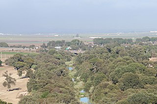
The Salinas Valley is one of the major valleys and most productive agricultural regions in California. It is located west of the San Joaquin Valley and south of San Francisco Bay and the Santa Clara Valley, or Silicon Valley.
Carmel River State Beach is a state park unit in Carmel, California, United States, featuring a 1-mile-long (1.6 km) protected beach with a lagoon formed by the Carmel River. The lagoon attracts many migratory birds. The state beach includes Monastery Beach, which is popular with scuba divers. Sea kayakers also frequent the beach, which has easy access to the natural reserves of Point Lobos. The 297-acre (120 ha) park was established in 1953.

The Ventana Wilderness of Los Padres National Forest is a federally designated wilderness area located in the Santa Lucia Range along the Central Coast of California. This wilderness was established in 1969 when the Ventana Wilderness Act redesignated the 55,800-acre (22,600 ha) Ventana Primitive Area as the Ventana Wilderness and added land, totalling 98,000-acre (40,000 ha). In 1978, the Endangered American Wilderness Act added 61,000 acres (25,000 ha), increasing the total wilderness area to about 159,000 acres (64,000 ha). The California Wilderness Act of 1984 added about 2,750 acres (1,113 ha). The Los Padres Condor Range and River Protection Act of 1992 created the approximately 14,500-acre (5,900 ha) Silver Peak Wilderness and added about 38,800 acres (15,700 ha) to the Ventana Wilderness in addition to designating the Big Sur River as a Wild and Scenic River. Most recently, the Big Sur Wilderness and Conservation Act of 2002 expanded the wilderness for the fifth time, adding nearly 35,000 acres (14,000 ha), increasing the total acreage of the wilderness to its present size of 240,026 acres (97,135 ha).

Ambler Park is an unincorporated community in Monterey County, California. It lies at an elevation of 285 feet. It is located off San Benancio Road.

Springtown is an unincorporated community in Monterey County, California, United States.

Corral de Tierra is an unincorporated community in Monterey County, California. It is located in the Corral de Tierra Valley, on the former land grant of Corral de Tierra, at an elevation of 404 feet.
Old Hilltown, formerly Hill Town, is an unincorporated community in Monterey County, California. It is located on the north side of the Salinas River 3 miles (4.8 km) south-southwest of Salinas on California State Route 68, at an elevation of 46 feet, approximately two miles from Spreckels, California The name is from James Bryant Hill, one of the first settler in the area. The first European land exploration of Alta California, the Spanish Portolá expedition, camped on the Salinas River in this vicinity on September 30, 1769, having followed the river from the south for several days. From this camp, the scouts went out to survey the route ahead and saw Monterey Bay for the first time. Unsure whether the point they could see at the southern end of the bay was the "Point of Pines" described by Sebastian Vizcaino in 1602, Portola decided that the party should investigate.
Robles Del Rio is an unincorporated community in Monterey County, California. It is located west of the Carmel River adjacent to Carmel Valley, at an elevation of 597 feet.

Slates Hot Springs is an unincorporated community in the Big Sur region of Monterey County, California. It is located 8 miles (13 km) north-northwest of Lopez Point, at an elevation of 118 feet.
Sycamore Flat is an unincorporated community in Monterey County, California. It is located on Arroyo Seco 9 miles (14 km) west-southwest of Greenfield, at an elevation of 617 feet.
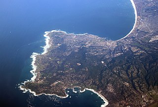
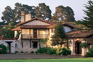
The Monterey Peninsula is located on the central California coast and comprises the cities of Monterey, Carmel, and Pacific Grove, and unincorporated areas of Monterey County including the resort and community of Pebble Beach.
The Monterey County Board of Supervisors is the central governing body for Monterey County, California. The Board is made up of five elected officials, each of whom represent a distinct geographical district within the County.

Palo Colorado Canyon is an unincorporated community in the Big Sur region of Monterey County, California. The canyon entrance is located 11.3 miles (18.2 km) south of Carmel Valley River at the former settlement of Notley's Landing, 6.5 miles (10 km) north of Point Sur, and at an elevation of 112 feet.
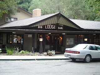
Big Sur is an unincorporated community village in Big Sur, Monterey County, California. It is located along a 1 mile (1.6 km) long stretch of Big Sur Coast Highway in the Big Sur Valley 24 miles (39 km) south of Carmel, California. The village contains the largest collection of shops and visitor services along the entire 71-mile (114 km) segment of California State Route 1 between Malpaso Creek near Carmel Highlands in the north and San Carpóforo Creek near San Simeon in the south. The population is about 1,463. The collection of small roadside businesses and homes is often confused with the larger region, also known as Big Sur. On March 6, 1915, United States Post Office granted the English-speaking resident's request to change the name of their post office from Arbolado to Big Sur. CalTrans also refers to the village as Big Sur.

