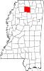
Lafayette County is a county in the U.S. state of Mississippi. At the 2020 census, the population was 55,813. Its county seat is Oxford. The local pronunciation of the name is "la-FAY-et." The county's name honors Marquis de Lafayette, a French military hero and American general who fought during the American Revolutionary War.

Washington County is a regional economic, educational, and cultural hub in the Northwest Arkansas region. Created as Arkansas's 17th county on November 30, 1848, Washington County has 13 incorporated municipalities, including Fayetteville, the county seat, and Springdale. The county is also the site of small towns, bedroom communities, and unincorporated places. The county is named for George Washington, the first President of the United States.

Bethel Heights was a city in Benton County, Arkansas, United States. Always a small, sparsely populated community, the region coalesced around a school named Bethel in the late 19th century but did not incorporate until 1967 to avoid annexation by larger neighboring communities. The town offered police and fire protection and wastewater service to residents, but sent students to Springdale Public Schools and purchased water from Springdale Water Utilities. By the 21st century, Northwest Arkansas was gaining population rapidly, and Bethel Heights reincorporated as a city and grew from a population of 714 in 2000 to 2,372 at the 2010 census. Growth put pressure on the city's subsurface discharge wastewater treatment system, and following a series of wastewater treatment plant violations, voters dissolved the city and completely annexed into Springdale in August 2020.

Elm Springs is a city in Benton and Washington Counties, Arkansas, United States. Located immediately west of Springdale in the Northwest Arkansas metropolitan statistical area, Elm Springs has been gaining population in recent years, including a 47% increase in population between the 2000 and 2010 censuses.

Springdale is the fourth-largest city in Arkansas, United States. It is located in both Washington and Benton counties in Northwest Arkansas. Located on the Springfield Plateau deep in the Ozark Mountains, Springdale has long been an important industrial city for the region. In addition to several trucking companies, the city is home to the world headquarters of Tyson Foods, the world's largest meat producing company. Originally named Shiloh, the city changed its name to Springdale when applying for a post office in 1872. It is included in the four-county Northwest Arkansas Metropolitan Statistical Area, which is ranked 102nd in terms of population in the United States with 546,725 in 2020 according to the United States Census Bureau. The city had a population of 84,161 at the 2020 Census.

Johnson is a city in Washington County, Arkansas, United States. The community is located in the Ozark Mountains and is surrounded by valleys and natural springs. Early settlers took advantage of these natural features and formed an economy based on mining lime, the Johnson Mill and trout. Although a post office was opened in the community in 1887, Johnson did not incorporate until it required the development of a city government to provide utility services in 1961. Located between Fayetteville and Springdale in the heart of the rapidly growing Northwest Arkansas metropolitan statistical area, Johnson has been experiencing a population and building boom in recent years, as indicated by a 46% growth in population between the 2000 and 2010 censuses.

Tontitown is a city in northern Washington County, Arkansas, United States. The community is located in the Ozark Mountains and was founded by Italian settlers in 1898. Known for its grapes and wines, Tontitown has hosted the Tontitown Grape Festival continuously since 1898. It is part of the Northwest Arkansas region, serving as a bedroom community for larger neighbors Fayetteville and Springdale. The town experienced a 160% growth in population between the 2000 and 2010 censuses.

Springdale is an unincorporated area and census-designated place (CDP) in Prince George's County, Maryland, United States. Per the 2020 census, the population was 5,301.

Oxford is a city in and the county seat of Lafayette County, Mississippi, United States. Oxford lies 75 miles (121 km) south-southeast of Memphis, Tennessee. A college town, the University of Mississippi or "Ole Miss" is located adjacent to the city. Founded in 1837, it is named for Oxford, England.
Abbeville is a town in Lafayette County, Mississippi. As of the 2020 census, the population was 372.

Springdale is a borough in northeastern Allegheny County, Pennsylvania, United States, 18 miles (29 km) northeast of Pittsburgh along the Allegheny River. The population was 3,400 at the 2020 census. The borough became official in 1906, after breaking away from the township.
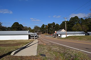
Harmontown is an unincorporated community in Lafayette County, Mississippi. A post office operated under the name Harmonton from 1879 to 1914. In 1900, Harmontown had a population of 75.
University is a census-designated place (CDP) and the official name for an area covering a portion of the University of Mississippi campus, in Lafayette County, Mississippi, United States. The CDP is surrounded by the city of Oxford. Its official United States Postal Service designation is "University, Mississippi", with a ZIP Code of 38677.
The Yocona Area Council of Boy Scouts of America serves 12 counties in northeast Mississippi including Alcorn, Benton, Itawamba, Lafayette, Lee, Marshall, Prentiss, Pontotoc, Tippah, Tishomingo, Union, and Yalobusha. The council headquarters is in Tupelo, Mississippi. The Yocona Area Council, supported by 1,100 volunteers, and 130 chartered partners, serves approximately 6,500 youth annually in one of five programs: Boy Scouts, Cub Scouts, Venturing, Learning for Life, and Exploring.

Springdale is an unincorporated community and census-designated place (CDP) in Gaston County, North Carolina, United States. It was first listed as a CDP in the 2020 census with a population of 1,203. It is bordered on the west and south by the City of Gastonia, on the east by the town of Ranlo, and on the north by the unincorporated community of Monterey Park.
Paris is a census-designated place and unincorporated community in Lafayette County, Mississippi, United States. Paris is located at the junction of Mississippi Highway 9W and Mississippi Highway 315 10 miles (16 km) east of Water Valley.
Tula is a census-designated place and unincorporated community in Lafayette County, Mississippi, United States. Tula is located on Mississippi Highway 331 7.5 miles (12.1 km) west-southwest of Toccopola.
Denmark is an unincorporated community in Lafayette County, Mississippi, United States. Denmark is located near Mississippi Highway 6 10.6 miles (17.1 km) east-southeast of Oxford. A post office operated under the name Denmark from 1872 to 1968. In 1900, Denmark had a population of 75.
Springdale is a census-designated place and unincorporated community in Park County, Montana, United States. Its population was 42 at the 2010 census. The community is located near Interstate 90 and the Yellowstone River. Springdale has its own ZIP code, 59082.
Yocona is an unincorporated community in Lafayette County, in the U.S. state of Mississippi.