The Advisory Committee on Antarctic Names is an advisory committee of the United States Board on Geographic Names responsible for recommending commemorative names for features in Antarctica.
The UK Antarctic Place-Names Committee is a United Kingdom government committee, part of the Foreign and Commonwealth Office, responsible for recommending names of geographical locations within the British Antarctic Territory (BAT) and the South Georgia and the South Sandwich Islands (SGSSI). Such names are formally approved by the Commissioners of the BAT and SGSSI respectively and published in the BAT Gazetteer and the SGSSI Gazetteer maintained by the Committee. The BAT names are also published in the international Composite Gazetteer of Antarctica maintained by SCAR.
Sinsinawa is an unincorporated community in Grant County, Wisconsin, United States. The community is in the towns of Jamestown and Hazel Green, one mile north of the border with Illinois. The community is 7+1⁄2 miles (12.1 km) east of Dubuque, Iowa, and 6+1⁄2 miles (10.5 km) west of the village of Hazel Green, Wisconsin. The town is best known for being the mother house of the Sinsinawa Dominican Sisters.
The Black River is a 41.1-mile-long (66.1 km) river on the Upper Peninsula of the U.S. state of Michigan, flowing mostly in Gogebic County into Lake Superior at 46°40′03″N90°02′57″W. Its source at 46°18′54″N90°01′15″W is a boreal wetland on the border with Iron County, Wisconsin. The northern section of the river, 14 miles (23 km) within the boundaries of the Ottawa National Forest, was designated a National Wild and Scenic River in 1992.
Olema Valley is a gorge formed by the San Andreas Fault in rural west Marin County, Northern California. The valley runs from the southern end of Tomales Bay through Point Reyes Station, the town of Olema, and Dogtown, to the Bolinas Lagoon, which lies between Bolinas and Stinson Beach. It is part of the Golden Gate National Recreation Area.
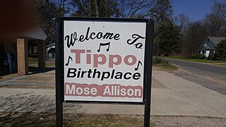
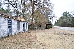
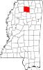
Tippo is an unincorporated community located in Tallahatchie County, Mississippi, United States, located approximately 10 miles (16 km) from Swan Lake; 11 miles (18 km) northeast of Glendora; and approximately 14 miles (23 km) from Charleston. Tippo is located at the intersection of Tippo and Sharkey roads.

Turtletown is an unincorporated community in Polk County, Tennessee, United States. Turtletown is located on Tennessee State Route 68 6.5 miles (10.5 km) north-northeast of Ducktown. Turtletown is in a primarily mountainous terrain, covered in forests except for areas cleared by farmers, ponds, or roads. Turtletown has a post office with ZIP code 37391. Turtletown's borders, however, in the eyes of some are disputed. According to one, parts of it are known as Dogtown, which appears on a few local maps. However, to others, it is simply all Turtletown and Dogtown does not exist. The only known map that contains this is the USGS map of the area, and a U.S. Forest Service map. There is an abandoned school, Turtletown School, across the street from the Post Office.
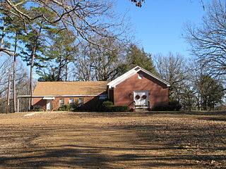
Kirkville is a census-designated place and unincorporated community in Itawamba County, Mississippi, United States.
Dogtown is an unincorporated community in Walker County, Alabama, United States.

Dogtown is an unincorporated community in Gadsden County, Florida, United States. It is located 1.3 mi (2.1 km) south of the Florida-Georgia state line, along County Road 159.
Eulogy is an unincorporated community located in Holmes County, Mississippi, United States.
Oregon is an unincorporated community in Holmes County, Mississippi, United States.
Possum Corner is an unincorporated community in Wilkinson County, Mississippi, United States.
Gulde is an unincorporated community in Rankin County, Mississippi, United States.
Leggo is a ghost town in Yalobusha County, Mississippi, United States.