Related Research Articles

The Trent–Severn Waterway is a 386-kilometre-long (240 mi) canal route connecting Lake Ontario at Trenton to Georgian Bay, Lake Huron, at Port Severn. Its major natural waterways include the Trent River, Otonabee River, Kawartha Lakes, Lake Simcoe, Lake Couchiching and Severn River. Its scenic, meandering route has been called "one of the finest interconnected systems of navigation in the world".

Lake Simcoe is a lake in southern Ontario, Canada, the fourth-largest lake wholly in the province, after Lake Nipigon, Lac Seul, and Lake Nipissing. At the time of the first European contact in the 17th century the lake was called Ouentironk by the native Wendat/Ouendat (Huron) people. It was also known as Lake Taronto until it was renamed by John Graves Simcoe, the first Lieutenant-Governor of Upper Canada, in memory of his father, Captain John Simcoe of the Royal Navy. In Anishinaabemowin, the ancestral language of the First Nations living around this lake, namely Anishinaabek of Rama and Georgina Island First Nations, Lake Simcoe is called Zhooniyaang-zaaga'igan, meaning "Silver Lake".

Coboconk, often shortened to Coby, is a community in the city of Kawartha Lakes, in the south-central portion of the Canadian province of Ontario. The village lies at the junction of Highway 35 and former Highway 48, on the northern tip of Balsam Lake, the highest point on the Trent–Severn Waterway. Coboconk has a prominent role in the logging, limestone, and tourism industries of the Kawartha Lakes region over the past 150 years.

The County of Victoria, or Victoria County, was a county in the Canadian province of Ontario. It was formed in 1854 as The United Counties of Peterborough and Victoria, and separated from Peterborough in 1863. In 2001, the county was dissolved and reformed as the city of Kawartha Lakes. Though first opened to settlement in 1821, the area that was encompassed by Victoria County has a history of Indian occupation, first by the Hurons.

Severn is a township in south-central Ontario, Canada, located between Lake Couchiching, and the Severn River in Simcoe County.

Campbellford is an unincorporated place and former town in Northumberland County, Ontario, Canada, in the township municipality of Trent Hills. It lies approximately midway between Toronto and Ottawa. It is situated on both the Trent-Severn Waterway and the Trans Canada Trail. It can be reached from Highway 401 by exiting at Brighton and going north on County Road 30. It can also be reached from Highway 7 at the Havelock exit going south. Campbellford is surrounded by prime agricultural land which is home to many farms. In recent years, some of the town's agricultural sector has diversified into non-traditional areas such as bison farming, rare breeds farming and there are many horse farms in the area. The town has a farmers market that is open two days a week in the summer.

Lake Scugog is an artificially flooded lake in Scugog, Regional Municipality of Durham and the unitary city of Kawartha Lakes in central Ontario, Canada. It lies between the communities of Port Perry and Lindsay. The lake has been raised and lowered several times over its history. Though not technically part of the Kawartha lakes due to its shallow depths, it is often geographically linked to them. Its sole outflow, the Scugog River, connects to Sturgeon Lake. Lake Scugog is in the Great Lakes Basin and forms part of the Trent–Severn Waterway.
The Kawartha Lakes (/kə'wɔrθɐ/) are a chain of lakes in south-central Ontario, Canada that form the upper watershed of the Trent River. The lakes are located on the boundary between the Paleozoic limestone regions of the Golden Horseshoe, and the Precambrian granite Canadian Shield of northern and central Ontario.

Bobcaygeon is a community on the Trent–Severn Waterway in the City of Kawartha Lakes, east-central Ontario, Canada.
Balsam Lake is a lake in the City of Kawartha Lakes in Central Ontario, Canada. It is in the Great Lakes Basin, is one of the lakes of the Kawartha Lakes, and is at the summit of the Trent–Severn Waterway.
Severn Bridge is a small community in the Town of Gravenhurst, of the District of Muskoka in the province of Ontario, Canada. It is located approximately 160 kilometres north of Toronto, on the Severn River, roughly halfway between Orillia and Gravenhurst. Its population was around 300 in 1992. It was founded in the nineteenth century. The village is served by important road, rail, water links and its postal services and rural route are handled in Washago, Ontario.

The Township of Bexley was a municipality located in the northern half of the former Victoria County, now the city of Kawartha Lakes, in the Canadian province of Ontario.

The Township of Verulam was a rural municipality within the former Victoria County, now the city of Kawartha Lakes. It was bounded on the north by the geographic township of Somerville, the south by the geographic township of Emily, the west by the geographic township of Fenelon, and the east by the County of Peterborough. For the purposes of government, land surveying and reference, it is now properly referred to as the "Geographic Township of Verulam".
Balsam Lake Provincial Park is a provincial park located in south-central Ontario on Balsam Lake. The park is situated along the Trent-Severn Waterway, a few kilometres southwest of Coboconk. It is an all-seasons recreation area offering camping, boating and fishing, and while closed in winter it is also used for skiing and snowshoeing.
The Gull River is a river in Algonquin Highlands and Dysart et al, Haliburton County and the single-tier municipality of Kawartha Lakes in south-central Ontario, Canada. It is in the Trent River and Lake Ontario drainage basins, and flows from southern Algonquin Provincial Park to Balsam Lake on the Trent–Severn Waterway.
Mitchell Lake is a small, artificial lake in the Great Lakes Basin and located in the city of Kawartha Lakes in Central Ontario, Canada. The lake was formed sometime in the first decade of the twentieth century alongside the construction of the Kirkfield Lift Lock, which was completed and operational by the end of 1907. It is part of the summit of the Trent–Severn Waterway, the middle of a connection via canals of Balsam Lake on the Gull River system, which flows eventually to Lake Ontario, and the Kirkfield Lift Lock and Canal Lake on the Talbot River system, which flows to Lake Simcoe and eventually to Lake Huron.
King's Highway 46, commonly referred to as Highway 46, was a provincially maintained highway in the Canadian province of Ontario that connected Highway 7 with Highway 48 in Victoria County. The route existed between 1937 and 1997, after which it was decommissioned and transferred to the county. In 2001, Victoria County amalgamated into the city of Kawartha Lakes, and the road became known as Kawartha Lakes Road 46. It is 25.7 kilometres (16.0 mi) long, passing through the villages of Woodville, Argyle and Bolsover.

Burleigh Falls is both a geological feature and a small community in Peterborough County, Ontario, Canada. The falls form the boundary between the municipality of North Kawartha to the north and the municipality of Selwyn to the south.

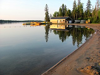
Canal Lake is a lake of Ontario, Canada, situated in the City of Kawartha Lakes. The lake is triangular, roughly 8.4 kilometres (5.2 mi) long and 2.6 kilometres (1.6 mi) at its widest point, with an area of 2,136 acres (864 ha). The depth ranges from 4.44 feet (1.35 m) to a max depth of 15 feet (4.6 m). Canal Lake is a medium size lake with a large diversity of fishing spots.

Canal Lake Concrete Arch Bridge is an arch bridge in Ontario, Canada, spanning a portion of Canal Lake on the Trent–Severn Waterway between Balsam Lake and Lake Simcoe. It is north-northeast from the town of Bolsover.
References
- ↑ Kirkconnell, Watson (1967) [1921]. "County of Victoria, Centennial History". Victoria County Council: 79–82. Archived from the original on 2008-10-16. Retrieved 2009-07-10.
{{cite journal}}: Cite journal requires|journal=(help) - 1 2 3 4 5 Kirkconnell, Watson (1967) [1921]. County of Victoria, Centennial History. Victoria County Council. pp. 81–82. Archived from the original on 2010-09-19. Retrieved 2009-07-10.
- ↑ Angus, James T. (1999). A Respectable Ditch. A History of the Trent-Severn Waterway, 1833-1920. pp. 139–141. ISBN 0-7735-1821-5. Archived from the original on 2022-01-06. Retrieved 2009-07-07.
- 1 2 "Library and Archives Canada - Post Offices and Postmasters (Aros)". Archived from the original on 2012-10-10. Retrieved 2009-08-12.
Coordinates: 44°34′36.94″N78°53′40.34″W / 44.5769278°N 78.8945389°W
City of Kawartha Lakes | |||||||
|---|---|---|---|---|---|---|---|
| Towns |  | ||||||
| Villages and unincorporated communities |
| ||||||
| Former townships | |||||||
| Major lakes |
| ||||||
| Topics | |||||||
1) This area lies on the border of an adjacent region, but is part of the Kawartha Lakes census. | |||||||