
Sherborne is a market town and civil parish in north west Dorset, in South West England. It is sited on the River Yeo, on the edge of the Blackmore Vale, 6 miles east of Yeovil. The parish includes the hamlets of Nether Coombe and Lower Clatcombe. The A30 road, which connects London to Penzance, runs through the town. In the 2011 census the population of Sherborne parish and the two electoral wards was 9,523. 28.7% of the population is aged 65 or older.
Verwood is a town and civil parish in eastern Dorset, England. The town lies 10 miles (16 km) north of Bournemouth and 13 miles (21 km) north east of Poole as the crow flies. The civil parish comprises the town of Verwood together with the extended village of Three Legged Cross, and has a population of 15,170 according to latest figures (2014) from Dorset County Council. Verwood is the largest town in Dorset without an upper school.

Pewsey is a large village and civil parish at the centre of the Vale of Pewsey in Wiltshire, about 6 miles (10 km) south of Marlborough and 71 miles (114 km) west of London. It is within reach of the M4 motorway and the A303 and is served by Pewsey railway station on the Reading to Taunton line.

Kineton is a village and civil parish on the River Dene in southeast Warwickshire, England. The village is part of Stratford-on-Avon district, and in the 2001 census it had a population of 2,278, increasing to 2,337 at the 2011 Census.

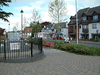
Ferndown is a town and civil parish in Dorset in southern England, immediately to the north of Bournemouth and Poole. The parish, which until 1972 was called Hampreston, includes the communities of Hampreston, Longham, Stapehill and Trickett's Cross. At the 2011 Census, the population of the parish was 26,559, making Ferndown the second largest inland town in Dorset in terms of population, after Dorchester.

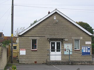
Colehill is a parish, neighbouring Wimborne Minster, in Dorset, England, with a population of 7,000 (2001), reducing slightly to 6,927 at the 2011 census.

Sixpenny Handley or Handley is a village and former civil parish, now in the parish of Sixpenny Handley and Pentridge, in north east Dorset, England, situated on Cranborne Chase ten miles (16 km) north east of Blandford Forum. In the 2011 census the parish had a population of 1,233. The civil parish was abolished on 1 April 2015 and merged with Pentridge to form Sixpenny Handley and Pentridge.
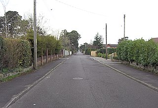
St Leonards is a village in south east Dorset, England, situated on the A31 road approximatley 2.5 miles (4.0 km) south-west of Ringwood, Hampshire, 8 miles (13 km) north of Bournemouth and 3 miles (4.8 km) north-east of Ferndown. With adjacent St Ives and Ashley Heath, it forms the civil parish of St Leonards and St Ives, which had a population of 6,859 in 2011.

Arne is a village and civil parish in Dorset, England, situated 4 miles (6.4 km) east of Wareham. The local travel links are located at Wareham railway station. Bournemouth International Airport is 11 miles (18 km) away. The main road through the village is Arne Road connecting Arne to Wareham. The village is situated on the Arne Peninsula, which protrudes into Poole Harbour opposite the town of Poole.

Hockley Heath is a large village and civil parish in the Arden area mostly within the Metropolitan Borough of Solihull, West Midlands, England, incorporating the hamlet of Nuthurst, with a history dating back to the year 705 AD as a wood owned by Worcester Cathedral. The parish, known as Nuthurst cum Hockley Heath, is to the south of the West Midlands conurbation, 12 miles (19 km) southeast of Birmingham 5.5 miles (8.9 km) from Solihull town centre and 12.5 miles (20.1 km) north of Stratford-upon-Avon. The village forms part of the border with Warwickshire and the District of Stratford-on-Avon to the south, with some parts of the village on either side of the border. According to the 2001 census, the parish had a population of 6,771, being measured at the 2011 Census as 2,038.

Newton St Loe is a small Somerset village and civil parish located close to the villages of Corston and Stanton Prior, between Bath and Bristol in England. The majority of the village is owned by the Duchy of Cornwall. The parish has a population of 681.
Fair Oak is a large village to the east of Eastleigh in Hampshire, England. Together with the village of Horton Heath, which lies to the south, it is part of the civil parish of Fair Oak and Horton Heath.

Bulford is a village and civil parish in Wiltshire, England, close to Salisbury Plain. The village is close to Durrington and about 1.5 miles (2.4 km) north of the town of Amesbury. The Bulford Camp army base is separate from the village but within the parish.

Chelwood is a small village within the civil parish of Compton Dando in Somerset, England, and is in the affluent Chew Valley in the Bath and North East Somerset council area, about 8 miles (13 km) from Bristol and Bath. The parish which includes the hamlets of West Chelwood and Breach has a population of 148. It is situated on the A368 between Marksbury and Bishop Sutton, very close to the A37.
Hinton Blewett is a village and civil parish in Somerset, England, 5 miles (8.0 km) north of Wells and 15 miles (24.1 km) south of Bristol on the northern slope of the Mendip Hills, within the designated Area of Outstanding Natural Beauty (AONB) and in the Chew Valley near the source of the River Chew. The parish has a population of 308.

Lelant is a village in west Cornwall, England, UK. It is on the west side of the Hayle Estuary, about 2+1⁄2 miles (4.0 km) southeast of St Ives and one mile (1.6 km) west of Hayle. The village is part of St Ives civil parish, the Lelant and Carbis Bay ward on Cornwall Council, and also the St Ives Parliamentary constituency. The birth, marriage, and death registration district is Penzance. Its population at the 2011 census was 3,892 The South West Coast Path, which follows the coast of south west England from Somerset to Dorset passes through Lelant, along the estuary and above Porth Kidney Sands.
Semington is a village and civil parish in Wiltshire, England. The village is about 2 miles (3 km) south of Melksham and about 3 miles (5 km) northeast of Trowbridge. The parish includes the hamlets of Little Marsh and Littleton.

Farmborough is a small village and civil parish, 6 miles (9.7 km) south west of Bath in Somerset, England. It straddles both the A39 and A368 roads. The parish has a population of 1,035.

Hutton is a village and civil parish in Somerset, England. The parish, which has a population of 2,582, is within the unitary authority of North Somerset and located on the western edge of the Mendip Hills, close to Weston-super-Mare.

Ashley Heath is a village in Dorset, England adjacent to the villages of St Leonards and St Ives. Together these make up the majority of the St Leonards and St Ives civil parish.


