Phoenix is the capital and most populous city in Arizona, with 1,680,992 people. It is also the fifth-most populous city in the United States and the largest state capital by population, and the only state capital with a population of more than one million residents.

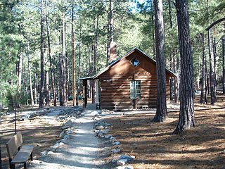
Scouting in Arizona has a long history, from the 1910s to the present day, serving thousands of youth in programs that suit the environment in which they live.

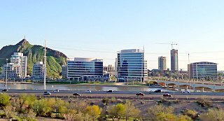
Tempe, is a city in Maricopa County, Arizona, United States, with the Census Bureau reporting a 2019 population of 195,805. The city is named after the Vale of Tempe in Greece. Tempe is located in the East Valley section of metropolitan Phoenix; it is bordered by Phoenix and Guadalupe on the west, Scottsdale and the Salt River Pima–Maricopa Indian Community on the north, Chandler on the south, and Mesa on the east. Tempe is also the location of the main campus of Arizona State University.

Lake Pleasant Regional Park is a large outdoors recreation area straddling the Maricopa and Yavapai county border northwest of Phoenix, Arizona. The park is located within the municipal boundaries of Peoria, Arizona, and serves as a major recreation hub for the northwest Phoenix metropolitan area.

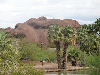
Papago Park is a municipal park of the cities of Phoenix and Tempe, Arizona, United States. It has been designated as a Phoenix Point of Pride. It includes Hunt's Tomb, which is listed on the National Register of Historic Places.

Encanto Village is one of the 15 Urban villages that make up the City of Phoenix, in Arizona. The village includes the city's midtown and uptown districts, as well as the popular Encanto neighborhood, its namesake. In 2010, Encanto had a population of 54,614 residents.
Splash Pad Park is the name of several parks containing a splash pad. The original is in Oakland, California, along Lake Park Ave, between Grand Ave and Lakeshore Ave, and north of the 580 Freeway. The Phoenix Zoo also has a Splash Pad Park at its location off Interstate 10 in Arizona between the Loop 101 and the Loop 303.

Indian School/Central Avenue is a station on the Metro light rail line in Phoenix, Arizona, United States. It is the sixth stop southbound and the twenty-third stop northbound on the initial 20 mile starter line.

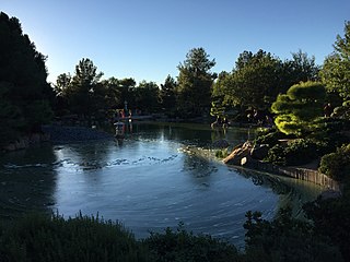
The Japanese Friendship Garden is a Japanese stroll garden located at 1125 N. 3rd Avenue in Phoenix, Arizona. The garden encompasses 3.5 acres (14,000 m2) and includes a tea garden and tea house. It is a joint project of the sister cities of Phoenix, Arizona, and Himeji, Japan. The Japanese name is Rohō-en (鷺鳳園).
Estrella is a mixed-use master-planned community located in Goodyear, Arizona, in the United States. Encompassing roughly 20,000 acres, the lakeside community is nestled in the foothills of the Sierra Estrella Mountains, in the Sonoran Desert Valley. Located approximately 17 miles west of Phoenix off the I-10 and Estrella Parkway, the community offers easy access to the Greater Metro-Phoenix area. Currently, Estrella is home to more than 40,000 residents ranging from young couples to retirees. The community hosts regular family-friendly events, provides residents with a variety of amenities and its design includes an abundance of parks, trails and open space to support a healthy, outdoor lifestyle. Estrella currently comprises three distinct communities – Mountain Ranch, Montecito and the gated, 55-Plus CantaMia.

Roper Lake State Park is a state park of Arizona, surrounding 32-acre (130,000 m2) Roper Lake. The park is located off U.S. Route 191, 5 miles (8.0 km) south of Safford, at the Gila River and Valley.

Evelyn Hallman Pond, at Evelyn Hallman Park is a small man-made lake located west of Scottsdale Road and south of McKellips Road in the northern part of Tempe, Arizona. Lying on the east side of the Cross Cut Canal it must be reached from the east.

Rio Vista Pond is located in Rio Vista Park in south central Peoria, Arizona, on Rio Vista Boulevard, just north of Thunderbird Road.

Steele Indian School Park is located on the northeast corner of Indian School Road and Central Avenue in Encanto Village, Phoenix, Arizona.

Arizona is a state in the southwestern region of the United States. It is also part of the Western and the Mountain states. It is the 6th largest and the 14th most populous of the 50 states. Its capital and largest city is Phoenix. Arizona shares the Four Corners region with Utah, Colorado, and New Mexico; its other neighboring states are Nevada and California to the west and the Mexican states of Sonora and Baja California to the south and southwest.

Salt River Fields at Talking Stick is a stadium complex located in the Salt River Pima–Maricopa Indian Community near Scottsdale, Arizona, at the former site of the Indian Bend Country Club. It serves as the Major League Baseball spring-training facility for the Arizona Diamondbacks and the Colorado Rockies, replacing Tucson Electric Park for the Diamondbacks and Hi Corbett Field for the Rockies. The complex represents the first MLB park to be built on Native American Indian land.

Phoenix Pride is a parade and festival held each year in Phoenix, Arizona to celebrate the lesbian, gay, bisexual, and transgender (LGBT) people and their allies.
Many arterial roads in the Phoenix metropolitan area have the same name in multiple cities or towns. Some roads change names or route numbers across town borders, resulting in occasional confusion. For example, the road known as Apache Boulevard in Tempe continues east as Main Street in neighboring Mesa and then as Apache Trail in Apache Junction. Although Broadway Road maintains the same name through Goodyear, Avondale, Phoenix, Tempe, Mesa, and Apache Junction, each town uses a different reference point for address numbers.

The Phoenix Indian School, or Phoenix Indian High School in its later years, was a Bureau of Indian Affairs-operated school in Encanto Village, in the heart of Phoenix, Arizona. It served lower grades also from 1891 to 1935, and then served as a high school thereafter. It opened in 1891 and closed in 1990 at the orders of the federal government. During its existence, it was the only non-reservation BIA school in Arizona.

Indian Mesa is a flat top hill whose sides are steep cliffs. Indian Mesa is located within the Lake Pleasant Regional Park grounds by the shores of Lake Pleasant and Agua Fria River in the Bradshaw Mountain Range. Lake Pleasant Regional Park is within the municipal boundaries of Peoria, Arizona. On top of the mesa there are ruins of a prehistoric Hohokam village which is monitored by the Arizona Site Stewards and considered an important archaeological site by the U.S. Bureau of Land Management. There is a small, steep and narrow path which begins at the skirt of the hill and leads to the top of the mesa.


