Stephensville, Wisconsin

Last updated
Stephensville, Wisconsin
StevensvilleWisconsinNorth.jpg
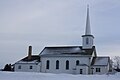
Downtown Stephensville
USA Wisconsin location map.svg
Red pog.svg
Stephensville, Wisconsin
Usa edcp location map.svg
Red pog.svg
Stephensville, Wisconsin
Coordinates: 44°22′24″N88°35′3″W / 44.37333°N 88.58417°W / 44.37333; -88.58417 Coordinates: 44°22′24″N88°35′3″W / 44.37333°N 88.58417°W / 44.37333; -88.58417
Country Flag of the United States.svg  United States
State Flag of Wisconsin.svg  Wisconsin
County Outagamie
Town Ellington
Elevation
250 m (830 ft)
Time zone UTC-6 (Central (CST))
  Summer (DST) UTC-5 (CDT)

Stephensville is a small unincorporated community located entirely within the town of Ellington in west-central Outagamie County, Wisconsin, United States. Stephensville is classified as a Class U6 Community by the USGS, being a populated place located wholly or substantially outside the boundaries of any incorporated place or CDP with a recognized authoritative common name.

Contents

Stephensville is located 4 miles northeast of Hortonville, 7 miles northwest of Greenville, 5 miles south of Shiocton and 15 miles northwest of Appleton.

Bear Creek passes through the community just east of its mouth with the Wolf River.

Mail is delivered by the Hortonville post office.

Geography

Stephensville is located at 44°22′24″N88°35′3″W / 44.37333°N 88.58417°W / 44.37333; -88.58417 (44.3733170, -88.5842708), and the elevation is 804 feet (245 m). [1]

Education

Stephensville is located within the Hortonville Area School District.

Transportation

Stephensville is located on Wisconsin Highway 76. Outagamie County Highways S & MM also enter the community. Because of its scenic nature, Outagamie County Highway MM has been classified as a Rustic Road (Route 61) from Stephensville to Hortonville. [2]

Worship

Saint Patrick Catholic Church and Saint Paul Evangelical Lutheran Church are located within the community.

Images

Related Research Articles

<span class="mw-page-title-main">Winnebago County, Wisconsin</span> County in Wisconsin, United States

Winnebago County is a county in the U.S. state of Wisconsin. As of the 2020 census, the population was 171,730. Its county seat is Oshkosh. It was named for the historic Winnebago people, a federally recognized Native American tribe now known as the Ho-Chunk Nation. Chief Oshkosh was a Menominee leader in the area. Winnebago County comprises the Oshkosh-Neenah, WI Metropolitan Statistical Area, which is included in the Appleton-Oshkosh-Neenah, WI Combined Statistical Area.

<span class="mw-page-title-main">Shawano County, Wisconsin</span> U.S. county in Wisconsin

Shawano County is a county located in the U.S. state of Wisconsin. As of the 2020 census, the population was 40,881. Its county seat is Shawano.

<span class="mw-page-title-main">Outagamie County, Wisconsin</span> County in Wisconsin, United States

Outagamie County is a county in the northeast region of the U.S. state of Wisconsin. As of the 2020 census, the population was 190,705. Its county seat is Appleton.

<span class="mw-page-title-main">Calumet County, Wisconsin</span> County in Wisconsin, United States

Calumet County is a county located in the U.S. state of Wisconsin. As of the 2020 census, the population was 52,442. The county seat is Chilton. The county was created in 1836 and organized in 1850.

<span class="mw-page-title-main">Freedom, Outagamie County, Wisconsin</span> Town in Wisconsin, United States

Freedom is a town in Outagamie County, Wisconsin, United States. The population was 6,200 at the 2020 census. The unincorporated communities of Freedom and Murphy Corner are located in the town and the unincorporated community of Five Corners is located partially within the town.

<span class="mw-page-title-main">Greenville, Wisconsin</span> Village in Wisconsin, United States

Greenville is a village in Outagamie County, Wisconsin. It is one of 18 communities that form the basis of the Fox Cities, the third largest metropolitan area in Wisconsin. The population was 12,619 in 2020.

<span class="mw-page-title-main">Hortonville, Wisconsin</span> Village in Wisconsin, United States

Hortonville is a village in Outagamie County, Wisconsin, United States. The population was 2,711 at the 2010 census.

<span class="mw-page-title-main">Shiocton, Wisconsin</span> Village in Wisconsin, United States

Shiocton is a village in Outagamie County, Wisconsin, United States. The population was 921 at the 2010 census. It is wholly surrounded by the Town of Bovina.

<span class="mw-page-title-main">Howard, Wisconsin</span> Village in Wisconsin, United States

Howard is a village in Brown and Outagamie counties in the U.S. state of Wisconsin. The population was 17,399 at the 2010 census. All of this population resided in the Brown County portion of the village. It is part of the Green Bay Metropolitan Statistical Area.

<span class="mw-page-title-main">Oneida, Wisconsin</span> Unincorporated community in Wisconsin, United States

Oneida is an unincorporated community and former census-designated place (CDP) in the Town of Oneida, Outagamie County, Wisconsin, United States. The population was 1,070 at the 2000 census. At the census, part of the CDP lay within the Town of Hobart, which has since incorporated as a village, in adjacent Brown County. Oneida is located on Wisconsin Highway 54.

<span class="mw-page-title-main">Black Creek, Wisconsin</span> Village in Wisconsin, United States

Black Creek is a village in north-central Outagamie County, Wisconsin, United States. The population was 1,357 at the 2020 census. The village is located within the Town of Black Creek, but is governed independently. Origins of the community trace back to 1862 when it was settled by American Civil War veteran, Thomas J. Burdick and his son, Abraham. Initially, the village had been referred to as Middleburg, due to its geographical proximity to Green Bay, Shawano, and Appleton. However, the name was later changed to reflect the dark-colored creek along the outskirts of the community following village incorporation in 1904. Today, Black Creek hosts a variety of community events including the annual Family Daze celebration.

The Fox Cities of Northeastern Wisconsin are the cities, towns and villages along the Fox River as it flows from Lake Winnebago northward into Green Bay.

<span class="mw-page-title-main">Wisconsin Highway 15</span>

State Trunk Highway 15 is a 14.8-mile (23.8 km)state highway in Outagamie County in the US state of Wisconsin that runs east–west and provides a shortcut to Appleton from U.S. Highway 45 (US 45) for travelers inbound from points north and west. Most of WIS 15 was once part of US 45, which was redirected south of New London to bypass Appleton and provide direct access to Oshkosh and points south.

<span class="mw-page-title-main">Isaar, Wisconsin</span> Unincorporated community in Wisconsin, United States

Isaar is a small unincorporated community in the Town of Seymour in Outagamie County, the United States, about 10 miles from Green Bay. Isaar has the same zip code as the City of Seymour and its schools are part of the Seymour Community School District.

<span class="mw-page-title-main">Center Valley, Wisconsin</span> Unincorporated community in Wisconsin, United States

Center Valley is a small unincorporated farming community in the town of Center in Outagamie County, Wisconsin, United States. Center Valley lies 5 miles (8.0 km) north of the City of Appleton, and is served by the post office of Black Creek, which has the ZIP code 54106.

Sugar Bush is an unincorporated community located entirely within the town of Maple Creek in northwest Outagamie County, Wisconsin, United States. Sugar Bush is classified as a Class U6 Community by the USGS, being a populated place located wholly or substantially outside the boundaries of any incorporated place or CDP with a recognized authoritative common name.

<span class="mw-page-title-main">Medina, Outagamie County, Wisconsin</span> Unincorporated community in Wisconsin, United States

Medina, originally Young's Corner, is an unincorporated community in the Town of Dale in southwest Outagamie County, Wisconsin, United States. It is located 3.5 miles (5.6 km) south of the village of Hortonville, 11 miles (18 km) west of Appleton, and 20 miles (32 km) northwest of Oshkosh.

<span class="mw-page-title-main">Wiouwash State Trail</span>

The Wiouwash State Trail is a rail trail in northeastern Wisconsin. Its name is derived from the first two letters of the four counties it traverses: Winnebago, Outagamie, Waupaca, and Shawano. The trail's Tribal Heritage Crossing of Lake Butte des Morts is a nationally designated recreation trail. The trail is used by walkers, hikers, bikers, horseback riders, and snowmobilers during the winter months. Two sections of the trail are complete: 24 miles from Aniwa south to Split Rock and 21 miles from Hortonville south to Oshkosh.

<span class="mw-page-title-main">Leeman, Wisconsin</span> Unincorporated community in Wisconsin, United States

Leeman is a small unincorporated community located in the Town of Maine in northern Outagamie County, Wisconsin, United States. It is two miles west of Nichols and one mile south of Shawano County. The Wolf River runs through the community. Postal service is provided by the Shiocton post office, ZIP code 54170.

Freedom is an unincorporated community located in the town of Freedom, Outagamie County, Wisconsin, United States. Freedom is located along Wisconsin Highway 55 7.5 miles (12.1 km) north of Kaukauna. Freedom has a post office, located in Kaukauna, which uses ZIP code 54131.

References

  1. "Stephensville". Geographic Names Information System . United States Geological Survey, United States Department of the Interior.
  2. Wisconsin Rustic Road #61