Vilshofen an der Donau is a town in the German district of Passau.

Aichach is a town in Germany, located in the Bundesland of Bavaria and situated just northeast of Augsburg. It is the capital of the district of Aichach-Friedberg. The municipality of Aichach counts some 20,000 inhabitants. It is not far from the motorway that connects Munich and Stuttgart, the A8. The local river is called Paar. A prison for women Bavaria was established in Aichach in 1909.

Schwanstetten is a municipality in the district of Roth, in Bavaria, Germany. Schwanstetten is located 15 km south of Nuremberg.

Erbendorf is a town in the Upper Palatinate (Oberpfalz) region of Germany. As of December, 2006, the town has a population of 5,341.

Kirchlauter is a municipality in the Bavarian Administrative Region of Lower Franconia in the district of Haßberge in Germany. It is a part of the Verwaltungsgemeinde of Ebelsbach.

Oberasbach is a municipality in the district of Fürth, in Bavaria, Germany. It is situated 6 km southwest of Fürth, and 10 km west of Nuremberg (centre).

Stadtbergen is a town in the district of Augsburg, in Bavaria, Germany. It is situated in the outskirts of Augsburg, 4 kilometres (2.5 mi) west of Augsburg city centre. Stadtbergen was granted town privileges in May 2007.

Gaimersheim is a municipality in the district of Eichstätt, in Bavaria, Germany. It is situated 7 km northwest of Ingolstadt.

Parsberg is a town in the county of Neumarkt in Bavaria, Germany. It is 23 km southeast of Neumarkt in der Oberpfalz, and 33 km northwest of Regensburg, next to the A3 autobahn, the main route from Nuremberg to Regensburg. It was formerly the seat of the Counts of Parsberg, whose coat of arms is now used by the town.

Zusmarshausen is a municipality in the district of Augsburg, Bavaria, Germany. The 1648 Battle of Zusmarshausen took place here.

Neuendettelsau is a local authority in Middle Franconia, Germany. Neuendettelsau is situated 20 miles southwest of Nuremberg and 12 miles east of Ansbach. Since 1947 it has a Lutheran seminary.

Ensdorf is a municipality in the district of Amberg-Sulzbach in Bavaria in Germany.

Hahnbach is a municipality in the district of Amberg-Sulzbach in Bavaria in Germany. There are living at the moment about 5000 people. The most important districts are: Fronbergsiedlung, Friedhofsiedlung, Süd 3, Markt. About 2000 of the 5000 people are not living in Hahnbach by itself, they are living in villages like Dürnsricht or Iber, which are in the area of Hahnbach. SSince 2014, the Mayor of Hahnbach is Bernhard Lindner (CSU). The CSU is the most popular party in Hahnbach, at the last election they got more than 75% of the votes, at place two was the SPD with at least 20% of the votes. The most important objects of interest are the Amberger Tor and the Fahrraddenkmal, which shows a biker holding his bike. The church in Hahnbach is called St. Jakobus Church. The sports team is called SV Hahnbach.

Grub am Forst is a municipality in the district of Coburg in Bavaria in Germany. It has ca 3,100 residents. The nearest large town is Coburg. The following villages are part of it:

Böhmfeld is a municipality in the district of Eichstätt in Bavaria in Germany.

Lenting is a municipality in the district of Eichstätt in Bavaria in Germany.

Spardorf is a small town in the district of Erlangen-Höchstadt, in Bavaria, Germany.

Vorra is a municipality in the district of Nürnberger Land in Bavaria in Germany.

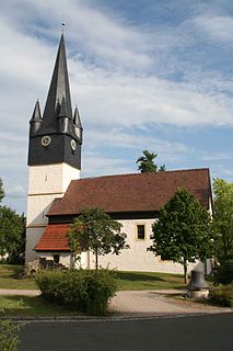
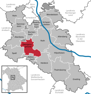
Georgensgmünd is a municipality in the district of Roth, in Bavaria, Germany.

Alerheim is a municipality in the district of Donau-Ries in Bavaria in Germany.


