Sublette County is a county in the U.S. state of Wyoming. As of the 2010 United States Census, the population was 10,247. The county seat is Pinedale. It is a sparsely populated rural county in western Wyoming, along the Green River.

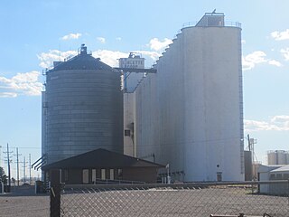
Sublette is a city in and the county seat of Haskell County, Kansas, United States. As of the 2010 census, the city population was 1,453.

U.S. Route 160 is a 1,465 mile (2,358 km) long east–west United States highway in the Midwestern and Western United States. The western terminus of the route is at US 89 five miles (8 km) west of Tuba City, Arizona. The eastern terminus is at US 67 and Missouri 158 southwest of Poplar Bluff, Missouri.

The Green River, located in the western United States, is the chief tributary of the Colorado River. The watershed of the river, known as the Green River Basin, covers parts of Wyoming, Utah, and Colorado. The Green River is 730 miles (1,170 km) long, beginning in the Wind River Mountains of Wyoming and flowing through Wyoming and Utah for most of its course, except for 40 miles (64 km) into western Colorado. Much of the route is through the Colorado Plateau and through some of the most spectacular canyons in the United States. It is only slightly smaller than the Colorado when the two rivers merge, but typically carries a larger load of silt. The average yearly mean flow of the river at Green River, Utah is 6,121 cubic feet (173.3 m3) per second.

The Big Sandy River is a 141-mile-long (227 km) tributary of the Green River in Wyoming in the United States.

Gannett Peak is the highest mountain peak in the U.S. state of Wyoming at 13,810 feet (4,210 m). It lies in the Wind River Range within the Bridger Wilderness of the Bridger-Teton National Forest. Straddling the Continental Divide along the boundary between Fremont and Sublette counties, it has the second greatest topographic prominence in the state (7076') after Cloud Peak (7077'), and is the highest ground for 290 miles in any direction.

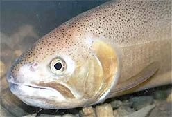
The Gila trout is a species of salmonid, related to the rainbow, native to the Southwest United States. Prior to 2006 the Gila trout was federally listed as endangered. In July 2006, after much work by the Game and Fish departments in New Mexico and Arizona, the US Forest Service and the US Fish and Wildlife Service, the Gila trout was down-listed to threatened, with a special provision called a "4d rule" that will allow limited sport fishing – for the first time in nearly half a century. This possibility is distinct: there may be no one alive today that has legally angled a pure Gila trout from its native waters. By the time the Gila trout was closed to fishing in the 1950s, its numbers and range were so depleted and so reduced this copper-colored trout simply wasn’t very accessible to anglers. As of 2011 there is fishing in both states for this fish.

The Cumbres & Toltec Scenic Railroad (C&TS) is a 3 ft narrow-gauge heritage railroad running for 64 miles (103 km) between Antonito, Colorado and Chama, New Mexico, United States. The railroad gets its name from two geographical features along the route, the 10,015-foot (3,053 m)-high Cumbres Pass and the Toltec Gorge. Originally part of the Denver and Rio Grande Western Railroad's narrow-gauge network, the line has been jointly owned by the states of Colorado and New Mexico since 1970.

Ned Sublette is an American composer, musician, record producer, musicologist, and author. Sublette studied Spanish Classical Guitar with Hector Garcia at the University of New Mexico and with Emilio Pujol in Spain. He studied composition with Kenneth Gaburo at the University of California, San Diego. He grew up in Portales, New Mexico, moved to New York City in 1976, and has worked with John Cage, LaMonte Young, Glenn Branca, and Peter Gordon.

William Lewis Sublette, also spelled Sublett, was an American frontiersman, trapper, fur trader, explorer, and mountain man. With his four brothers, after 1823 he became an agent of the Rocky Mountain Fur Company. Later he became one of the company's co-owners, exploiting the riches of the Oregon Country. He helped settle and improve the best routes for migrants along the Oregon Trail.
Osier is a populated place in Conejos County, Colorado, USA. It is an old railroad settlement and train stop approximately halfway along the Cumbres and Toltec Scenic Railroad where trains from both ends of the line meet and stop for lunch, making it possible for passengers to either continue in the same direction or return to their point of origin afterwards.

Fort Vasquez is a former fur trading post 35 miles (56 km) northeast of Denver, Colorado, United States, founded by Louis Vasquez and Andrew Sublette in 1835. Restored by the Works Progress Administration in the 1930s, it now lies in a rather incongruous position as U.S. Route 85 splits to run either side of the building. History Colorado took possession of the property in 1958 and runs it as a museum to display exhibits of the fur-trade era.

The Parting of the Ways is an historic site in Sweetwater County, Wyoming, United States, where the Oregon and California Trails fork from the original route to Fort Bridger to an alternative route, the Sublette-Greenwood Cutoff, across the Little Colorado Desert. Many wagon trains parted company, some preferring the shorter cutoff route, which involved fifty waterless miles, to the longer but better-watered main route.

Catostomus latipinnis is a North American fish identified by its enlarged lower lips. It belongs to the genus Catostomus, commonly known as suckers. Historically, the flannelmouth sucker ranged in the Colorado River Basin, including parts of Wyoming, Utah, Colorado, New Mexico, Nevada, California, and Arizona; however, this species has been entirely extirpated from the Gila River Basin in Arizona.
Sublette is a railroad town in northern Rio Arriba County, New Mexico, built as a section station in 1880. It is located north-east of Chama, just south of the Colorado state line and at milepost 306.1 of the former Denver and Rio Grande Western Railroad. When the Denver & Rio Grande Western Railroad abandoned its narrow gauge lines in the late 1960s, two parts of the system were preserved independently: the Cumbres & Toltec Scenic Railroad from Antonito to Chama, including Sublette itself, and the Durango and Silverton Narrow Gauge Railroad. Sublette sits at an elevation of 9,281 feet in the southeastern San Juan Mountains.
Gunsight Pass may be one of the following:

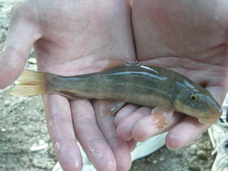
The desert sucker or Gila Mountain sucker, is a freshwater species of ray-finned fish in the sucker family, endemic to the Great Basin and the Colorado River Basin in the United States. It inhabits rapids and fast-flowing streams with gravelly bottoms. It is a bi-colored fish with the upper parts olive brown to dark green, and the underparts silvery-tan or yellowish. The head is cylindrical, tapering to a thick-lipped mouth on the underside. This fish can grow to 31 in (79 cm) in Arizona but is generally only about half this size elsewhere. There are three subspecies, found in different river basins, and some authorities allot this species its own genus Pantosteus.

The Philip L. Boyd Deep Canyon Desert Research Center is one of the original seven of the total 39 sites in the University of California Natural Reserve System. It contains lands originally donated to the University by regent Philip L. Boyd in 1958. The Research Center is contained within UNESCO's Mojave and Colorado Deserts Biosphere Reserve.

Sublette Mountain is a mountain summit in Lincoln County, Wyoming, 9,291 feet (2,832 m) in elevation. It is the tallest peak of the Sublette Mountains, which are part of the Southern Wyoming Overthrust Belt. Sublette Mountain is near the Bear Lake County, Idaho, border.


