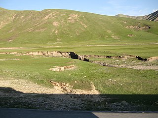
Zhongar-Alatau National Park, also Jungar Alatau, or Dzungurian Alatau, was created in 2010 to protect the unique ecology of the Dzungarian Alatau, an isolated, glaciated mountain range in Kazakhstan, on the southeastern border with China. One stated reason for creating the park is to protect forests of wild fruit trees, including apricots, barberry, cherries, and currants. Approximately 1% of the land area of the park is forested with Sievers Apple trees, which are the progenitors of all cultured apple varieties in the world. The park is 300 km long (west-to-east), and spreads across Aksu District, Sarkand District and Alakol District of Almaty Region, 300 km northeast of the regional city of Almaty.

The Southeast Tibet shrub and meadows are a montane grassland ecoregion that cover the southeast and eastern parts of the Tibetan Plateau in China. The meadows in this region of Tibet are in the path of the monsoon rains and are wetter than the other upland areas of the Tibetan Plateau. The "high cold" alpine terrain is one of high species diversity, due to the relatively high levels of precipitation for the region. Precipitation is lower in the northwest, and hence the vegetation thins from shrub to meadow or even desert.

The Changbai Mountains mixed forests ecoregion covers the Changbai Mountains and surrounding foothills in China and North Korea. The region features extensive and naturally preserved deciduous and conifer forests. The region exhibits high biodiversity due to its relative isolation, temperate climate with high rainfall, and centrality to central Chinese, Siberian, and European floral communities. In 1979, a significant portion of the ecoregion was designated the Changbaishan Biosphere Reserve by UNESCO.

The Central Tibetan Plateau alpine steppe ecoregion covers the high alpine plateau that stretches over 1,600 kilometres (1,000 mi) across the Tibetan Plateau to Qinghai Lake in China. Because of the high altitude—much it over 5,000 metres (16,000 ft)—the region is a cold, arid desert that is only 20% covered with steppe and meadow vegetation. The area has been relatively free from human development due to the hostile climate and unsuitability for agriculture. The ecosystem is relatively intact, and supports herds of wild antelope, sheep, deer, and gazelles.

The Hainan Island monsoon rain forests ecoregion covers mountainous interior of Hainan Island in China. The tropical forests receive over 1,000 mm/year of rain, heavily concentrated in the summer rainy season. The island has high levels of biodiversity, with over 4,200 plant species, 630 of which are endemic to the island. The region is under ecological pressure from deforestation for agriculture and timber extraction.

The Qin Ling Mountains deciduous forests ecoregion covers the Qin Mountains, which run west-to-east across central China. The mountains effectively divide the biological regions of China into north and south. To the north is the Yellow River basin, a loess-soil region of temperate deciduous forests. To the south is the Yangtze River basic, a subtropical forest region. In between, the Qin Mountains support many rare and endemic species, including the Giant panda and the Sichuan snub-nosed monkey.

The Khangai Mountains alpine meadows ecoregion runs along the central ridge of the Khangai Mountains in central Mongolia. The slopes to the north are conifer forests, the lowlands to the south are semi-arid steppe. The Khangai are an "island" mountain range surrounded by lower forest steppe and semi-arid regions of central Mongolia. Most of the region is now protected by Tarvagatai Nuruu National Park and Khangai Nuruu National Park.

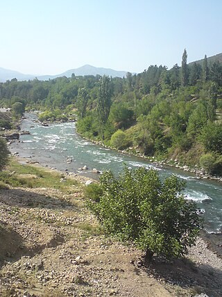
The Gissaro-Alai open woodlands ecoregion covers the western foothills winding around two western offshoots of the Tian Shan Mountains in western Tajikistan, and parts of eastern Uzbekistan and western Kyrgyzstan, in Central Asia. The woodlands are typically of Juniper trees and shrubs, fitting the altitude zone situated between the desert valley floor, and the tree line, above which the mountain ridges are glaciated and barren.

The Sumatran montane rain forests ecoregion covers the mountainous elevations of the Barisan Mountains Range that runs the length of the southwestern side of the island of Sumatra in Indonesia. The ecoregion is almost completely surrounded by the lower elevation Sumatran lowland rain forests. The area is one of very high biodiversity - because of the relative isolation, and variety of forest types, there are 7 endemic species of mammals and eight endemic species of birds.

The Mindanao montane rain forests ecoregion covers the montane forests - the zone between the lowland forest and the treeline - in the mountains on the island of Mindanao in the Philippines. Because the ecoregion covers only elevations above 1,000 metres (3,300 ft), it exists in seven discontinuous patches surrounded by lowland rainforest. Biodiversity is high, both because of the isolation of separate mountain ranges that have led to species variation within the island, and because of the altitude zonation. Because most of the surrounding lowland forest has been cleared for human use, the montane regions have become an important refuge for rare and endemic species.

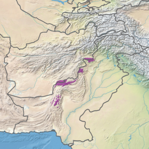
The East Afghan montane conifer forests ecoregion covers a series of unconnected conifer forests along the border between Afghanistan and Pakistan, at elevations of 2,000 metres (6,600 ft) to 3,400 metres (11,200 ft) above sea level. The ecoregion supports the near-threatened Markhor (Capra falconeri chiltanensis), known as the Screw-horned goat, the national animal of Pakistan. The forests of the ecoregion have been heavily thinned for timber.

The Afghan Mountains semi-desert ecoregion covers three disconnected interior valleys in the north of the mountains of Afghanistan. These valleys are arid, and covered mostly in thorny shrubs. Overgrazing by livestock has put pressure on the grasses and the wild animals dependent on them.

The Ghorat-Hazarajat alpine meadow ecoregion covers the high mountainous elevations of central Afghanistan. The ecoregion fans out to the west from the capital city of Kabul at the eastern point. Vegetation is thornbush meadows and alpine grassland. The region is the home of the critically endangered Afghan brook salamander, which depends on the cold waters of the high streams of the ecoregion.

The Kuh Rud and Eastern Iran montane woodlands ecoregion covers hills and mountains in central and eastern Iran. The habitat is wetter and cooler than the surrounding desert of the Iranian Plateau, supporting the vulnerable goitered gazelle and small populations of the cheetah. The ecoregion is under conservation threat from overgrazing and conversion of steep slopes to cultivation.

The Hindu Kush alpine meadow ecoregion covers a portion of the Hindu Kush Mountain Range in northern Afghanistan. Most of the terrain is between 3,000 and 4,000 meters in elevation. This portion of the Hindu Kush is very mountainous, with steep slopes. About half of the alpine meadow is bare rock or gravely soils with sparse vegetation. The remainder supports herbaceous cover of grasses and cushion plants. Human habitation is scarce and follows the river courses in the valleys.

The Central Afghan Mountains xeric woodlands ecoregion covers the xeric (dry) eastern and southern slopes of the central mountain range of Afghanistan, between the sandy desert to the south and the alpine meadows in the higher, wetter region to the north. Despite the 'woodlands' in the ecoregion name, very little of the territory is forested – less than 1% – but is instead sparse vegetation or herbaceous cover.

The Paropamisus xeric woodlands ecoregion covers the portion of northeastern Afghanistan north of the central mountain range and the Hindu Kush Mountains. The name is derived from the Old Persian name for the region, Parupraesanna. While there are low canopy woodlands in the northeast of the ecorgegion, most of the territory is desert or xeric (dry) scrubland.

The Baluchistan xeric woodlands ecoregion covers the middle elevations of a series of mountain ranges of western Pakistan and northeastern Afghanistan, reaching 1,200 kilometres (750 mi) from the Arabian Sea in the south to the Hindu Kush Mountains and the Himalayas in the north. The characteristic vegetation is xeric (dry) woodlands of shrubs and herbaceous cover. The region has rich biodiversity but relatively few endemic species.

The Interior Yukon-Alaska alpine tundra ecoregion covers alpine, sub-alpine, and boreal forest areas along the cordillera of Interior Alaska and south-central Yukon Territory. Geologically, they are the disjunct uplands of the Yukon-Tanana Terrane plus a southern extension of the Brooks Range. The cover is extensive 'dark taiga' of closed spruce forest, open forest of other species, and alpine vegetation at higher altitudes. The region is mostly wilderness and relatively untouched by human development.

The Ogilvie–MacKenzie alpine tundra ecoregion covers the mountainous middle of the Yukon Territory in Canada, with extensions into the Northwest Territories. The vegetation is alpine and subalpine open forest of stunted spruce, fir and pine. The area is rugged but sections appear to have been unglaciated in the late Pleistocene and there are therefore relic species in the region. The area is remote and supports large, sustainable predator-prey systems.


