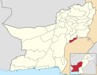
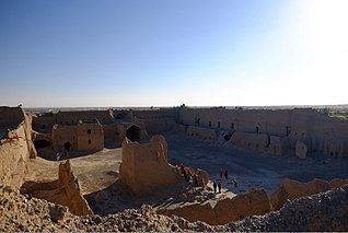
Chaghi District, also known as Chaghi District, is the largest district of Pakistan by area, located in the northwestern corner of the Balochistan province of Pakistan. District shares the border with two countries: Afghanistan and Iran.
Quetta is a district in the northwestern part of the Balochistan province of Pakistan. According to 2023 Pakistani census population of Quetta District is 2,272,290.

Loralai District is a district in the northeast of Balochistan province of Pakistan. The town of Loralai serves as the district headquarters.

Nasirabad is a district of Nasirabad Division in Balochistan, Pakistan. The District was notified in 1974 by separating from Kalat District. For three years, it was called Tamboo District from July 1987 to December 1990, The district's headquarters are located at Dera Murad Jamali. According to 2023 Pakistani census population of Nasirabad District is 565,315.

Awaran District, is a district in the southern part of the Balochistan province of Pakistan in Kalat division.

Kachhi or Kacchi, previously known until 2008 as Bolan District, is a district located in the central part of the Balochistan province in Pakistan. The Bolan area remained under one district Kacchi until 31 December 1991. The Deputy Commissioner's office started functioning on 17 May 1992, and Bolan became one of the four districts of Naseerabad Division, until the abolition of Divisions in 2000.
Jafarabad, district lies in the southeastern part of Pakistan's province of Balochistan. Dera Allah Yar, also known as Jhatpat among locals, serves as the district headquarters. Jaffarabad District is sub-divided into two tehsils. According to 2023 Pakistani census Jafarabad district has a population of 594,558.

Jhal Magsi District is a district in the central part of the Balochistan province in Pakistan. It is purely Baloch area previously part of Kachhi District, it was established as a district of its own in December 1991 and after a brief period in which it was known as Kachhi, its name was changed to Jhal Magsi in May 1992. The district is named after the town of Jhal, seat of the Magsi tribe.

Khuzdar is a district in the Balochistan province of Pakistan. The city of Khuzdar serves as the district's headquarters.
Mastung District is a district located in the northwest of Balochistan province, Pakistan. Prior to its creation as a separate district in 1991, Mastung was part of Kalat District.
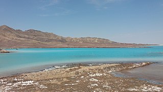
Kharan district is a district in the Balochistan province of Pakistan.

Nushki District is one of the districts of Balochistan province, Pakistan. The administration of the Nushki district was taken over from the Khan of Kalat by the British government in 1896 and was leased from him on a perpetual quit rent in 1899.
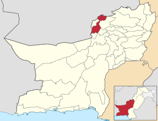
Kila Abdullah District or Qilla Abdullah is a district in the northwestern part of Balochistan province of Pakistan.
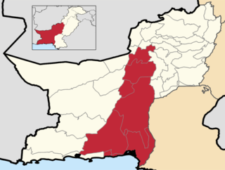
Kalat Division or Qalat Division is an administrative division of Balochistan Province of Pakistan. Its capital city is Khuzdar founded on 14 October 1955. CNIC Code of Kalat Division is 51. According to 2023 Pakistani census population of Kalat Division is 2,719,964.
Hub District, is a coastal administrative district and located at southern part of Balochistan Province of Pakistan. The district was created after bifurcation of Lasbela District in 2022.

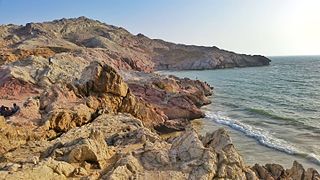
Lasbela District is a coastal district in Kalat Division of Balochistan,Pakistan.
Duki is a district in the Balochistan province of Pakistan.

Kila Saifullah District, Qilla Saifullah, or Saifullah Killa is a district in northwestern Balochistan province, Pakistan. It was established as a district in 1988, comprising two former administrative units of Zhob District: the Upper Zhob sub division and the sub tehsil of Badinai, previously named Kashatoo and part of the sub-district of Kakar Khurasan.

Washuk District is a district in Balochistan province of Pakistan. The town of Washuk, which serves as the district headquarters, is located in the center of the district.

Surab District is a district located in Kalat Division of Balochistan province, Pakistan. Prior to its creation as a separate district in 2017, Surab was part of Kalat District.

