Chaman District ضلع چمن | |
---|---|
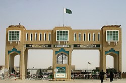
![]() Pakistan-Afghanistan Friendship Gate | |
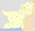
![]() Map of Balochistan with Chaman District highlighted in maroon | |
Country | ![]() |
Province | ![]() |
Divisions | Quetta |
Established | 2021 |
Headquarters | Chaman |
Government | |
• Type | District Administration |
• Deputy Commissioner | N/A |
• District Chairman | Haji Amanullah (JUI(F)) |
• District Vice Chairman | Majeed Khan Achakzai (BAP) |
Area | |
1,341 km2 (518 sq mi) | |
Population | |
466,218 | |
• Density | 350/km2 (900/sq mi) |
• Urban | 130,139 (27.91%) |
• Rural | 336,079 (72.09%) |
Literacy | |
• Literacy rate |
|
Time zone | UTC+5 (PKT) |
Chaman District [a] is located in the northwest of Balochistan, Pakistan. [2] [3] Chaman District was created after the bifurcation of Qila Abdullah District in 2021. [3] [4]
It contains the following Tehsils: [3] [4]
Tehsil | Area (km²) [5] | Pop. (2023) | Density (ppl/km²) (2023) | Literacy rate (2023) [6] | Union Councils |
---|---|---|---|---|---|
Chaman Tehsil | 22 | 130,139 | 5,915.41 | 51.36% | ... |
Chaman Saddar Tehsil | 1,319 | 336,079 | 254.80 | 35.18% | ... |
Year | Pop. | ±% p.a. |
---|---|---|
1961 | 26,087 | — |
1972 | 47,692 | +5.64% |
1981 | 68,848 | +4.16% |
1998 | 151,854 | +4.76% |
2017 | 434,561 | +5.69% |
2023 | 466,218 | +1.18% |
Sources: [7] |
As of the 2023 census, Chaman district has 61,915 households and a population of 466,218. The district has a sex ratio of 127.40 males to 100 females and a literacy rate of 39.97%: 47.73% for males and 30.60% for females. [8] [9] 182,044 (39.05% of the surveyed population) are under 10 years of age. [10] 130,139 (27.91%) live in urban areas. [8] 1,654 (0.35% of the surveyed population) are religious minorities, mainly Christians and some Hindus. [11] Pashto is the predominant language, spoken by 99.37% of the population. [12]