Loralai Division | |
---|---|
Country | Pakistan |
Province | Balochistan |
Capital | Loralai |
Established | 2021 |
Government | |
• Type | Divisional Administration |
• Commissioner | N/A |
• Regional Police Officer | N/A |
Population (2023) | |
870,000 | |
• Urban | 11.45% |
• Rural | 88.55% |
Ethnicities | |
• People | |
Literacy | |
• Literacy rate |
|
Website | loralai |
Loralai Division is an administrative division of Balochistan Province, Pakistan. [3] It was bifurcated from Zhob division in 2021. [4] The division consists of Barkhan, Loralai, Musakhail and Duki districts. CNIC code of Loralai Division is 56.
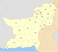
According to the 2023 census, Loralai Division had a population of 870,000. [5]
# | District [6] | Headquater | Area (km²) [7] | Pop. (2023) | Density (ppl/km²) (2023) | Lit. rate (2023) |
---|---|---|---|---|---|---|
1 | Barkhan | Barkhan | 3,514 | 210,249 | 59.8 | 33.62% |
2 | Duki | Duki | 4,233 | 205,044 | 48.4 | 44.18% |
3 | Musakhel | Musa Khel Bazar | 5,728 | 182,275 | 31.8 | 36.60% |
4 | Loralai | Loralai | 3,785 | 272,432 | 72.0 | 43.16% |
# | Tehsil | Area (km²) [8] | Population (2023) | Density (ppl/km²) (2023) | Literacy rate (2023) | Districts |
---|---|---|---|---|---|---|
1 | Barkhan Tehsil | 3,514 | 210,249 | 59.83 | Barkhan | |
2 | Duki Tehsil | 938 | 137,294 | 146.37 | Duki | |
3 | Bori Tehsil | 2,203 | 225,642 | 102.42 | Loralai | |
4 | Mekhtar Tehsil | 1,582 | 46,790 | 29.58 | ||
5 | Darug Tehsil | 301 | 21,792 | 72.40 | Musakhel | |
6 | Kingri Tehseel | 3,683 | 33,618 | 9.13 | ||
7 | Musakhel Tehsil | 658 | 49,809 | 75.70 | ||
8 | Toisar Tehsil | 539 | 56,818 | 105.41 |
# | Provincial Assembly Constituency | National Assembly Constituency | District |
---|---|---|---|
1 | PB-4 Musakhel-cum-Barkhan | NA-252 Musakhel-cum-Barkhan-cum-Loralai-cum-Duki | Musakhel |
Barkhan | |||
2 | PB-5 Loralai | Loralai | |
3 | PB-6 Duki | Duki |
The districts of Pakistan are the third-level administrative divisions of Pakistan, below provinces and divisions, but forming the first-tier of local government. In total, there are 166 districts in Pakistan, including the Capital Territory, and the districts of Azad Kashmir and Gilgit-Baltistan. These districts are further divided into tehsils and union councils.
Loralai District is a district in the northeast of Balochistan province of Pakistan. The town of Loralai serves as the district headquarters.
Awaran District, is a district in the southern part of the Balochistan province of Pakistan in Kalat division.
Kech District is a district in the Balochistan province of Pakistan. This district's old name was Turbat District which was changed to its even older name Kech District in 1994-1995.
Kohlu district is a district of the Balochistan province of Pakistan. It is bounded in the north by Loralai District, with Dera Bugti in the south, Barkhan in the east, and Sibi District in the west.
Musakhel (Urdu: ضلع موسیخیل) is a district in the northeast of the Balochistan province of Pakistan. It became a separate district in 1992, prior to which it was a tehsil within Loralai District. Musakhel District is now part of Loralai Division, which was created after splitting Zhob Division.
Nushki District is one of the districts of Balochistan province, Pakistan. The administration of the Nushki district was taken over from the Khan of Kalat by the British government in 1896 and was leased from him on a perpetual quit rent in 1899.
Kalat Division or Qalat Division is an administrative division of Balochistan Province of Pakistan. Its capital city is Khuzdar founded on 14 October 1955. CNIC Code of Kalat Division is 51. According to 2023 Pakistani census population of Kalat Division is 2,719,964.
Makran Division is an administrative division of Balochistan Province, Pakistan. It is the eastern component of the larger Makran region shared between Pakistan and Iran, located in southern Balochistan along the Gulf of Oman coast. CNIC Code of Makran Division is 52.
Naseerabad Division is an administrative division of Balochistan Province, Pakistan. It is the only Irrigation & Agricultural Division of Balochistan. The division connects Balochistan with Sindh. Naseerabad division was created by bifurcation of Sibi division in 1987. Its Divisional headquarters are at Dera Murad Jamali. CNIC Code of Naseerabad Division is 53. According to 2023 Pakistani census population of Nasirabad Division is 2,044,021.
Quetta Division is an administrative division of Balochistan Province, Pakistan, being the third tier of government. CNIC Code of Quetta Division is 54.
Sibi Division is a division of Balochistan province of Pakistan. It contains the following districts: This department was established in 1974 in this state. CNIC Code of Sibi Division is 55.
Zhob Division is an administrative division of Balochistan Province, Pakistan. It was created in 1988 bifurcated from Quetta division. It remained abolished between 2000 and 2008 during the military rule of Pervez Musharraf, but later restored when his rule ended. CNIC Code of Zhob Division is 56.
Gujranwala Division is an administrative division of Punjab province, Pakistan. The division, headquartered at the city of Gujranwala, consist of 3 districts, covers an area of 8,975 km2.
Harnai is a district in the northeastern part of the Balochistan province of Pakistan. Harnai is the principal town of this district and serves as its administrative headquarters.
Duki is a district in the Balochistan province of Pakistan.
Sohbatpur District is a district in the Pakistani province of Balochistan.
Rakhshan Division is an administrative division of Balochistan Province, Pakistan.
Chaman District is a district of Balochistan Province, Pakistan. Chaman District was created after the bifurcation of Qila Abdullah District in 2021.