Lasbela District

Last updated

Lasbela District
ضلعِ لسبیلہ
لسٻيلو ضلعو
لسبݔله دمگ
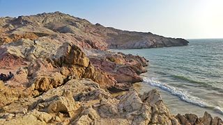
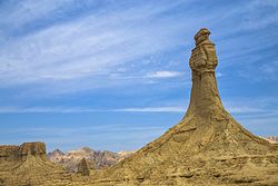
Princes of Hope, Hingol National Park, Pakistan.jpg
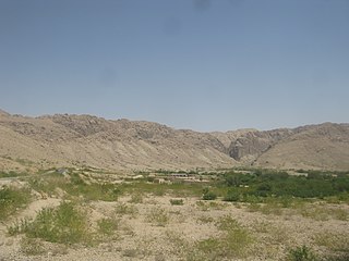
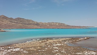
Cave city of Gondrani also known as Sheher e Roghan.jpg
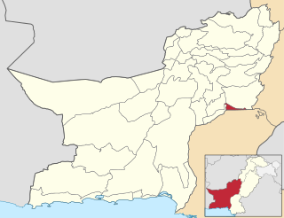
Pakistan - Balochistan - Lasbela (2022).png
Map of Balochistan with Lasbela District highlighted
Coordinates: 20°13′38″N66°18′22″E / 20.22722°N 66.30611°E / 20.22722; 66.30611
CountryFlag of Pakistan.svg  Pakistan
Province Flag of Balochistan.svg  Balochistan
Division Kalat
EstablishedJune 1954 [1]
Headquarters Uthal
Government
  TypeDistrict Administration
   Deputy Commissioner Humera Baloch
  District Police OfficerN/A
  District Health OfficerN/A
Area
  Total8,437 km2 (3,258 sq mi)
Population
 (2023) [2]
  Total298,092
  Density35/km2 (92/sq mi)
Time zone UTC+5 (PST)
Number of Tehsils 5

Lasbela District (Urdu : لسبیلہLasbēla [ləsˈbeːla] , Lasi : لسٻيلوLasɓēlō [ləsˈɓeːloː] , Balochi : لسبݔلهLasbèla [lasˈbeːla] ) is a coastal district of Balochistan province of Pakistan.

Contents

The district situated in the south of southwestern province of Balochistan, Pakistan, lies approximately 125 kilometers west of Karachi. With a population of around 298,092, according to the 2023 Pakistan Census, the district's economy thrives on fishing, agriculture, livestock breeding etc. Additionally, Lasbela is rich in natural resources, with limestone and gypsum mining contributing significantly.

During the British Raj era, Lasbela also held strategic importance.

Lasbela's climate is characterized as hot and humid subtropical, with scorching summers reaching up to 45°C and mild winters ranging from 10-20°C. The district receives minimal rainfall, averaging between 60-100 mm annually.

The predominant languages spoken are Balochi and Lasi(Sindhi).

The district capital is Uthal.

District Lasbela's stunning natural beauty, featuring beaches along the cost such as Sapat beach, Kund Malir beach, Sonmiani beach. Mountains and waterfalls of Kanraj, sandh, duddar etc makes it a treasured destination.

Administration

The district of Lasbela is administratively divided in four tehsils, one sub-tehsil and 22 Union Councils. [3]

Union Councils are given below:

Tehsil Uthal

  1. Uthal [4]
  2. Wayara
  3. Kenwari
  4. Lakhra [4]
  5. Sheh

Tehsil Bela

  1. Bela
  2. Welpat Shumali
  3. Welpat Junubi
  4. Kathor
  5. Gador

Geography

The main rivers of Lasbela are Porali River with its tributaries, Winder River and Wirhab River. Other rivers are the Phor and Hingol which rise in Awaran District before flowing through Lasbela on their way to the Arabian Sea. [5]

Demographics

Religions in Lasbela district (2023) [2]
ReligionPercent
Islam
97.05%
Hinduism
2.42%
Christianity
0.37%
Other
0.16%

In the 2023 census, Islam was the predominant religion with 97.05%, while Hindus were 2.42% of the population. [2]

Languages of Lasbela district (2023)

   Balochi (75.32%)
   Sindhi (incl. Lasi) (9.96%)
   Brahui (8.09%)
   Pashto (2.56%)
  Others (4.07%)

In the 1951 Census of Pakistan, 80% of population of former state of Las Bela was reported to be speaker of Sindhi, forming a majority. The share of Balochi was 19%. [6] At the time of the 2023 census, the share of Sindhi fell to 9.96% while that of Balochi rose to 75.32%. Other first languages include Brahui (8.09%) and Pashto (2.56%). [7]

Education

The Lasbela University of Agriculture, Water and Marine Science is located in Uthal.

Economy

In the south east, an oil refinery Cnergyico was constructed in 2014 at Hub in Lasbela District which is capable of processing 120,000 barrels of oil. Furthermore, a power station is located adjacent to refinery, that produces about 1350 MW of power. [8]

Bibliography

Related Research Articles

<span class="mw-page-title-main">Balochistan, Pakistan</span> Province of Pakistan

Balochistan is a province of Pakistan. Located in the southwestern region of the country, Balochistan is the largest province of Pakistan by land area but is the least populated one. It is bordered by the Pakistani provinces of Khyber Pakhtunkhwa to the north-east, Punjab to the east and Sindh to the south-east; shares international borders with Iran to the west and Afghanistan to the north; and is bound by the Arabian Sea to the south. Balochistan is an extensive plateau of rough terrain divided into basins by ranges of sufficient heights and ruggedness. It has the world's largest deep sea port, the Port of Gwadar lying in the Arabian Sea.

<span class="mw-page-title-main">Panjgur District</span> District of Balochistan in Pakistan

Panjgur is a district in the western part of Balochistan province of Pakistan. Panjgur was one of three tehsils of Makran District until 1 July 1977, when the district became a part of Makran Division. The other two districts of Makran Division are Kech (Turbat) and Gwadar. Chitkan is the district headquarter. Panjgur has sixteen (16) Union Councils.

<span class="mw-page-title-main">Awaran District</span> District in Balochistan, Pakistan

Awaran District, is a district in the southern part of the Balochistan province of Pakistan in Kalat division.

<span class="mw-page-title-main">Gwadar District</span> District in Balochistan, Pakistan

Gwadar District is a district in the Balochistan province of Pakistan. The name Gwadar originates from Gwat and Dar ، which means the door of air. Gwadar was notified as a separate district on 1 July 1977. The city of Gwadar serves as the district headquarters.
<span class="mw-page-title-main">Kech District</span> District in Balochistan, Pakistan

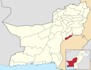
Kech District is a district in the Balochistan province of Pakistan. This district's old name was Turbat District which was changed to its even older name Kech District in 1994-1995.

<span class="mw-page-title-main">Khuzdar District</span> District of Balochistan in Pakistan

Khuzdar is a district in the Balochistan province of Pakistan. The city of Khuzdar serves as the district's headquarters.
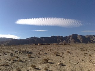
Bela, is an important city of Lasbela District in the Balochistan province of Pakistan. It is an ancient city in a historic track surrounded by hills above the Arabian Sea, nearly 180 km (110 mi) northwest of Karachi and 500 km (310 mi) south of Quetta. During the autumn of 325 BC, the settlement was part of the Asian campaign of Alexander the Great under the name Rhambacia. After Alexander conquered the town, he commended the place and thought that if he built a city there it would become great and prosperous and he left Hephaestion behind to build it. In 711 AD, it was part of Muhammad bin Qasim's campaign under the name Armabil.

<span class="mw-page-title-main">Las Bela (princely state)</span> Princely state of British India and later Pakistan

Las Bela was a princely state in a subsidiary alliance with British India which existed until 1955. The state occupied an area of 18,254 km2 (7,048 sq mi) in the extreme southeast of the Balochistan region, with an extensive coastline on the Arabian Sea to the south. Las Bela was bordered by the princely states of Kalat and Makran to the north and west. To the east lay the province of Sind and to the southeast lay the Federal Capital Territory around the city of Karachi.

<span class="mw-page-title-main">Hub, Balochistan</span> City in Balochistan, Pakistan

Hub is a city and capital of the Hub District in Pakistan's Balochistan province. It is the 49th largest city of Pakistan by population, according to the 2023 census, and is also Balochistan's fourth-largest city. Hub is an industrial city and its original name was Hub Chowki because once there was a police and customs check post, named Nakahi. After the development of factories and many other industries, the town was renamed as Hub. It is one of the largest industrial centres of Balochistan, and, because of its proximity to Karachi, is becoming a commuter town of the Karachi metropolitan area.

The Lasis are a Sindhi ethnic community or group of Sindhi tribes in Balochistan, Pakistan. They form 4.56% of the total population of the province as of 2017, and are the predominant group in the lowlands of former princely state of Lasbela. Now divided into two districts of Balochistan i.e. Lasbela and Hub, some area is in Gwadar district called Ormara. Lasis are also called as Jamote, a term used in Kalat and Kachhi regions, They occupy a high social position and have traditionally been engaged as agricultural landlords. They speak the Lasi dialect of Sindhi Language. Although social stratification is found in individual tribes, there is no social hierarchy or rigid tribal structure. The Lasis are assumed to be related to Jats.

<span class="mw-page-title-main">Dadu District</span> District of Sindh in Pakistan

Dadu District, is a district of Sindh Province, Pakistan. With headquarters the city of Dadu, the district was created in 1931 by merging Kotri and Mahal Kohistan tehsils from Karachi District and Mehar, Khairpur Nathan Shah, Dadu, Johi and Sehwan tehsils from Larkana District. In 2004, several talukas in the south were split off to create the new Jamshoro District. Its boundary touches with four districts of Sindh i.e. Jamshoro, Naushahro Feroze, Shaheed Benazirabad and Kamber Shahdadkot.

<span class="mw-page-title-main">Jamshoro District</span> District of Sindh in Pakistan

Jamshoro District, is a district of Sindh province, Pakistan. Jamshoro city is the capital while Kotri is the largest city of the Jamshoro District. The district borders Dadu district to the north. To the east, the Indus separates it from Shaheed Benazirabad, Matiari and Hyderabad districts. Thatta district lies to the south, and Karachi district to the south west. To the west, the Kheerthar Range separates it from the Sindh and Hub district of Baluchistan.

<span class="mw-page-title-main">Uthal</span> Town in Balochistan, Pakistan

Uthal is a city of Lasbela District in the Balochistan province of Pakistan. Uthal is the headquarters of Uthal Tehsil, an administrative subdivision of the district.

<span class="mw-page-title-main">Kalat Division</span> Administrative division of Balochistan, Pakistan

Kalat Division or Qalat Division is an administrative division of Balochistan Province of Pakistan. Its capital city is Khuzdar founded on 14 October 1955. CNIC Code of Kalat Division is 51. According to 2023 Pakistani census population of Kalat Division is 2,719,964.

<span class="mw-page-title-main">Karachi Division</span> Division in Sindh, Pakistan

Karachi Division is an administrative division of the Sindh Province of Pakistan created in December 1960. There are seven districts in Karachi Division. CNIC code of Karachi Division is 42. According to 2023 Pakistani census population of Karachi Division is 20,382,881.

<span class="mw-page-title-main">Hub District</span> District in Balochistan, Pakistan

Hub District, is a coastal administrative district and located at southern part of Balochistan Province of Pakistan. The district was created after bifurcation of Lasbela District in 2022.

Uthal is an administrative subdivision (tehsil) of Lasbela District in the Balochistan province of Pakistan. The tehsil is administratively subdivided into seven Union Councils and is headquartered at the city of Uthal.

<span class="mw-page-title-main">Sohbatpur District</span> District of Balochistan in Pakistan

Sohbatpur District is a district in the Pakistani province of Balochistan.

<span class="mw-page-title-main">Lasi dialect (Sindhi)</span> Dialect of Sindhi spoken in Pakistan

Lasi, or Lassi, also called Kohistani is a dialect of the Sindhi language spoken on the western frontier of Sindh and Balochistan in Pakistan. It is spoken by the Sindhi Lasi people of Lasbela, Hub and Gwadar in Balochistan, and Lasi is also spoken in the Kohistan region of Karachi, Thatta and Jamshoro districts of Sindh.

References

  1. 1 2 3 "History of Lasbela". Lasbela District Government website. 1 August 2006. Archived from the original on 6 October 2007. Retrieved 20 July 2021.
  2. 1 2 3 "Population by Sex, Religion and Rural/Urban, Census - 2023" (PDF). Pakistan Bureau of Statistics.
  3. 1 2 3 4 5 "Tehsils & Unions- Lasbela District". National Reconstruction Bureau, Government of Pakistan website. Archived from the original on 5 August 2012. Retrieved 18 April 2023.
  4. 1 2 3 4 Saleem Shahid and Abdul Wahid Shahwani (24 February 2019). "Efforts on to rescue people from Balochistan's flood-hit areas". Dawn (newspaper). Retrieved 20 July 2021.
  5. 1998 Census report, p. 2.
  6. "Census of Pakistan, VOLUME 2 1951. Baluchistan: Report & Tables" (PDF). Manager of Publications, Government of Pakistan, Karachi. 1951.
  7. "Population by Mother Tongue, Sex and Rural/Urban, Census-2023" (PDF). Pakistan Bureau of Statistics.
  8. Saad Hasan (4 July 2014). "A matter of weeks: Byco ready to utilise its Hub refinery". The Express Tribune (newspaper). Retrieved 20 July 2021.

25°45′N66°35′E / 25.750°N 66.583°E / 25.750; 66.583