Lahore Division

Last updated
Lahore Division
لاہور ڈویژن
Pakistan - Punjab - Lahore (division).svg
Map of Lahore Division
Country Flag of Pakistan.svg  Pakistan
Province Flag of Punjab.svg Punjab
Capital Lahore
Districts Lahore
Kasur
Nankana Sahib
Sheikhupura
Government
  TypeDivisional Administration
  CommissionerMuhammad Ali Randhawa (PAS)
  Capital City Police Officer (CCPO)Bilal Siddiqui Kamyana (PSP)
Area
   Division
11,727 km2 (4,528 sq mi)
Population
 (2023)
   Division
22,772,710
  Density1,900/km2 (5,000/sq mi)
   Urban
16,122,198 (70.80%)
   Rural
6,650,512
Literacy
[1]
  Literacy rate
  • Total:
    (73.63%)
  • Male:
    (76.60%)
  • Female:
    (70.35%)
National Assembly Seats (2024)Total (24)


  •   PMLN (16)
  •   PTI (73)
  •   IPP (4)
Provincial Assembly Seats (2024)Total (53)


Website lahoredivision.punjab.gov.pk

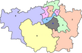
Lahore Division is an administrative division of Punjab Province, Pakistan. It comprises four Districts - Kasur, Lahore, Nankana Sahib and Sheikhupura. The Lahore Division is commanded by a Commissioner to manage the division. Under the Commissioner there are four Additional Commissioners. For each district there is a Deputy Commissioner. Under the reforms of 2000, this tier of government was abolished, but in 2008 divisions were restored. [2] [3] [4]

Contents

History

Map of the Lahore Division comprising the Districts of Gurdaspur, Amritsar, Lahore, Sialkot, and Gujranwala, surveyed in 1850-55. Reduced and drawn by Abdoos Sobhan, 1858. Map of the Lahore Division comprising the Districts of Gurdaspur, Amritsar, Lahore, Sialkot, and Gujranwala, surveyed in 1850-55. Reduced and drawn by Abdoos Sobhan, 1858 (F.4-31).jpg
Map of the Lahore Division comprising the Districts of Gurdaspur, Amritsar, Lahore, Sialkot, and Gujranwala, surveyed in 1850–55. Reduced and drawn by Abdoos Sobhan, 1858.

Lahore Division was originally an administrative division of the Punjab Province of British India. It extended along the right bank of the Sutlej River from the Himalaya to Multan division, and comprised the six districts of Sialkot, Gujranwala, Lahore, Amritsar, Gurdaspur and Gujrat. The total area of the division was 44,430 km2 (17,154 sq mi) and the population according to the 1901 census of India was 5,598,463. [5] The commissioner for the division also exercised political control over the hill state of Chamba.

The Commissioner's headquarters were at Lahore and Dalhousie.The total population of the Division increased from 4,696,636 in 1881 to 5,321,535 in 1891, and 5,598,463 in 1901. The total area was 44,430 square kilometres (17,154 sq mi), and the density of population was 326 persons per square mile, compared with 208 for British territory in the Province as a whole. In 1901 Muslims numbered 3,332,175, or 60 percent of the total; while other religions included Hindus, 1,567,402; Sikhs, 661,320; Jains, 5,5,07; Buddhists, 6; Parsis, 228; and Christians, 31,815, of whom 25,248 were natives. [6]

The division contained six districts: [5]

DistrictArea
(square miles)
Population
(1901 census figures)
Land revenue and cesses
(thousands of rupees).
Gujrat 4,771497,7066,90
Lahore 3,7041,162,10912,55
Amritsar 1,6011,023,82814,54
Gurdaspur 1,889940,33417,72
Sialkot 1,9911,083,90917,27
Gujranwala 3,198890,55712,89
Total17,1545,598,46381,87

Gurdaspur included a few square miles of mountainous country, enclosing the hill station of Dalhousie (highest, point, 7,687 feet) ; but otherwise the Division was flat. It contained 9,869 villages and 41 towns, of which the largest are Lahore (population, 202,964, including cantonment), Amristar(162,429), Sialkot (57,956), Gujranwala (29,224), Batala (27,365), and Gujrat (22,022). In commercial importance Lahore and Amritsar dwarfed all other towns in the Division, but Sialkot and Batala were considerably more than local centres. Besides the administrative charge of six British Districts, the Commissioner of Lahore had political control over the Native State of Chamba, which had an area of 8,330 square kilometres (3,216 sq mi) and a population (1901) of 127,834. [5]

Demographics

Population

Historical population
YearPop.±% p.a.
1951N/A    
1961N/A    
1972N/A    
1981N/A    
19988,694,620    
201719,581,281+4.37%
202322,772,710+2.55%
Sources: [7]

According to the 2023 census, Lahore division had a population of 22,772,710 [8] roughly equal to the nation of Sri Lanka [9] or the US state of Florida. [10]

List of the Districts

#District [11] HeadquarterArea

(km²) [12]

Pop.

(2023)

Density

(ppl/km²)

(2023)

Lit. rate

(2023)

1 Lahore Lahore 1,77213,004,1357,336.679.62%
2 Kasur Kasur 3,9954,084,2861,021.462.85%
3 Nankana Sahib [13] Nankana Sahib 2,2161,634,871737.063.12%
4 Sheikhupura Sheikhupura 3,7444,049,4181,080.368.88%

List of the Tehsils

#TehsilArea

(km²) [14]

Pop.

(2023)

Density

(ppl/km²)

(2023)

Lit. rate

(2023)

Districts
1 Chunian 1,212979,746808.3760.64% Kasur District
2 Kasur 1,4931,603,6581,074.1263.63%
3 Kot Radha Kishan 398424,8751,067.5364.66%
4 Pattoki 8921,076,0071,206.2962.98%
5 Lahore Cantonment 4661,885,0984,045.2781.01% Lahore District
6 Lahore City 2144,123,35419,268.0180.36%
7 Model Town 3533,244,9069,192.3778.94%
8 Raiwind 4671,080,6372,314.0072.35%
9 Shalimar 2722,670,1409,816.6981.21%
10 Nishtar N/AN/AN/AN/A
11 Wagah N/AN/AN/AN/A
12 Iqbal Town N/AN/AN/AN/A
13 Ravi N/AN/AN/AN/A
14 Saddar N/AN/AN/AN/A
15 Sangla Hill 223269,9931,210.7372.08% Nankana Sahib District
16 Nankana Sahib 1,6621,065,063640.8359.02%
17 Shah Kot 331299,815905.7969.28%
18 Muridke 1,028721,192701.5569.10% Sheikhupura District
19 Ferozewala 511997,2461,951.5666.55%
20 Safdarabad 461320,851695.9967.55 %
21 Sheikhupura 1,3691,780,8371,300.8370.72%
22 Sharak Pur 375229,292611.4565.05%

Independence

With the independence of India and Pakistan in 1947, Lahore Division was divided among the two countries. with the eastern half becoming Amritsar District.

Constituencies

Provincial Assembly ConstituencyNational Assembly ConstituencyDistrict
PP-132 Nankana Sahib-I NA-111 Nankana Sahib-I Nankana Sahib
PP-133 Nankana Sahib-II
PP-134 Nankana Sahib-III NA-112 Nankana Sahib-II
PP-135 Nankana Sahib-IV
PP-136 Sheikhupura-I NA-113 Sheikhupura-I Sheikhupura
PP-137 Sheikhupura-II
PP-138 Sheikhupura-III NA-114 Sheikhupura-II
PP-139 Sheikhupura-IV
PP-140 Sheikhupura-V
PP-141 Sheikhupura-VI NA-115 Sheikhupura-III
PP-142 Sheikhupura-VII
PP-143 Sheikhupura-VIII NA-116 Sheikhupura-IV
PP-144 Sheikhupura-IX
PP-145 Lahore-I NA-117 Lahore-I Lahore
PP-146 Lahore-II
PP-147 Lahore-III NA-118 Lahore-II
PP-148 Lahore-IV
PP-149 Lahore-V NA-119 Lahore-III
PP-150 Lahore-VI
PP-151 Lahore-VII NA-120 Lahore-IV
PP-154 Lahore-X
PP-152 Lahore-VIII NA-121 Lahore-V
PP-153 Lahore-IX
PP-155 Lahore-XI NA-122 Lahore-VI
PP-156 Lahore-XII
PP-157 Lahore-XIII
PP-158 Lahore-XIV NA-123 Lahore-VII
PP-164 Lahore-XX
PP-159 Lahore-XV NA-124 Lahore-VIII
PP-163 Lahore-XIX
PP-165 Lahore-XXI NA-125 Lahore-IX
PP-166 Lahore-XXII
PP-167 Lahore-XXIII NA-126 Lahore-X
PP-168 Lahore-XXIV
PP-160 Lahore-XVI NA-127 Lahore-XI
PP-162 Lahore-XVIII
PP-161 Lahore-XVII NA-128 Lahore-XII
PP-169 Lahore-XXV
PP-170 Lahore-XXVI
PP-171 Lahore-XXVII NA-129 Lahore-XIII
PP-172 Lahore-XXVIII
PP-173 Lahore-XXIX NA-130 Lahore-XIV
PP-174 Lahore-XXX
PP-176 Kasur-II NA-131 Kasur-I Kasur
PP-177 Kasur-III
PP-178 Kasur-IV
PP-175 Kasur-I NA-132 Kasur-II
PP-179 Kasur-V
PP-180 Kasur-VI NA-133 Kasur-III
PP-181 Kasur-VII
PP-182 Kasur-VIII NA-134 Kasur-IV
PP-183 Kasur-IX
PP-184 Kasur-X

See also

References

  1. "Literacy rate, enrolments, and out-of-school population by sex and rural/urban, CENSUS-2023" (PDF).
  2. Divisions/Districts of Pakistan Archived 2006-09-30 at the Wayback Machine
  3. "Firewall Notification" (PDF). health.punjab.gov.pk. Archived from the original (PDF) on 2015-04-16.
  4. "Punjab Government Plans to Carve a New District from Lahore". 6 January 2009. Archived from the original on 2010-06-03.
  5. 1 2 3 "Imperial Gazetteer2 of India, Volume 16, page 96 -- Imperial Gazetteer of India -- Digital South Asia Library". dsal.uchicago.edu. Archived from the original on 17 July 2014. Retrieved 27 April 2018.
  6. "Imperial Gazetteer2 of India, Volume 16, page 95 -- Imperial Gazetteer of India -- Digital South Asia Library". dsal.uchicago.edu. Archived from the original on 3 March 2016. Retrieved 27 April 2018.
  7. "Population by administrative units 1951-1998" (PDF). Pakistan Bureau of Statistics.
  8. "table 1" (PDF). www.pbs.gov.pk. 2023.
  9. US Directorate of Intelligence. "Country Comparison:Population". Archived from the original on 13 June 2007. Retrieved 2011-10-01. Latvia 2,204,708, July 2011 est.
  10. "2010 Resident Population Data". U. S. Census Bureau. Archived from the original on 19 October 2013. Retrieved 2011-09-30. New Mexico - 2,059,179
  11. "Lahore Division | Local Government and Community Development".[ permanent dead link ]
  12. "TABLE 1 : AREA, POPULATION BY SEX, SEX RATIO, POPULATION DENSITY, URBAN POPULATION, HOUSEHOLD SIZE AND ANNUAL GROWTH RATE, CENSUS-2023, PUNJAB" (PDF).
  13. "Nankana becomes district". Dawn. Pakistan. 10 May 2005. Retrieved 16 February 2014.
  14. "TABLE 1 : AREA, POPULATION BY SEX, SEX RATIO, POPULATION DENSITY, URBAN POPULATION, HOUSEHOLD SIZE AND ANNUAL GROWTH RATE, CENSUS-2023, PUNJAB" (PDF).

31°10′N74°30′E / 31.167°N 74.500°E / 31.167; 74.500