The City of Wanneroo is a local government area with city status in the northern suburbs of Perth, Western Australia. It is centred approximately 25 kilometres (15.5 mi) north of Perth's central business district and forms part of the northern boundary of the Perth metropolitan area. Wangara encompasses the federal divisions of Cowan, Moore and Pearce.

Yanchep is an outer coastal suburb of Perth, Western Australia, 56 kilometres (35 mi) north of the Perth CBD. It is a part of the City of Wanneroo local government area. Originally a small crayfishing settlement, it was developed by entrepreneur Alan Bond in the 1970s for the 1977 America's Cup. The area covers the urban centre of Yanchep as well as Yanchep National Park in its entirety.

Alkimos is a coastal suburb of Perth, Western Australia, located 42 kilometres (26 mi) north-northwest of Perth's central business district. It is part of the City of Wanneroo local government area.

Butler is an outer suburb of Perth, Western Australia, 41 kilometres north of Perth's central business district. It is part of the City of Wanneroo local government area. It forms the majority of the Brighton Estate, a large commercial and residential development by Satterley.

Clarkson is an outer northern suburb of Perth, Western Australia, located 34 kilometres north of Perth's central business district in the City of Wanneroo.

Eglinton is a locality in the Western Australian capital city of Perth, approximately 44 kilometres (27 mi) north of Perth's central business district on the Indian Ocean. For the most part, the suburb is covered in native banksia woodland, scrubland and heath typical of the Swan Coastal Plain. However, in recent years, there has been growth in residential estates, with a town centre to be built in the near future.
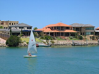
Mindarie is an outer coastal suburb of Perth, Western Australia. It is located 36 kilometres (22 mi) north of Perth's central business district, and forms part of the City of Wanneroo local government area.

Quinns Rocks is an outer coastal suburb of Perth, Western Australia, located 38 kilometres (24 mi) north of Perth's central business district. It is part of the City of Wanneroo local government area. The suburb was formally established in 1962 as a rural townsite, focused around Quinns Beach, the area's main amenity.
Tamala Park is an unpopulated locality in Perth, Western Australia. It sits on the border between the City of Wanneroo and the City of Joondalup local authorities, and separates the Clarkson-Butler region from the suburbs of Joondalup.

Merriwa is a coastal, northern suburb of Perth, Western Australia, 36 kilometres (22 mi) north of the central business district. It is part of the City of Wanneroo local government area. It is a predominantly residential suburb, containing two RAAF retirement villages.
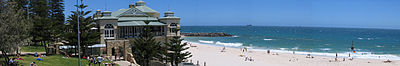
Hillarys is a northern coastal suburb of Perth, the capital city of Western Australia, in the local government area of the City of Joondalup. It is part of the Whitfords precinct, and is located 21 km north-northwest of Perth's central business district via Mitchell Freeway and Hepburn Avenue.

Wanneroo Road is a 44-kilometre (27 mi) arterial highway in the northern suburbs of Perth, Western Australia linking Joondanna and Yokine in the south with Wanneroo and Yanchep in the north. As part of State Route 60, it begins from Charles Street in the inner city and becomes Indian Ocean Drive up to Dongara.

Wooden Spoon Highway is an arterial coastal highway located in the western and inner northern suburbs of Perth, Western Australia. It is part of State Route 71, and also Tourist Drive 204 in various coastal parts.

Marmion Avenue is a 40-kilometre (25 mi) arterial road in the northern coastal suburbs of Perth, Western Australia, linking Trigg in the south with Yanchep in the north. It forms part of State Route 71 along with West Coast Highway, which it joins onto at its southern terminus.
Mindarie was an electoral district of the Legislative Assembly in the Australian state of Western Australia. The district was named for the outer northern Perth suburb of Mindarie, which falls within its borders.
Beach Road is a major east-west road in the northern suburbs of Perth, Western Australia, connecting Perth's inner northern beachside suburbs and inland state housing areas with shopping and public transport facilities at Warwick and the Malaga industrial area. It was mostly built between 1967 and 1974, and is a dual carriageway for most of its length, except for a small western part between Marmion Avenue and the coast, which is a minor residential distributor road and is discontinuous at Marmion Avenue. Beach Road also serves as a local government boundary. From Alexander Drive to Wanneroo Road, Beach Road is the boundary with the City of Wanneroo on the northern side and the City of Stirling on the southern side. From Wanneroo Road to the coast Beach Road is the boundary with the City of Joondalup on the northern side and the City of Stirling on the southern side.
Transport in Perth, Western Australia, is served by various means, among them an extensive highway / freeway network and a substantial system of commuter rail lines and bus routes. Public transport is managed by the Transperth agency.
Ocean Reef was an electoral district of the Legislative Assembly of Western Australia. It was located in Perth's northern suburbs, and was named after the suburb of Ocean Reef.
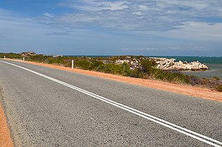
Indian Ocean Drive is a coastal highway in the Australian state of Western Australia which services the coastal communities along the Indian Ocean immediately north of the state capital Perth, linking the northern suburb of Yanchep with the Brand Highway, just south of Dongara. In terms of regions, most of it exists in the Wheatbelt coastal region. The road provides travellers between Perth and Geraldton a 30-minute shorter and more scenic route than the inland Brand Highway which mainly services heavy traffic.

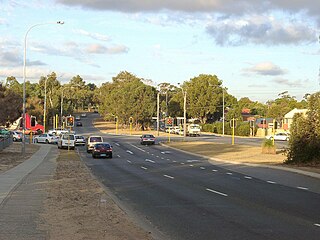
Hester Avenue is an east-west distributor road in the northern suburbs of Perth, Western Australia, located within the City of Wanneroo. It primarily links the coastal suburbs of the Clarkson-Butler region to the arterial highway Wanneroo Road in the east.