Svirstroy

Last updated
Svirstroy
Свирьстрой(Russian)
-   Urban-type settlement [1]   -
Map of Russia - Leningrad Oblast (2008-03).svg
Location of Leningrad Oblast in Russia
Outline Map of Leningrad Oblast.svg
Red pog.svg
Svirstroy
Location of Svirstroy in Leningrad Oblast
Coordinates: 60°48′0″N33°43′17″E / 60.80000°N 33.72139°E / 60.80000; 33.72139 Coordinates: 60°48′0″N33°43′17″E / 60.80000°N 33.72139°E / 60.80000; 33.72139
Administrative status
Country Russia
Federal subject Leningrad Oblast
Administrative district Lodeynopolsky District [1]
Municipal status  (as of February 2010)
Municipal district Lodeynopolsky Municipal District [2]
Urban settlement Svirstroyskoye Urban Settlement [2]
Administrative center of Svirstroyskoye Urban Settlement [2]
Statistics
Population (2010 Census) 927 inhabitants [3]
Time zone MSK (UTC+03:00) [4]
Urban-type settlement status since 1931 [5]
Svirstroy on Wikimedia Commons

Svirstroy (Russian : Свирьстрой) is an urban locality (an urban-type settlement) in Lodeynopolsky District of Leningrad Oblast, Russia, located on the left bank of the Svir River several kilometers northeast of the town of Lodeynoye Pole. Municipally, it is incorporated as Svirstroyskoye Urban Settlement, one of the two urban settlements in the district. The name of the settlement is an abbreviation meaning Construction on the Svir. Population: 927(2010 Census); [3] 1,044(2002 Census); [6] 1,156(1989 Census). [7]

Russian language East Slavic language

Russian is an East Slavic language, which is official in the Russian Federation, Belarus, Kazakhstan and Kyrgyzstan, as well as being widely used throughout Eastern Europe, the Baltic states, the Caucasus and Central Asia. It was the de facto language of the Soviet Union until its dissolution on 25 December 1991. Although, nowadays, nearly three decades after the breakup of the Soviet Union, Russian is used in official capacity or in public life in all the post-Soviet nation-states, as well as in Israel and Mongolia, the rise of state-specific varieties of this language tends to be strongly denied in Russia, in line with the Russian World ideology.

The classification system of the types of inhabited localities in Russia, the former Soviet Union, and some other post-Soviet states has certain peculiarities compared with the classification systems in other countries.

Urban-type settlement is an official designation for a semi-urban settlement, used in several Eastern European countries. The term was historically used in Bulgaria, Poland, and the Soviet Union, and remains in use today in 10 of the post-Soviet states.

Contents

History

Svirstroy Svirstroy.jpg
Svirstroy

In 1927, a large-scale construction of the Lower Svir Hydroelectric Station started, and subsequently in 1931, the concentration camp of Svirlag was established. The settlement which hosted the headquarters of Svirlag became known as Svirstroy. In the same year, Svirstroy was granted urban-type settlement status. On May 13, 1963, during the abortive Khrushhyov administrative reform, Svirstroy was subordinated to the town of Podporozhye, but on January 13, 1965 it was transferred back to Lodeynopolsky District. [5]

Lower Svir Hydroelectric Station dam in Russia

Lower Svir Hydroelectric Station is a hydroelectric station on the Svir River located in the urban-type settlement of Svirstroy, Leningrad Oblast, in northwestern Russia. It was open on December 19, 1933 and has the total power of 99 MW. It is operated by the TGC-1 power company.

Svirlag, SvirLAG was a Soviet forced labour camp run by NKVD's GULAG Directorate. It was located on the river Svir in the forests by the town Lodeynoye Pole, 244 km north-east of Saint Petersburg, in Leningrad oblast, Vepsland – the land of the Vepses, operated in the 1930s and onwards. SvirLAG concentration camp was supplier of wood to Moscow and Saint Petersburg.

Podporozhye, Leningrad Oblast Town in Leningrad Oblast, Russia

Podporozhye is a town and the administrative center of Podporozhsky District in Leningrad Oblast, Russia, located on the Svir River 285 kilometers (177 mi) northeast of St. Petersburg. Population: 18,733 (2010 Census); 20,312 (2002 Census); 23,295 (1989 Census).

Economy

Cruise and cargo traffic along the waterway Chiuse tra San Pietroburgo e Svirstroi2.jpg
Cruise and cargo traffic along the waterway

The economy of the settlement is essentially based on the Lower Svir Hydroelectric Station.

Transportation

A paved road connecting Lodeynoye Pole with Podporozhye and Vytegra passes Svirstroy.

Lodeynoye Pole Town in Leningrad Oblast, Russia

Lodeynoye Pole is a town and the administrative center of Lodeynopolsky District in Leningrad Oblast, Russia, located on the left bank of the Svir River 244 kilometers (152 mi) northeast of St. Petersburg. Population: 20,674 (2010 Census); 22,830 (2002 Census); 26,718 (1989 Census); 21,400 (1972).

Vytegra Town in Vologda Oblast, Russia

Vytegra is a town and the administrative center of Vytegorsky District in Vologda Oblast, Russia, located along the shores of the Vytegra River on Volga–Baltic Waterway, 315 kilometers (196 mi) northwest of Vologda, the administrative center of the oblast. Population: 10,488 (2010 Census); 11,400 (2002 Census); 12,905 (1989 Census).

The Svir River is navigable and is a part of the Volga–Baltic Waterway, connecting the basins of the Volga and the Neva Rivers. There is regular cruise and cargo traffic along the waterway.

Volga–Baltic Waterway series of canals and rivers in Russia

The Volga–Baltic Waterway, formerly known as the Mariinsk Canal System, is a series of canals and rivers in Russia which link the Volga River with the Baltic Sea via the Neva River. Volga–Baltic Waterway connects the biggest lake on Earth, the Caspian Sea to the World Ocean. Its overall length between Cherepovets and Lake Onega is 368 kilometres (229 mi).

Related Research Articles

Toksovo Urban-type settlement in Leningrad Oblast, Russia

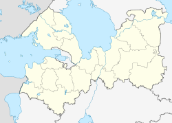
Toksovo is an urban locality in Vsevolozhsky District of Leningrad Oblast, Russia, located 20 kilometers (12 mi) to the north of St. Petersburg on the Karelian Isthmus. It is served by two neighboring stations of the Saint Petersburg-Khiytola railroad: Toksovo and Kavgolovo (1929). Population: 6,127 (2010 Census); 5,893 (2002 Census); 5,699 (1989 Census).

Syasstroy Town in Leningrad Oblast, Russia

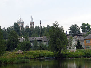
Syasstroy is a town in Volkhovsky District of Leningrad Oblast, Russia, located near the mouth of the Syas River, at its confluence with the Valgonka, close to Lake Ladoga, 140 kilometers (87 mi) east of St. Petersburg. Population: 13,745 (2010 Census); 13,969 (2002 Census); 16,122 (1989 Census).

Lesogorsky Urban-type settlement in Leningrad Oblast, Russia

Lesogorsky is an urban locality in Vyborgsky District of Leningrad Oblast, located on the left bank of the Vuoksi River, on the Karelian Isthmus, near the Russia–Finland border, and a station of the Kamennogorsk–Svetogorsk–Imatra railway. Population: 3,273 (2010 Census); 3,004 (2002 Census); 3,744 (1989 Census).

Sovetsky, Leningrad Oblast Urban-type settlement in Leningrad Oblast, Russia

Sovetsky is an urban locality in Vyborgsky District of Leningrad Oblast, Russia. It is situated on the eastern shore of the Gulf of Vyborg on the Karelian Isthmus. Population: 7,131 (2010 Census); 6,607 (2002 Census); 6,471 (1989 Census).

Yefimovsky (urban-type settlement) Urban-type settlement in Leningrad Oblast, Russia

Yefimovsky is an urban locality in Boksitogorsky District of Leningrad Oblast, Russia, located on the Sominka River, in the basin of the Chagodoshcha River. Municipally, it is incorporated as Yefimovskoye Urban Settlement, one of the three urban settlements in the district. Population: 3,611 (2010 Census); 3,937 (2002 Census); 5,177 (1989 Census).

Vazhiny Urban-type settlement in Leningrad Oblast, Russia

Vazhiny is an urban locality in Podporozhsky District of Leningrad Oblast, Russia, located on the right bank of the Svir River at the mouth of the Vazhinka River, several kilometers northwest of the town of Podporozhye. Municipally, it is incorporated as Vazhinskoye Urban Settlement, one of the four urban settlements in the district. Population: 2,754 (2010 Census); 2,941 (2002 Census); 3,956 (1989 Census).

Nikolsky, Leningrad Oblast Urban-type settlement in Leningrad Oblast, Russia

Nikolsky is an urban locality in Podporozhsky District of Leningrad Oblast, Russia, located on the right bank of the Svir River, several kilometers west of the town of Podporozhye. Municipally, it is incorporated as Nikolskoye Urban Settlement, one of the four urban settlements in the district. Population: 2,989 (2010 Census); 2,931 (2002 Census); 2,953 (1989 Census).

Voznesenye Urban-type settlement in Leningrad Oblast, Russia

Voznesenye is an urban locality in Podporozhsky District of Leningrad Oblast, Russia, located on the banks of the Svir River at the place if flow out of Lake Onega. Municipally, it is incorporated as Voznesenskoye Urban Settlement, one of the four urban settlements in the district. Population: 2,425 (2010 Census); 2,817 (2002 Census); 3,123 (1989 Census).

Priladozhsky Urban-type settlement in Leningrad Oblast, Russia

Priladozhsky is an urban locality in Kirovsky District of Leningrad Oblast, Russia, located 3 kilometres (1.9 mi) from the southern shore of Lake Ladoga, on the left bank of the Naziya River, 10 kilometres (6.2 mi) east of the town of Kirovsk. Municipally, together with the village of Naziya, it is incorporated as Priladozhskoye Urban Settlement, one of the eight urban settlements in the district. Population: 5,757 (2010 Census); 5,185 (2002 Census); 5,280 (1989 Census).

Pavlovo, Kirovsky District, Leningrad Oblast Urban-type settlement in Leningrad Oblast, Russia

Pavlovo is an urban locality in Kirovsky District of Leningrad Oblast, Russia, located on the left bank of the Neva River, at the mouth of the Mga River, east of Saint Petersburg. Municipally, together with three rural localities, it is incorporated as Pavlovskoye Urban Settlement, one of the eight urban settlements in the district. Population: 3,250 (2010 Census); 3,365 (2002 Census); 3,886 (1989 Census).

Naziya Urban-type settlement in Leningrad Oblast, Russia

Naziya is an urban locality in Kirovsky District of Leningrad Oblast, Russia, located on the left bank of the Lava River and on the right bank of the Kovra River, east of the town of Kirovsk. Municipally it is incorporated as Naziyevskoye Urban Settlement, one of the eight urban settlements in the district. Population: 4,858 (2010 Census); 5,755 (2002 Census); 7,712 (1989 Census).

Fornosovo Urban-type settlement in Leningrad Oblast, Russia

Fornosovo is an urban locality in Tosnensky District of Leningrad Oblast, Russia, located on the Khennaya River southeast of the town of Pavlovsk. Municipally it is incorporated as Fornosovskoye Urban Settlement, one of the seven urban settlements in the district. Population: 6,408 (2010 Census); 4,866 (2002 Census); 2,774 (1989 Census).

Ryabovo, Tosnensky District, Leningrad Oblast Urban-type settlement in Leningrad Oblast, Russia

Ryabovo is an urban locality in Tosnensky District of Leningrad Oblast, Russia, located southeast of Saint Petersburg, between the towns of Tosno and Lyuban. Municipally it is incorporated as Ryabovskoye Urban Settlement, one of the seven urban settlements in the district. Population: 3,251 (2010 Census); 3,309 (2002 Census); 3,935 (1989 Census).

Rakhya Urban-type settlement in Leningrad Oblast, Russia

Rakhya is an urban locality in Vsevolozhsky District of Leningrad Oblast, Russia, located on the Karelian Isthmus northeast of Saint Petersburg. Municipally it is incorporated as Rakhyinskoye Urban Settlement, one of the eight urban settlements in the district. Population: 3,188 (2010 Census); 3,156 (2002 Census); 3,316 (1989 Census).

Dubrovka, Vsevolozhsky District, Leningrad Oblast Urban-type settlement in Leningrad Oblast, Russia

Dubrovka is an urban locality in Vsevolozhsky District of Leningrad Oblast, Russia, located on the right bank of the Neva River northeast of Saint Petersburg. Municipally it is incorporated as Dubrovskoye Urban Settlement, one of the eight urban settlements in the district. Population: 6,693 (2010 Census); 5,432 (2002 Census); 6,093 (1989 Census).

Imeni Morozova Urban-type settlement in Leningrad Oblast, Russia

Imeni Morozova is an urban locality in Vsevolozhsky District of Leningrad Oblast, Russia, located on the bank of Lake Ladoga by the source of the Neva River, northeast of Saint Petersburg. Municipally it is incorporated as Morozovskoye Urban Settlement, one of the eight urban settlements in the district. Population: 10,873 (2010 Census); 10,677 (2002 Census); 12,347 (1989 Census).

Imeni Sverdlova, Russia Urban-type settlement in Leningrad Oblast, Russia

Imeni Sverdlova is an urban locality in Vsevolozhsky District of Leningrad Oblast, Russia, located on the right bank of the Neva River, southeast of the center of Saint Petersburg and opposite to Ust-Izhora. Municipally it is incorporated as Sverdlovskoye Urban Settlement, one of the eight urban settlements in the district. Population: 9,260 (2010 Census); 9,197 (2002 Census); 8,905 (1989 Census).

Kuzmolovsky Urban-type settlement in Leningrad Oblast, Russia

Kuzmolovsky is an urban locality in Vsevolozhsky District of Leningrad Oblast, Russia, located north of the city of Saint Petersburg. Municipally it is incorporated as Kuzmolovskoye Urban Settlement, one of the eight urban settlements in the district. Population: 9,689 (2010 Census); 9,725 (2002 Census); 10,435 (1989 Census).

Yanino-1 Urban-type settlement in Leningrad Oblast, Russia

Yanino-1 is an urban locality in Vsevolozhsky District of Leningrad Oblast, Russia, located east of Saint Petersburg. Municipally it is, together with other localities, incorporated as Zanevskoye Urban Settlement, one of the eight urban settlements in the district. Population is over 5,000.

References

Notes

  1. 1 2 Государственный комитет Российской Федерации по статистике. Комитет Российской Федерации по стандартизации, метрологии и сертификации. №ОК 019-95 1 января 1997 г. «Общероссийский классификатор объектов административно-территориального деления. Код 41 227 554 009», в ред. изменения №278/2015 от 1 января 2016 г.. (State Statistics Committee of the Russian Federation. Committee of the Russian Federation on Standardization, Metrology, and Certification. #OK 019-95 January 1, 1997 Russian Classification of Objects of Administrative Division . Code 41 227 554 009, as amended by the Amendment #278/2015 of January 1, 2016. ).
  2. 1 2 3 Law #78-oz
  3. 1 2 Russian Federal State Statistics Service (2011). "Всероссийская перепись населения 2010 года. Том 1" [2010 All-Russian Population Census, vol. 1]. Всероссийская перепись населения 2010 года (2010 All-Russia Population Census) (in Russian). Federal State Statistics Service . Retrieved June 29, 2012.
  4. Правительство Российской Федерации. Федеральный закон №107-ФЗ от 3 июня 2011 г. «Об исчислении времени», в ред. Федерального закона №271-ФЗ от 03 июля 2016 г. «О внесении изменений в Федеральный закон "Об исчислении времени"». Вступил в силу по истечении шестидесяти дней после дня официального опубликования (6 августа 2011 г.). Опубликован: "Российская газета", №120, 6 июня 2011 г. (Government of the Russian Federation. Federal Law #107-FZ of June 31, 2011 On Calculating Time , as amended by the Federal Law #271-FZ of July 03, 2016 On Amending Federal Law "On Calculating Time". Effective as of after sixty days following the day of the official publication.).
  5. 1 2 Лодейнопольский район (с августа 1927) (in Russian). Система классификаторов исполнительных органов государственной власти Санкт-Петербурга. Retrieved December 9, 2012.
  6. Russian Federal State Statistics Service (May 21, 2004). "Численность населения России, субъектов Российской Федерации в составе федеральных округов, районов, городских поселений, сельских населённых пунктов – районных центров и сельских населённых пунктов с населением 3 тысячи и более человек" [Population of Russia, Its Federal Districts, Federal Subjects, Districts, Urban Localities, Rural Localities—Administrative Centers, and Rural Localities with Population of Over 3,000](XLS). Всероссийская перепись населения 2002 года [All-Russia Population Census of 2002] (in Russian). Retrieved August 9, 2014.
  7. Demoscope Weekly (1989). "Всесоюзная перепись населения 1989 г. Численность наличного населения союзных и автономных республик, автономных областей и округов, краёв, областей, районов, городских поселений и сёл-райцентров" [All Union Population Census of 1989: Present Population of Union and Autonomous Republics, Autonomous Oblasts and Okrugs, Krais, Oblasts, Districts, Urban Settlements, and Villages Serving as District Administrative Centers]. Всесоюзная перепись населения 1989 года [All-Union Population Census of 1989] (in Russian). Институт демографии Национального исследовательского университета: Высшая школа экономики [Institute of Demography at the National Research University: Higher School of Economics]. Retrieved August 9, 2014.

Sources