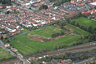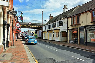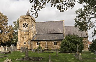
Lincoln is a cathedral city and district in Lincolnshire, England, of which it is the county town. In the 2021 Census, the city's district had a population of 103,813. The 2021 census gave the urban area of Lincoln, including Bracebridge Heath, North Hykeham, South Hykeham and Waddington, a recorded population of 127,540.

Lincolnshire, abbreviated Lincs, is a ceremonial county in the East Midlands and Yorkshire and the Humber regions of England. It is bordered by the East Riding of Yorkshire across the Humber estuary to the north, the North Sea to the east, Norfolk, Cambridgeshire, Northamptonshire and Rutland to the south, and Leicestershire, Nottinghamshire and South Yorkshire to the west. The county town is the city of Lincoln. Lincolnshire is the second largest ceremonial county in England, after North Yorkshire.

Sleaford is a market town and civil parish in the North Kesteven district of Lincolnshire, England. On the edge of the Fenlands, it is 11 miles north-east of Grantham, 16 mi (26 km) west of Boston, and 17 mi (27 km) south of Lincoln. It is the largest settlement in North Kesteven with a population of 19,807 in 2021. Centred on the former parish of New Sleaford, the modern boundaries and urban area include Quarrington to the south-west, Holdingham to the north-west and Old Sleaford to the east. The town is bypassed by the A17 and the A15 roads, which link it to Lincoln, Newark, Peterborough, Grantham, Boston and King's Lynn. Sleaford railway station is on the Nottingham to Skegness and Peterborough to Lincoln lines.

Horncastle is a market town and civil parish in the East Lindsey district in Lincolnshire, England. It is 17 miles (27 km) east of Lincoln. Its population was 6,815 at the 2011 census and estimated at 7,123 in 2019. A section of the ancient Roman walls remains.

Stamford is a town and civil parish in the South Kesteven district of Lincolnshire, England. The population at the 2011 census was 19,701 and estimated at 20,645 in 2019. The town has 17th- and 18th-century stone buildings, older timber-framed buildings and five medieval parish churches. It is a frequent film location. In 2013 it was rated a top place to live in a survey by The Sunday Times. Its name has been passed on to Stamford, Connecticut, founded in 1641.

Market Rasen is a market town and civil parish within the West Lindsey district of Lincolnshire, England. The River Rase runs through it east to west, approximately 13 miles (21 km) north-east from Lincoln, 18 miles (29 km) east from Gainsborough, 14 miles (23 km) west of Louth, and 16 miles (26 km) south-west from Grimsby. It lies on the main road between Lincoln and Grimsby, the A46, and is famous for its racecourse. In 2001, the town had a population of 3,200. In the 2011 census, the population of the civil parish was 3,904.

Waddington is a village and civil parish in the North Kesteven district of Lincolnshire, England, situated approximately 4 miles (6 km) south of Lincoln on the A607 Grantham Road. The village is known for its association with RAF Waddington. At the 2001 Census Waddington had a population of 6,086, increasing to 6,122 at the 2011 census. It grew to 12,622 and this included the village of Bracebridge Heath,

Bracebridge Heath is a village and civil parish in the North Kesteven district of Lincolnshire, England. It is 2 miles (3 km) south of Lincoln and straddles the border with the Lincoln and North Kesteven district boundaries.

Donington is a village and civil parish in the South Holland District of Lincolnshire, England. It is 8 miles (13 km) north from the market town of Spalding and 11 miles (18 km) south of Boston on the A152, it is bypassed by the A52, and sits between the A16 and A17. The parish includes the hamlet of Northorpe, and falls within the drainage area of the Black Sluice Internal Drainage Board. Donington is the birthplace of the explorer Matthew Flinders and he was reburied there in 2024.

Baumber is a village and civil parish in the East Lindsey district of Lincolnshire, England. It is situated approximately 4 miles (6 km) north-west from Horncastle, and at the junction of the B1225 and the A158 roads.

North Hykeham is an industrial town and civil parish in the North Kesteven District of Lincolnshire, England. It is located directly south of the city of Lincoln, where it forms the southern part of the wider Lincoln Urban Area along with Waddington, Bracebridge Heath, Canwick and South Hykeham. The parish covering the town had a population of 16,844 in the 2021 Census.

Bottesford is a town in North Lincolnshire, Lincolnshire, England.

Frodingham is a historic hamlet and now a suburb of Scunthorpe in the borough of North Lincolnshire, in Lincolnshire, England. The village lay directly to the south of Scunthorpe town centre, the name Frodingham is now often used to refer to the area directly to the north of the town centre.

Bracebridge Low Fields is a suburb to the south of Lincoln in Lincolnshire, England. It is located directly to the south of the city, close to the boundary with North Kesteven and the village of Waddington. The suburb is also located northeast of North Hykeham, south of Bracebridge, and west of Bracebridge Heath. The suburb was likely built at some point in time around the 19th-20th century and primarily built for the workers at the former Bracebridge Ironworks. The suburb now forms one of Lincoln's largest estates and suburbs.

St George's Church was a medieval parish church in the city of Lincoln in Lincolnshire, England. It was built around 1100 and served as one of the many parish churches for the city and surrounding area until 1499, when it was demolished. The site of the church and churchyard is now under a car park and partly occupied by the Lincoln Museum.

Moorland is an inner city ward of Lincoln in Lincolnshire, England. The population of the City of Lincoln ward at the 2021 census was 8,046. The ward is one of the eleven electoral districts within the City of Lincoln Council.

Witham is a suburb and ward of Lincoln in Lincolnshire, England. The population of the City of Lincoln ward at the 2021 census was 8,136. The ward is one of the eleven electoral districts within the City of Lincoln Council.

Witham is a suburb and ward of North Hykeham in Lincolnshire, England. It is one of the six wards of North Hykeham Town Council. It had a population of 2,230 at the 2021 census.

Waddington Low Fields is a suburb located to the south of Lincoln and west of Waddington in Lincolnshire, England. It is located close to the boundary with the North Kesteven and City of Lincoln districts. The suburb is also located east of North Hykeham, south of Bracebridge Low Fields, and north of Brant Broughton.


