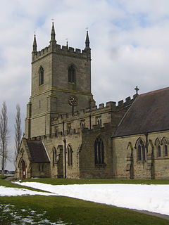
Sutton Cheney is a village and former civil parish, now in the parish of Dadlington and Sutton Cheney, in the borough of Hinckley and Bosworth, in the county of Leicestershire, England, near the county border with Warwickshire. In addition to the village of Sutton Cheney itself, the civil parish also contains the villages of Dadlington and Shenton, a number of farms, and the location of the Battle of Bosworth. Its closest large towns are Nuneaton and Hinckley. Its closest market town is Market Bosworth.
Hampole is a small village and civil parish in the City of Doncaster in South Yorkshire, England, close to the border with West Yorkshire. Historically part of the West Riding of Yorkshire, the eastern boundary of the parish is marked by the Great North Road, and the parish lies in what was once the Barnsdale Forest. It had a population of 187 in 2001, increasing to 203 at the 2011 Census, which includes the neighbouring village of Skelbrooke. Hampole lies on the A638 between Doncaster and Wakefield.

Aston-on-Trent is a village and civil parish in the South Derbyshire district, in the county of Derbyshire, England. The parish had a population of 1,682 at the 2011 Census. It is adjacent to Weston-on-Trent and near Chellaston, very close to the border with Leicestershire.

Measham is a large village in the North West Leicestershire district in Leicestershire, England, near the Derbyshire, Staffordshire and Warwickshire boundaries. It lies off the A42, 4+1⁄2 miles (7.2 km) south of Ashby de la Zouch, in the National Forest. Historically it was in an exclave of Derbyshire absorbed into Leicestershire in 1897. The name is thought to mean "homestead on the River Mease". The village was once part of Derbyshire before being transferred to Leicestershire.

Whitwick is a village and civil parish in the North West Leicestershire district of Leicestershire, England, close to the town of Coalville in the northwest of the county. It lies in an ancient parish which formerly included the equally historic villages of Thringstone and Swannington.

Abbotskerswell is a village and civil parish in the English county of Devon. The village is in the north part of the parish and is located two miles (3 km) south of the town of Newton Abbot, 7 miles (11 km) from the seaside resort of Torquay and 32 miles (51 km) from the city of Plymouth. The A381 road between Newton Abbot and Totnes runs down the western side of the parish and the main railway line between these two towns forms part of its eastern boundary.

Ibstock is a former coal mining village and civil parish in North West Leicestershire, England. The population of the civil parish was 5,760 at the 2001 census increasing to 6,201 at the 2011 census and 7,615 at the 2021 census.
Ravenstone is a village and former civil parish, now in the parish of Ravenstone with Snibstone, in the North West Leicestershire district, in the county of Leicestershire, England. It is within the National Forest, just off the A511 road between Coalville and Ashby-de-la-Zouch, in 2001 it had a population of 2,149.
Kilby is a village and civil parish in the Blaby district of Leicestershire, England. Kilby is the easternmost village in the district, and is 6.1 miles (9.8 km) south east of Leicester. Kilby civil parish includes the former parish of Foston and its deserted medieval village. Nearby places are Countesthorpe 2.21 miles (3.56 km), Fleckney 2.12 miles (3.41 km), Arnesby 1.96 miles (3.15 km), Wistow 1.4 miles (2.3 km) and Kilby Bridge 1.18 miles (1.90 km).
Snarestone is a small rural village in North West Leicestershire, England.

Ampleforth is a village and civil parish in North Yorkshire, England, 20 miles (32 km) north of York. The village is situated on the edge of the North York Moors National Park. The parish has a population of 883 according to the 2001 census, increasing to 1,345 at the 2011 Census, and includes Ampleforth College. The name Ampleforth means "the ford where the sorrel grows".
Ashley is a village and civil parish in North Northamptonshire, England, about 4 miles (6.4 km) northeast of Market Harborough, Leicestershire and 5 miles (8.0 km) west of Corby. The population of the civil parish at the 2011 Census was 224, an increase from 217 at the 2001 Census. The village is near the River Welland, which forms the border with Leicestershire. The Roman road called Via Devana in the part from Ratae to Duroliponte ran just north of the village.

Sheepy is a civil parish in the Borough of Hinckley and Bosworth in Leicestershire, England. It contains the villages of Sheepy Magna, Sheepy Parva, Sibson, Wellsborough, Upton, Pinwall and Cross Hands—collectively 449 homes. At the 2001 census, the parish had a population of 1,192, including Orton on the Hill but falling slightly to 1,174 at the 2011 census.
Holcombe Rogus is a village, civil parish and ecclesiastical parish in the English county of Devon. In 2001 the population of the parish was 503.

Packington is a village and civil parish in the district of North West Leicestershire. It is situated close to the A42 road and the towns of Ashby de la Zouch and Measham. The population of Packington according to the 2001 UK census is 738, reducing slightly to 734 at the 2011 census. Nearby villages include Normanton le Heath and Heather.

Odstone is a hamlet and former civil parish, now in the parish of Shackerstone, in the Hinckley and Bosworth district of Leicestershire, England. It stands on a marked promontory of high ground between two river valleys. In 1931 the parish had a population of 142.

Smisby is an ancient manor, civil parish and small village in South Derbyshire, England. It is 4 miles (6.4 km) from Melbourne and near the Leicestershire border and the town of Ashby-de-la-Zouch. The village including the outlying farms and houses has a population just over 200 that occupies some 110 properties. The population at the 2011 Census had increased to 260.

Normanton le Heath is a village and civil parish situated between the parishes of Packington, Ravenstone and Heather in North West Leicestershire, England. The population of the civil parish was 131 at the 2001 census, rising to 165 at the 2011 census. It should not be confused with another Normanton in the county which is near Bottesford.

Newton Burgoland is a village in the civil parish of Swepstone and Newton Burgoland, in the North West Leicestershire district of Leicestershire, England. The Swepstone parish used to include a small settlement named Newton-Nethercote, which formed part of the village, but that is now part of the rest of Newton Burgoland. The population is included in the civil parish of Swepstone.

Cold Overton is a village and former civil parish, now in the parish of Knossington and Cold Overton, in the Melton district of Leicestershire, England. It is close to the border with Rutland, and approximately 3 miles (5 km) west from the market and county town of Oakham, and 1.5 miles (2.4 km) south-west of the A606 road. In 1931 the parish had a population of 133.